Learn Synthetic Aperture Radar (SAR) by Example
Synthetic Aperture Radar (SAR) is an emerging technology in remote sensing with the advantage to see in any weather condition and even at night.
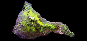
Synthetic Aperture Radar (SAR) is an emerging technology in remote sensing with the advantage to see in any weather condition and even at night.

From A to Z, we deliver stunning visualizations and meanings with the GIS Dictionary – Definition Glossary. Sharpen your skills with new GIS terminology.

At the end of every year, we countdown our top 10 pieces of content for what you like most. Here’s what tops the list with our “best of 2024”.

The geospatial industry is all about maps and location. It helps us know where things are and where to go. Learn all about it today.
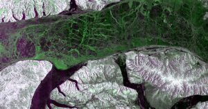
The RADARSAT Constellation Mission (RCM) consists of three satellites. Using SAR, these satellites can see through clouds and darkness.
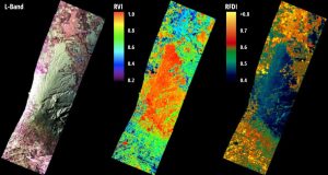
Radar bands are groups of wavelengths. Each has its unique ability to penetrate the Earth’s surface and reveal aspects of the environment.
There are free tools online that convert DWG to SHP. But we recommended using QGIS, which is an open source GIS software option.

We compare the commercial satellite companies – BlackSky, Planet, and Maxar. Each company has carved out its niche in satellite technology.
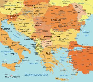
This map collection of the Balkan States (or simply the Balkans) showcases this geographical region in Southeast Europe.

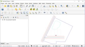
This article will highlight our 15 favorite editing tools in ArcGIS Pro. It will showcase their functionality and how to digitize GIS data.