Balkan States Map Collection
This map collection of the Balkan States (or simply the Balkans) showcases this geographical region in Southeast Europe.

Download any map from our collection and use it for free. See our guidelines on how you can use it in your work.
You are free to use our maps of the Balkan States for educational and commercial uses. Attribution is required. How to attribute?
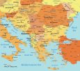
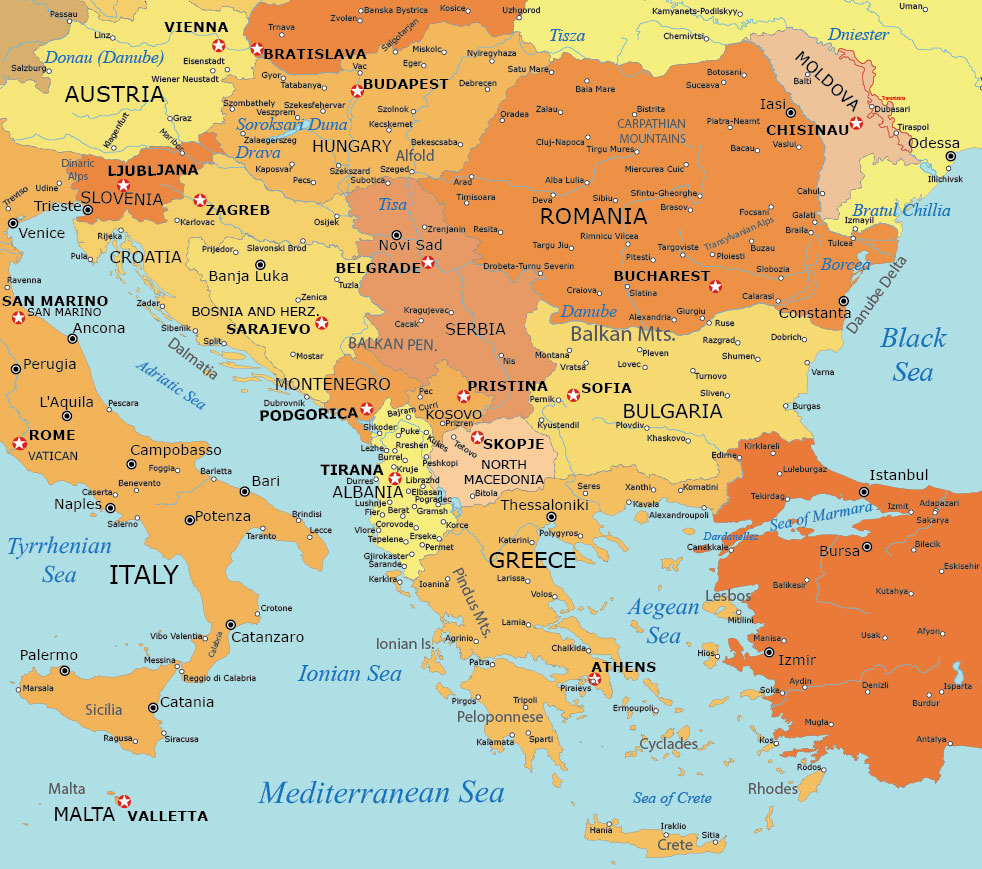
Detailed Balkan States Map
This Balkan States map clearly marks the national boundaries of Albania, Bosnia and Herzegovina, Bulgaria, Croatia, Greece, Kosovo, Montenegro, North Macedonia, and Serbia.
It also includes the countries of Romania, Slovenia, and other neighboring countries. You’ll also find cities, towns, and other populated places in this Balkan States map.
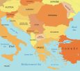
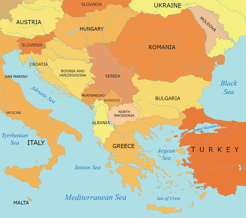
Balkan States Map with Countries
Looking for a simple map of the Balkan States region that only shows countries and corresponding labels. This is your ticket.
Our simple map of the Balkan region contains political borders. But it also has a nice balance with water features like gulfs and bays.
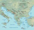
Physical Map of the Balkan States
Our physical map of the Balkan area is a specialist in representing the physical terrain. This includes mountains, valleys, plains, and peaks.
It also depicts geographical features like the Balkan Mountains, the Dinaric Alps, and the Transylvanian Alps. You’ll also find water features like the Aegean Sea and major rivers like the Danube, Tisa, and Drava.

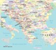
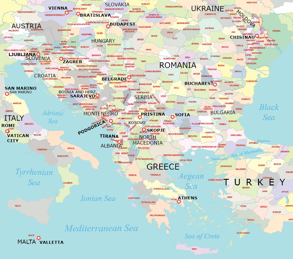
Administration Map of the Balkan States
This administration map gives you a bit higher level of detail. On this map, you get to see administrative units for each Balkan country.
You can also view borders with neighboring countries outside the Balkans. For example, you can see Italy across the Adriatic Sea, Hungary, and others.
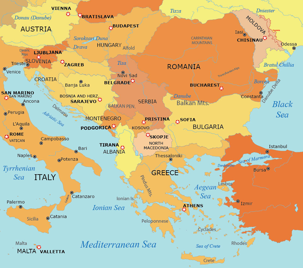
Balkan States Map with Capitals
This map features the countries in the Balkan State region. But the key here is that it includes the capital city of each country with the red star symbols.
You’ll find capital cities like Tirana (Albania), Sarajevo (Bosnia and Herzegovina), Sofia (Bulgaria), Zagreb (Croatia), Athens (Greece), Pristina (Kosovo), Podgorica (Montenegro), Skopje (North Macedonia), Bucharest (Romania), Ljubljana (Slovenia), and Belgrade (Serbia).
World Atlas with the Balkan Countries
The Balkan region is known for its beautiful landscapes, rich history, and diverse cultures. But at the same time, it has complex political and ethnic relationships.
The Balkan region has been a crossroads of various civilizations over the centuries. Over time, it has contributed to its diverse cultural heritage.
Our world atlas is where you can find detailed maps of each country in the Balkan States. Click on the map below to get more detailed information.


Geography of the Balkan States
Below, you can find a table that lists all the Balkan States. You can also find a brief description of where it is located geographically in Southeast Europe.
| Country | Geography Description |
|---|---|
| Albania | Mountainous terrain with extensive Adriatic and Ionian coastlines. |
| Bosnia and Herzegovina | Rugged landscape with forests, mountains, and a small Adriatic coastline. |
| Bulgaria | Diverse terrain with mountains, plains, and Black Sea coastline. |
| Croatia | Coastal country with a long Adriatic Sea coastline and many islands. |
| Greece | Mountainous peninsula and numerous islands in the Aegean and Ionian Seas. |
| Kosovo | Landlocked with a central and western mountainous region. |
| Montenegro | Mountainous with a narrow coastal plain along the Adriatic Sea. |
| North Macedonia | Mountainous with valleys and fertile basins. |
| Romania | Diverse with mountains, hills, and plains; Danube Delta at the Black Sea. |
| Serbia | Predominantly mountainous in the south; plains in the north. |
| Slovenia | Mountainous with a small coastline along the Adriatic Sea. |
Maps of Regions of the World
Get a view of the different regions of the world. Our map collection offers a range of detailed maps with diverse geographical landscapes, cultural areas, and political boundaries.