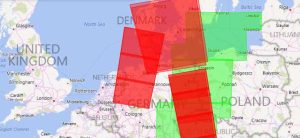
How to Download Free Sentinel Satellite Data
If you want to download Sentinel satellite data, then you’ve come to the right place. We show you how to obtain free Sentinel satellite data.
If you want to download Sentinel satellite data, then you’ve come to the right place. We show you how to obtain free Sentinel satellite data.

If you want to display rasters in true color, you will have to combine the red, green & blue bands. The ArcGIS Composite Bands tool creates RGB composites.

ArcObjects is a library of Component Object Models (COM) to build UI components and stand-alone applications on top of the ArcGIS platform.
From geodatabases to PostGIS, spatial databases have quickly become the primary method of managing spatial data effectively in a GIS.

We give you 5 steps to deliver a GIS business case at your organization because for some organizations it’s hard to imagine without one

A GIS developer needs to be focused because you’re going to be writing, examining and error-checking code. Learn more about GIS programmers.
Over the years, the USGS has been a driving force in the production of GIS data. The USGS formats we explore are DLG, DRG and DOQ.

GIS analysts are well-rounded, tech-saavy spatial individuals with a wide range of skills. They are multi-tasking, multi-disciplinary and fast-on-their-feet.
The focus of uDig (User-friendly Internet GIS) is placed on database viewing and editing as well as a rich collection of GIS functionality.
Ellipsoids, survey benchmarks and triangulation – these are the ingredients for geodetic datums. NAD27, NAD83 and WGS84 are common datums in North America.