Landsat 9: A Legacy of Earth Observation
In order to continue the Landsat program’s long-standing legacy, NASA and the USGS launched Landsat-9 in September 2021 as the 9th satellite.

In order to continue the Landsat program’s long-standing legacy, NASA and the USGS launched Landsat-9 in September 2021 as the 9th satellite.
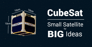
A CubeSat is a miniaturized satellite roughly the size of a Rubik’s cube. They’re small enough to hold in your hand and inexpensive to build.
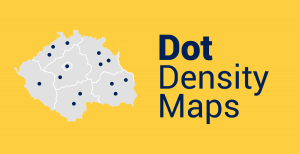
Dot maps use dots to show the density of a particular phenomenon in an area. More dots represent a higher density compared to fewer dots.
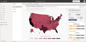
ArcGIS for Power BI is a tool that helps users analyze and visualize location-based data directly in Microsoft Power BI reporting dashboards.
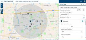
ArcGIS Solutions are out-of-the-box web app templates that you plug and play in ArcGIS Online to address any challenges in your organization.
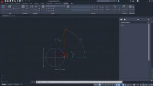
The ArcGIS for AutoCAD plugin is a bridge between both software that gives you interoperability for image services and editing features.
Because data analysis is a critical part of any business, Esri Business Analyst offers a suite of tools to help you make better decisions.
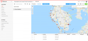
Because data collection is one of the most time-consuming and crucial aspects of any field project, the Fulcrum App can simplify this process.
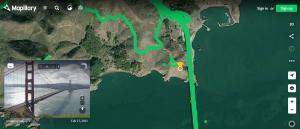
Mapillary is a crowdsourced platform where users can upload geotagged photos in the world and explore 1.5+ billion street-level images.

Google Street View is like a virtual tour of the entire world, right at your fingertips. But there’s more to explore with these 5 features.