US Election of 1852 Map
In the US Election of 1852, Pierce won in a surprising landslide victory with 254 electoral votes. Scott could only pull together 42 electoral votes.
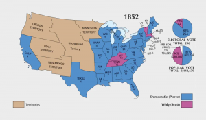
In the US Election of 1852, Pierce won in a surprising landslide victory with 254 electoral votes. Scott could only pull together 42 electoral votes.
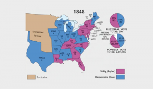
In 1848, Zachary Taylor from the Whig Party became the 12th president of America. While he won with 163 electoral votes, his opponent Lewis Cass had 127.
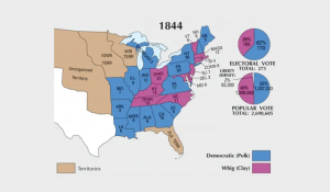
In the US election of 1844, James Polk emerged as a dark horse candidate. He became the 11th president of the United States with 170 electoral votes.
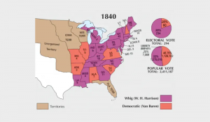
In the election of 1840, William Henry Harrison recorded 234 electoral votes. But he died only 31 days in office so vice president, John Tyler, took over.
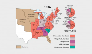
To continue with tradition, Andrew Jackson stepped down as president in the election of 1836. Martin Van Buren won this election with 170 electoral votes.
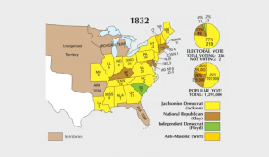
In the election of 1832, Andrew Jackson won re-election. He earned 219 electoral votes against the National Republican party and Anti-Masonic Party.
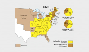
In the 1828 election, Jackson earned his revenge defeating John Quincy Adams. He gained 178 electoral votes and became the 7th American president in history.
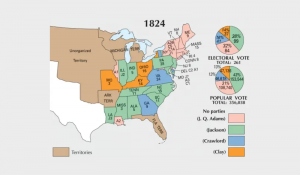
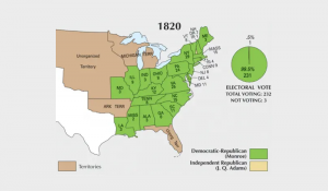
In the election of 1824, Andrew Jackson had the most electoral votes of 99. But John Quincy Adams ended up voted as the 6th president of the United States.
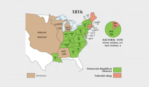
James Monroe ran for president without any notable opponents. He really didn’t have to campaign to regain his second term as president because he easily won.
James Monroe of the Democratic-Republicans ran for president and won with ease. From here, popularity grew so much that no one wanted to run against him.