US Election of 1812 Map
The results from the election of 1812 was close with James Madison barely winning with just over 50% of votes. It was one of the closest election in history.
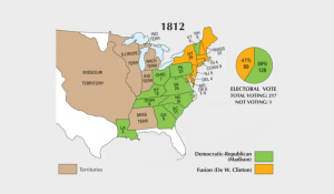
The results from the election of 1812 was close with James Madison barely winning with just over 50% of votes. It was one of the closest election in history.
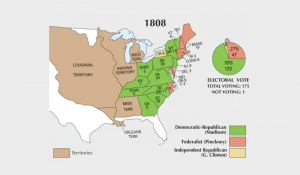
In 1808, James Madison became the 4th president of the United States. He dominated with 122 electoral votes, which represented 70% of total voting.
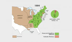
In the 4th presidential election in American history, incumbent Thomas Jefferson wished for re-election against Charles Pinckney of the Federalist party.
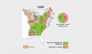
Although the results were disputed, Thomas Jefferson became the third president in American history after gaining 73 electoral votes in the election of 1800.
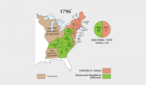
This election was a very tight race between John Adams and Thomas Jefferson. But Adams became the 2nd president of the United States with 71 electoral votes.
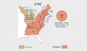
In 1792, George Washington served his second term as president. He didn’t have any opposition after winning 132 total (or 100%) of electoral votes.
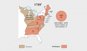
The election of 1789 was between the Federalists & Anti-Federalists. Both factions sided with George Washington as he unanimously became the first president.

Just like any API, the Esri JavaScript API offers ways to create your own custom 2D and 3D webmaps and webscenes to interact with it.

Is a GIS degree worth it? Find out typical job titles, who employers are, how much money and the career outlook for GIS degree graduates.
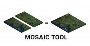
A mosaic combines multiple raster images to obtain a seamless raster. We show you how to mosaic raster datasets in ArcGIS and QGIS.