How To Mosaic Raster Datasets
What is a Raster Mosaic?
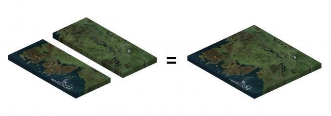
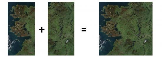
A mosaic combines multiple raster images to obtain a seamless raster. Here are some of the tools available to help mosaic raster datasets:
Let’s take a look at how to stitch together multiple raster images.
This can be anything from satellite imagery, digital elevation models to land cover.
Mosaic Tool
The Mosaic Tool accepts one or more input rasters. Then, it merges them into a complete raster mosaic. There are several variations of this tool:
MOSAIC RASTER – This appends rasters into an existing raster dataset.
MOSAIC TO NEW RASTER – This merges rasters and creates a new raster dataset.
Some of the options include:
- Compression type
- File format
- Ignore background and NoData values
In QGIS, the Mosaic Tool is called the Merge Tool. It’s in the GDAL Toolbox and is within the Miscellaneous Raster tools.
Raster Catalog
Raster catalogs are like containers, specifically designed for large raster datasets. But they’re more like pointers because they just reference existing raster datasets. They don’t actually store the large files within.
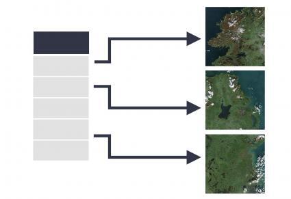
They also have the advantage of building footprints, which are extents for each dataset. Then, it’s possible to export these footprints to display a vector coverage of all available imagery.
If you want to produce a mosaic, you can use the tool – Raster Catalog to Raster Dataset. This is how to get into usable GIS formats like GeoTIFF, JPEG, or IMG files.
Common Errors and Issues for Mosaic Raster
Here are some of the most common errors in running the mosaic raster tool.
1. INCORECT RASTER INPUTS – A common error when mosaicking is ensuring that your inputs are consistent.
- Input raster datasets must have the same bit depth (such as 8-bit images).
- They also must have the same number of bands. This means you can’t mosaic a single-band raster with a 3-band raster
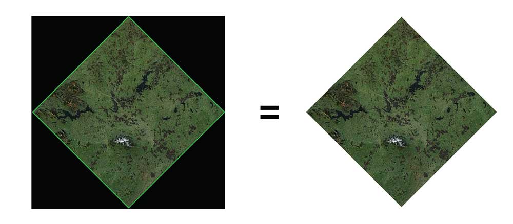
2. BLACK IMAGE BORDER – Another common error is having a black surrounding border around your image. This is especially common for drone images and after georeferencing raster datasets.
If it’s pure black, a quick fix is to set the transparent values in your symbology to (0, 0, 0). But the problem with this method is that anywhere there is pure black in your image, it will become transparent too. Also, it won’t work if it’s slightly different from pure black.
The best way to remove the black area in your image is to build footprints in a raster catalog. You can manually adjust each footprint, then and set the property to clip each footprint. Alternatively, you can export footprints, and use the Raster Clip Tool.
Raster Mosaic Examples
There are a lot of examples of mosaic datasets. First, Esri’s World Imagery is an enormous mosaic of satellite and aerial imagery of the entire world.
Second, the Living Atlas of the World stitches demographics, transportation, and environmental access of the whole planet.
When you mosaic raster datasets, you achieve one composite image. For the cartography aspect, you can achieve one consistent color ramp creating a seamless image.
If you want to perform image classification, then imagery mosaics allow you to systematically classify it.
Can you think of any other examples of image mosaics? Why do you use this geoprocessing tool? Please let us know with a comment below.


