MapInfo Professional by Precisely
At its core, MapInfo Professional by Precisely allows you to create, manage and visualize geospatial data. It does what all good GIS software can do – MapInfo connects geography with data but with a smaller price tag. Its motto is “locational intelligence”.
Detailed mapping, data analysis, pattern, and trend identification are reasons why businesses are deploying MapInfo’s “location intelligence”. The MapInfo GIS Suite lets you create, access, and manage geospatial assets, visualize business intelligence and customer data, and share high-quality interactive maps – quickly and easily.
Pros/Cons of MapInfo Professional
Here are some of the advantages and disadvantages of using MapInfo Professional compared to other GIS software applications.
PROS
CONS
Note: As of May 2020, Pitney Bowes is now Precisely
MapInfo Professional Ratings
Mapping
Analysis
Editing
Data Support
Ranked #5 from 30 GIS Software
MapInfo Professional for Visualization
Usability is key to MapInfo’s philosophy because usability means productivity.
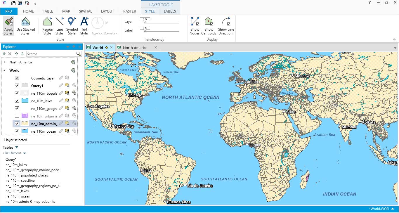
I found it very easy to access symbology. For example, it was convenient to add patterns to polygon fills. Point symbols were plentiful, relevant, and easy to find.
Beginner to advanced level users can appreciate the added functionality for labeling. For example, you can add an outline or glow to labels from the tab interface.
The ribbon-based navigation is intuitive and has all your favorite tools at your fingertips. For example, querying and table management are available in their own respectable tabs.
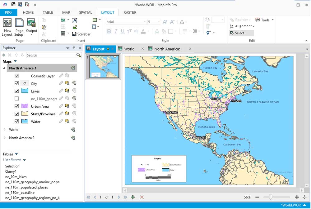
The latest version brings improvements in cartographic output. It’s smarter with labeling, legend, and scale bars. Also, a neat feature is its side-by-side mapping.
MapInfo Professional brings 64-bit compatibility, enhanced layouts, and much more (as shown below).
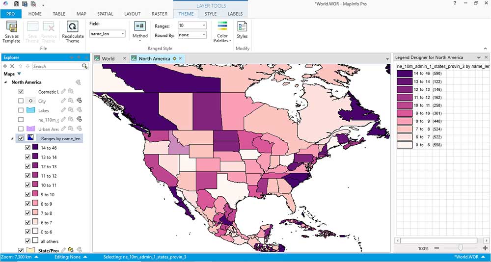
For example, I liked the wizard to create thematic maps. After creating a thematic map, the ribbon made our job easier to update it for further refinements.
MapInfo Professional for Analysis
MapInfo Professional has a clear focus on location intelligence like locating optimal positions for retail stores, uncovering geographic patterns, and improving insurance risk with GIS insurance mapping.
For example, geocoding was a prominent feature as it’s important to know the locations of nearest customers and retail competitors.
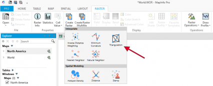
It has the common GIS processing tools that you’d expect in a GIS suite but maybe lack the specialized tools (LiDAR, remote sensing, kriging, etc.)
Admittedly, it was difficult to add different GIS data formats at times. TAB files are the native file types to MapInfo but it has different “Add” buttons for various file types.
Even with FME interoperability, it was rough to add a GeoTIFF or raw satellite imagery. MapInfo Professional has base maps such as Bing Aerial, but I wasn’t able to use it out-of-the-box.
Overall, MapInfo Professional has tools for most of your purposes, but its strong suit is business intelligence. Hence, the focus is on business analytics types of tools. For example, PBBI’s geocoding services can pinpoint accurate latitude and longitude location coordinates for over 200 countries and territories worldwide.
For your questions and answers, Li360 is MapInfo’s GIS community (short for location intelligence) for product documentation, user content, and tutorial FAQ.
Conclusion
MapInfo has been a strong competitor to Esri in the commercial GIS software market.
And they still are.
Actually, Esri is still playing catch up with the releases of a 64-bit, ribbon-based ArcGIS Pro of their own.
MapInfo Professional is a full-blown GIS software package surprisingly easy to get accustomed to – especially for creating beautiful-looking maps.


Hi, in May 2020 Pitney Bowes Software and Syncsort, who acquired Pitney Bowes Software back in late 2019, has been rebranded. The new name of the company is now Precisely – https://www.precisely.com/
Hello, I need a quote for Map info Licence. I´m from Argentina.
Regards
Thanks for a nice review of MapInfo Pro!
You should be able to open GeoTIFF files straight into MapInfo Pro via the Open dialog where you can select the Raster formats from the File Type dropdown.