The Hidden Powers of QGIS 3: Features and Plugins
When QGIS releases a new version, it’s kinda a big deal. Because the unsung heroes of open source GIS software are back with QGIS 3!
When QGIS releases a new version, it’s kinda a big deal. Because the unsung heroes of open source GIS software are back with QGIS 3!
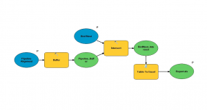
This example explains how to use model builder in ArcGIS. We show you how to create custom toolboxes and export models as Python scripts.
MapInfo Professional by Precisely (formerly Pitney Bowes) specializes in location intelligence, business analytics, and geocoding services.
OpenJUMP GIS is good at the basics. It started as a tool for data conflation. Then, it grew into a modest size open source project.

Planet Labs (or simply Planet) started with one main idea: To capture our dynamic Earth… Every day. using an ultra-compact, inexpensive CubeSAT satellite.
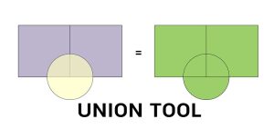
The Union tool combines input data layers into a single composite layer, preserving the boundaries and attributes from all input features.
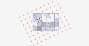
Bilinear interpolation (or bilinear resampling) uses 4 nearest neighbors to generate an output surface when you resample or reproject rasters.
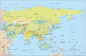
A map of Asia with countries and labels, including outlines of all the countries. It includes southeast Asia, Middle East, and central Asia.
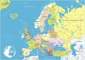
A Europe Map featuring countries and labels. It includes western, northern, southern, and eastern Europe with outlines for each country.
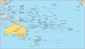
An Oceania map displaying countries and geography including Australia, New Zealand, Papua New Guinea Map, Melanesia, Micronesia, and Polynesia.