South America Map – Countries and Cities
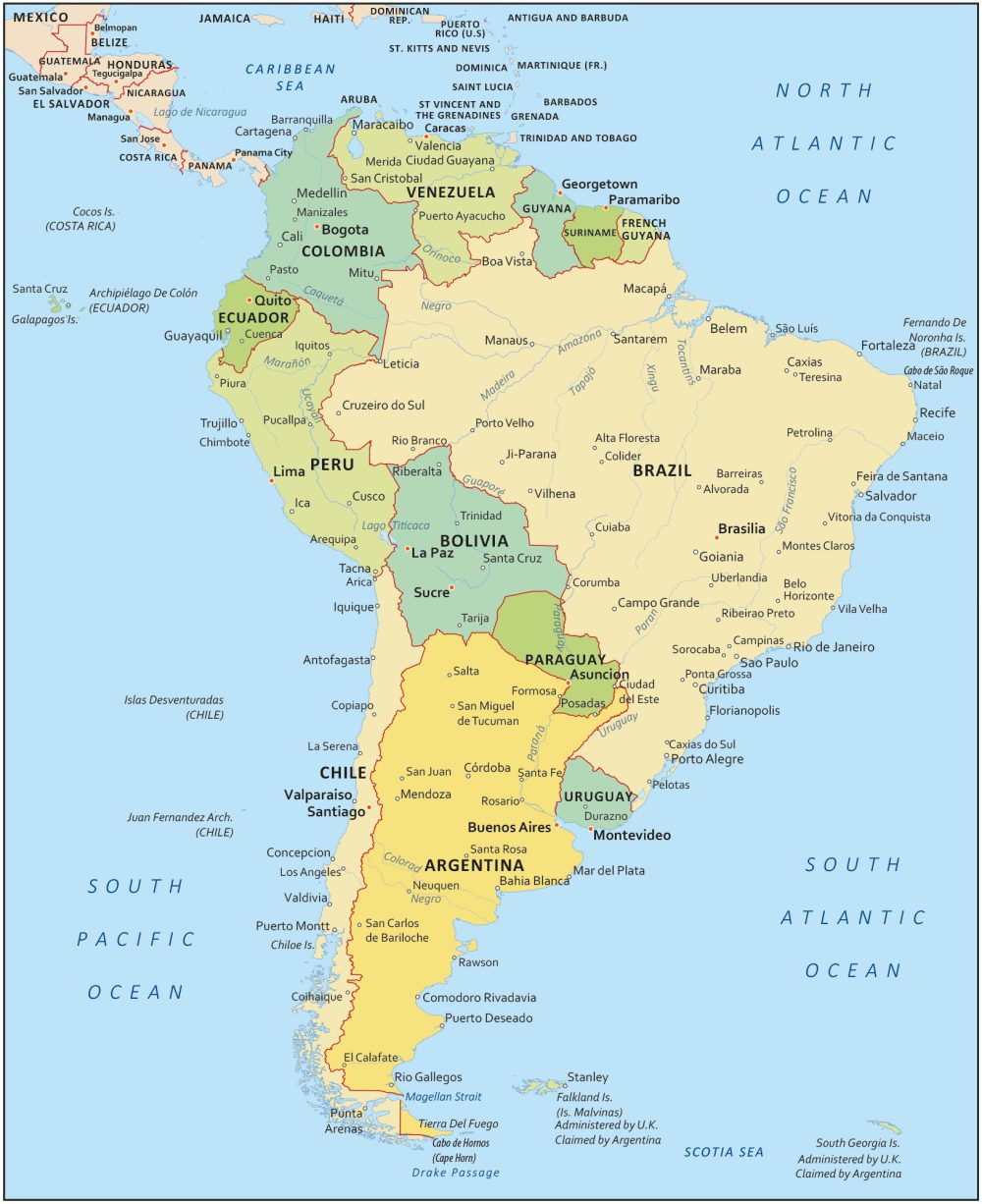
South America Map
Step into the world of South America. These maps will help you explore a continent of unique cultures, landscapes, and history. From the Amazon rainforest to the Andes mountains, this South America map will be your guide.
As each country offers a unique flavor, South America is a continent full of wonders. For example, it’s the only place with wild flamingos and glaciers together. So, let’s start our journey through South America. We’ll look at its geography, countries, and water bodies.
South America Maps


Countries in South America
Brazil
Colombia
Argentina
Peru
Venezuela
Chile
Ecuador
Bolivia
Paraguay
Uruguay
Guyana
Suriname
French Guiana
Capital Cities
Argentina – Buenos Aires
Bolivia – La Paz, Sucre
Brazil – Brasilia
Chile – Santiago
Colombia – Bogotá
Ecuador – Quito
French Guiana – Cayenne
Guyana – Georgetown
Paraguay – Asunción
Peru – Lima
Suriname – Paramaribo
Uruguay – Montevideo
Venezuela – Caracas
Major Cities
Sao Paulo
Buenos Aires
Rio de Janeiro
Bogota
Lima
Santiago
Belo Horizonte
Caracas
Porto Alegre
Brasilia
Fortaleza
Salvador
Recife
Medellin
Waterbodies and Rivers
Lake Titicaca
Magellan Strait
Amazon River
Rio de la Plata
Japuura River
Orinoco River
Paraguay River
Parana River
Sao Francisco River
Purus River
Mamore River
Uruguay River
Paraguay River
The full map reports French Guiana as a country. The silhouettes down below don’t list French Guiana.
When was this map published??
November, 2017
How do you get from Lapa, Rio de Janeiro brazil to Buenas Aires, Argentina?
Take a bus
But what is wrong is that you put Paraguay River 2 times.
Well, on some maps, I think it is like that.
The borders for Suriname are wrong. There are 2 disputed zones that should be displayed as such. At the moment they are not even displayed as disputed. This is incorrect