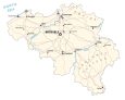
Map of Belgium and Satellite Imagery

This map of Belgium features its major cities, rivers, and highways. It includes a satellite and elevation map to view its physical features such as its low coastal plain in the north to its plateaus and Ardennes Upland region to the southeast.

You are free to use our Belgium map for educational and commercial uses. Attribution is required. How to attribute?
About the map
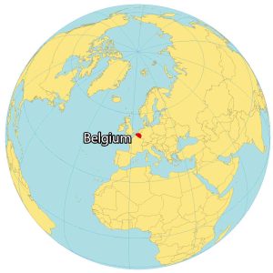
Belgium is a small and mostly low-lying country located in western Europe along the North Sea. It’s positioned between France to the south, Germany and Luxembourg to the east, as well as the Netherlands to the north.
Belgium is famous for its chocolate, waffles, beer, festivals, and national football (soccer) team, known as the Red Devils. Additionally, Belgium’s medieval towns and architecture make it a popular destination for history enthusiasts.
The population is estimated to be 11 million people with one-tenth living in the capital and largest city of Brussels. This city is known for being the headquarters of the European Union, an alliance within Europe promoting free trade and economic movement.
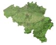
SATELLITE IMAGERY
Belgium Satellite Map
Belgium is mostly flat plain without any significant mountain ranges other than the Ardennes, which is a forested plateau in the east of Belgium. This region consists of rugged terrain, rolling valleys, and meandering rivers, as well as extensive forests and hiking.
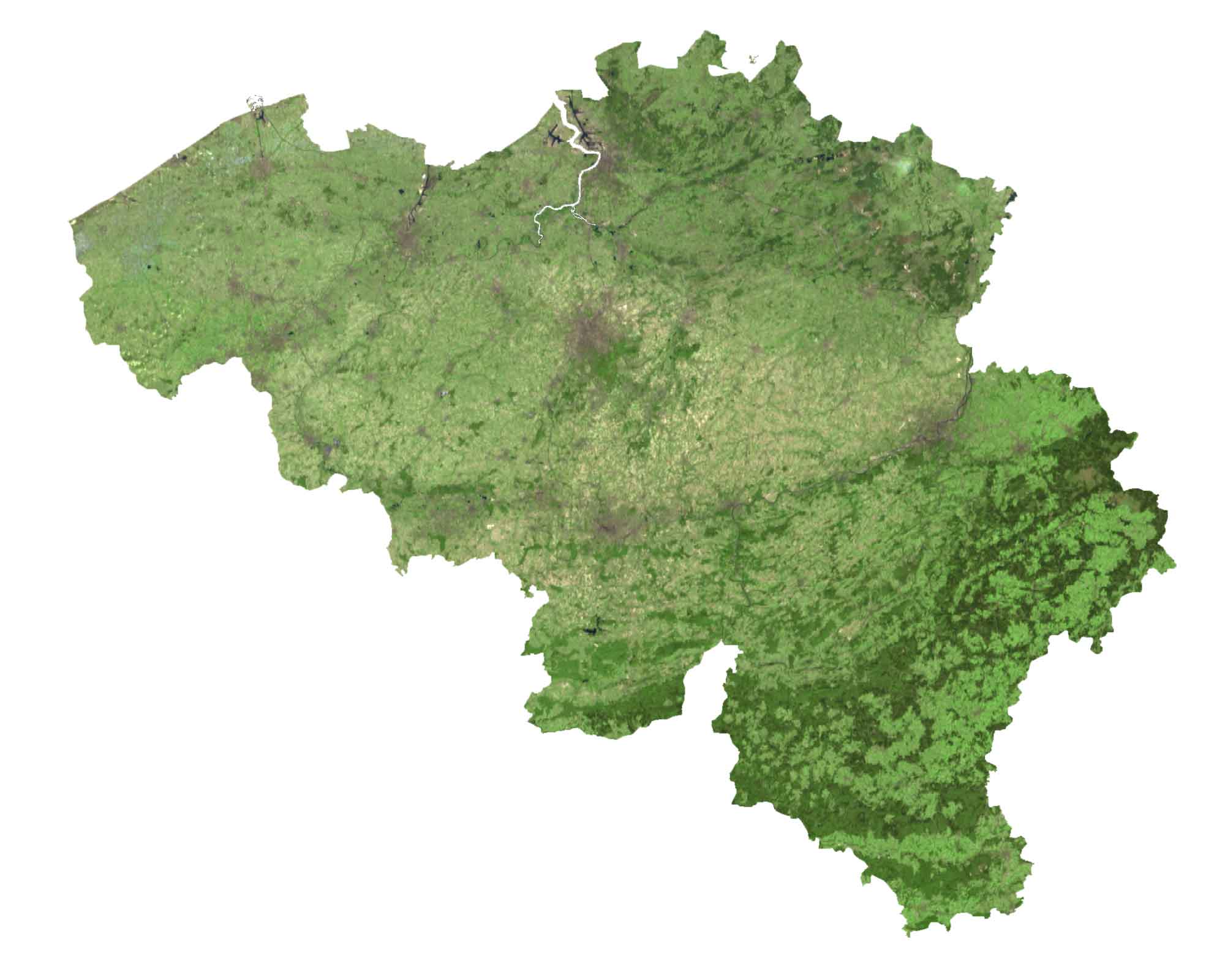
Approximately 22% of Belgium is forested with less than 1% classified as water. Belgium’s longest rivers include the Meuse, Scheldt, Semois, and Leie Rivers. These waterways not only contribute to Belgium’s picturesque landscapes but also play a vital role in recreation.
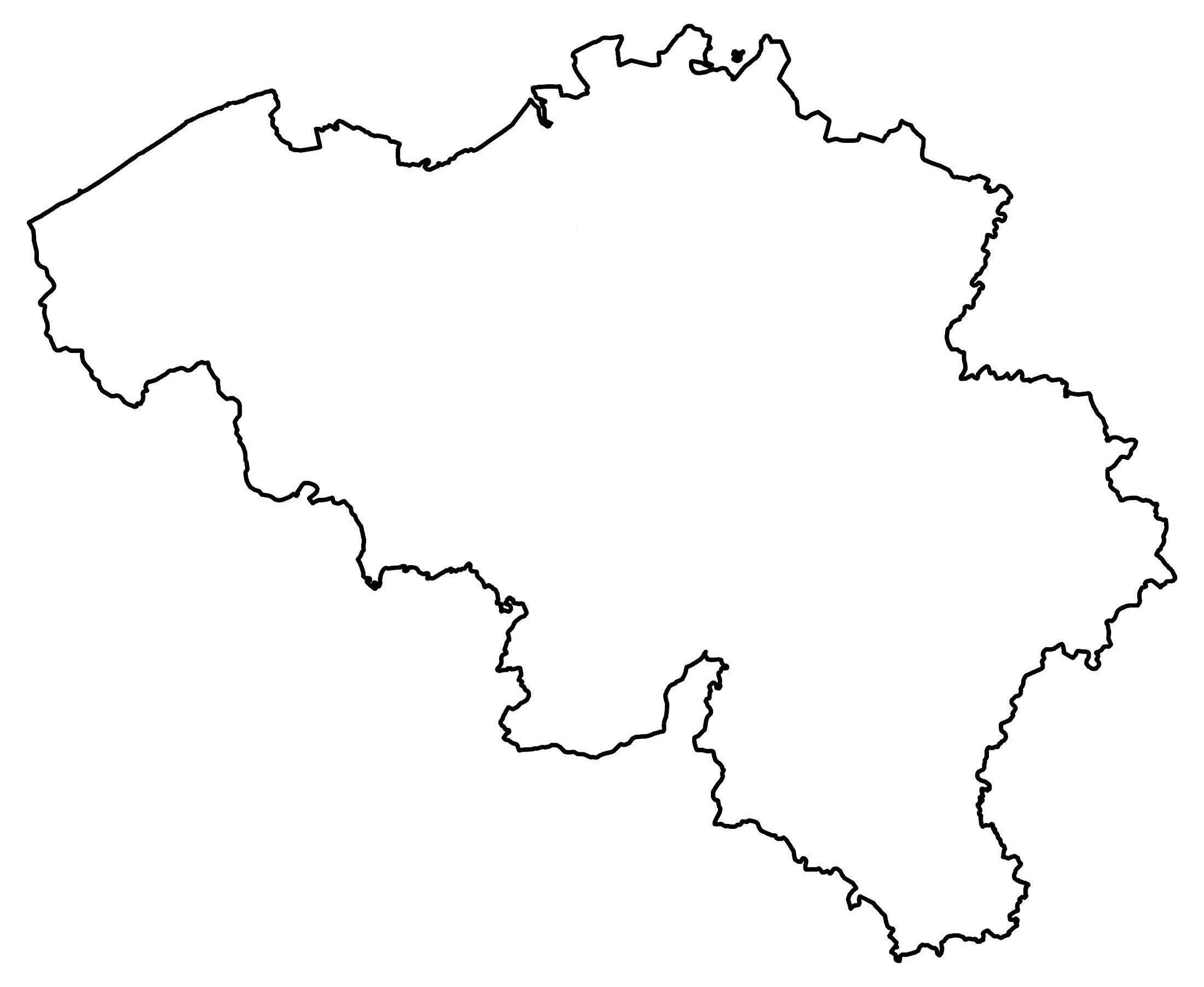
PHYSICAL MAP
Belgium Elevation Map
The terrain of Belgium is mostly flat coastal plains in the northwest. Then, it transitions into a slightly more elevated central plateau in the center. Finally, the terrain moves from rolling hills to rugged mountains in the southeast (also known as the Ardennes Uplands).
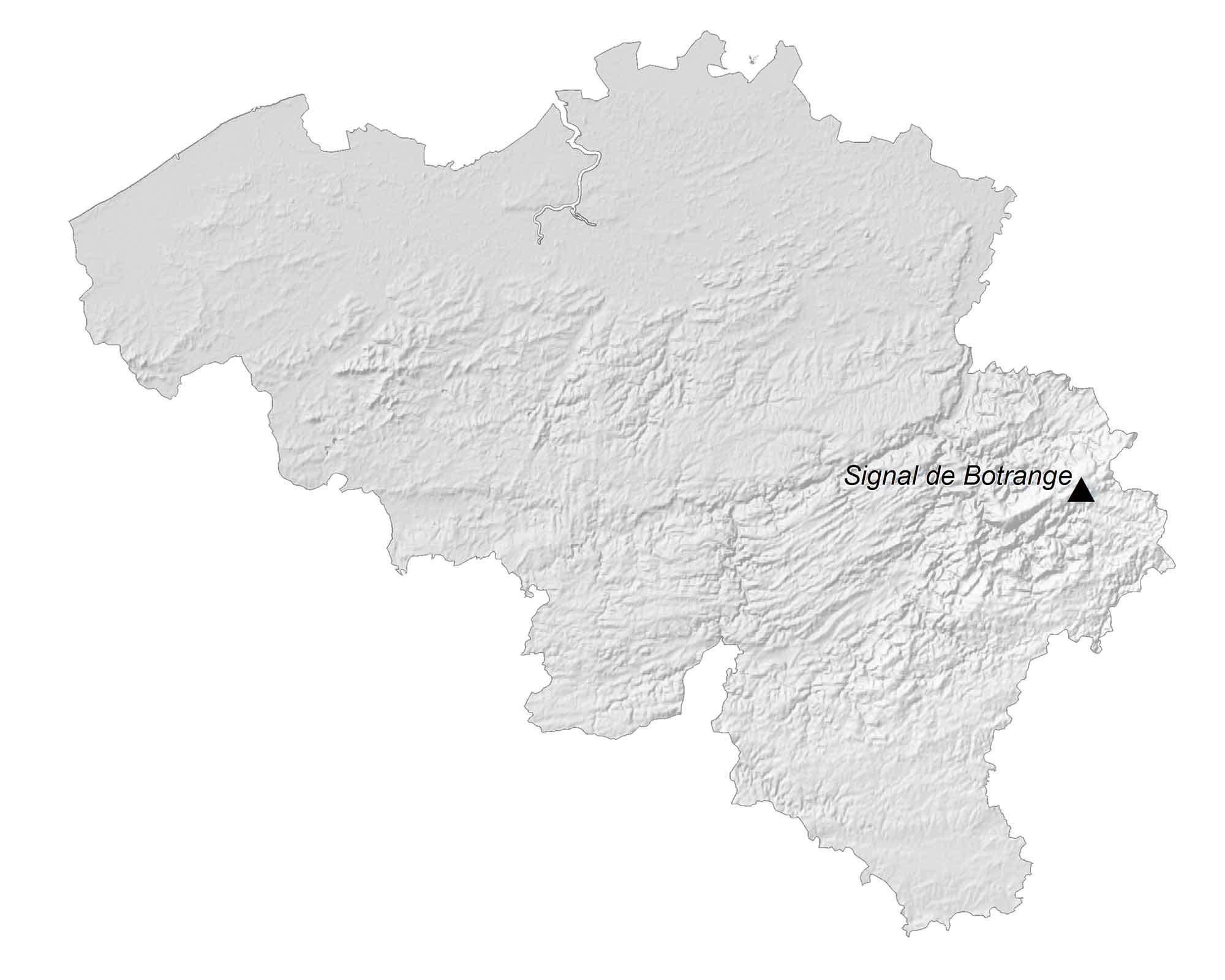
Within this region, it contains the Signal de Botrange. At 694 meters (2,277 feet), estimated at 694 meters in height, it is the highest point in Belgium. The Signal de Botrange offers panoramic views and a unique glimpse into the country’s varied landscapes.
POLITICAL MAP
Belgium Provincial Map
There are three regions, which are the first-level administrative unit in Belgium. Two regions contain five provinces, which are the second-level administrative unit. The three regions of Belgium are the Brussels Capital Region, the Flemish Region, and the Walloon Region.
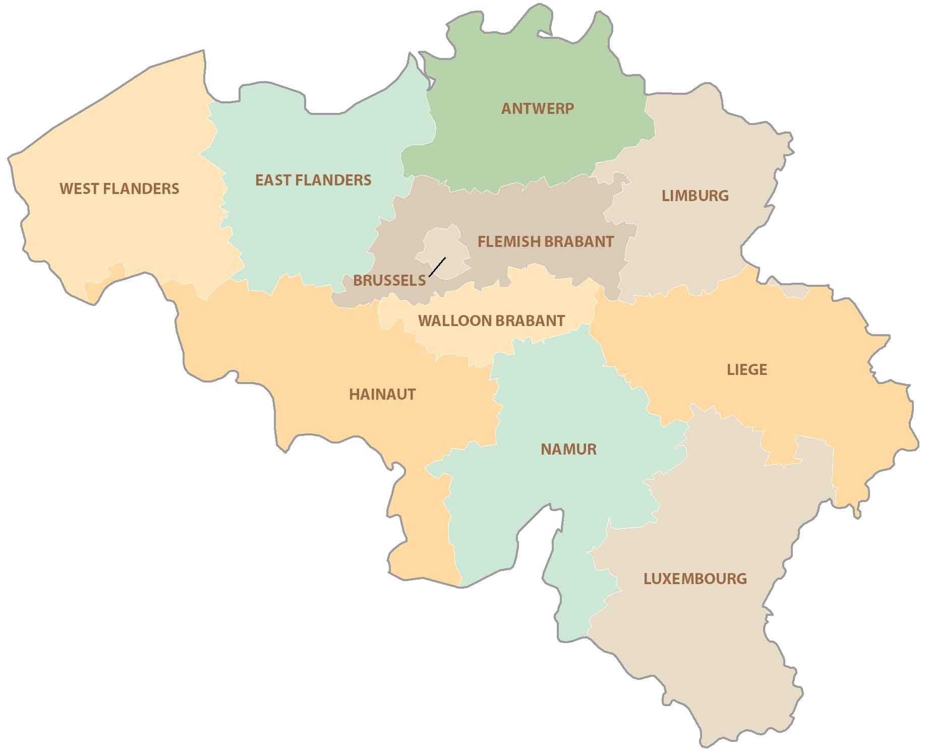
The Flemish Region is subdivided into Antwerp, Limburg, Flemish Brabant, East Flanders, and West Flanders. But the Walloon Region consists of Hainaut, Walloon Brabant, Namur, Liège, and Luxembourg. Brussels is not only Belgium’s capital, but it’s also the home to the European Union headquarters.
Capital City
Brussels
Major cities
Antwerpen
Gent
Charleroi
Liège
Brugge
Namur
Cities and towns
Oostende
Roeselare
Kortrijk
Mons
Mechelen
Verviers
Arlon
Hasselt
Leuven
Rivers and Seas
Maas River
North Sea
Schelde River
Provinces
West Flanders
East Flanders
Brussels
Antwerp
Flemish Brabant
Limburg
Walloon Brabant
Hainaut
Namur
Liege
Luxembourg
Physical Geography
Campine
Ardennes Plateau
Highest Point
Signal de Botrange