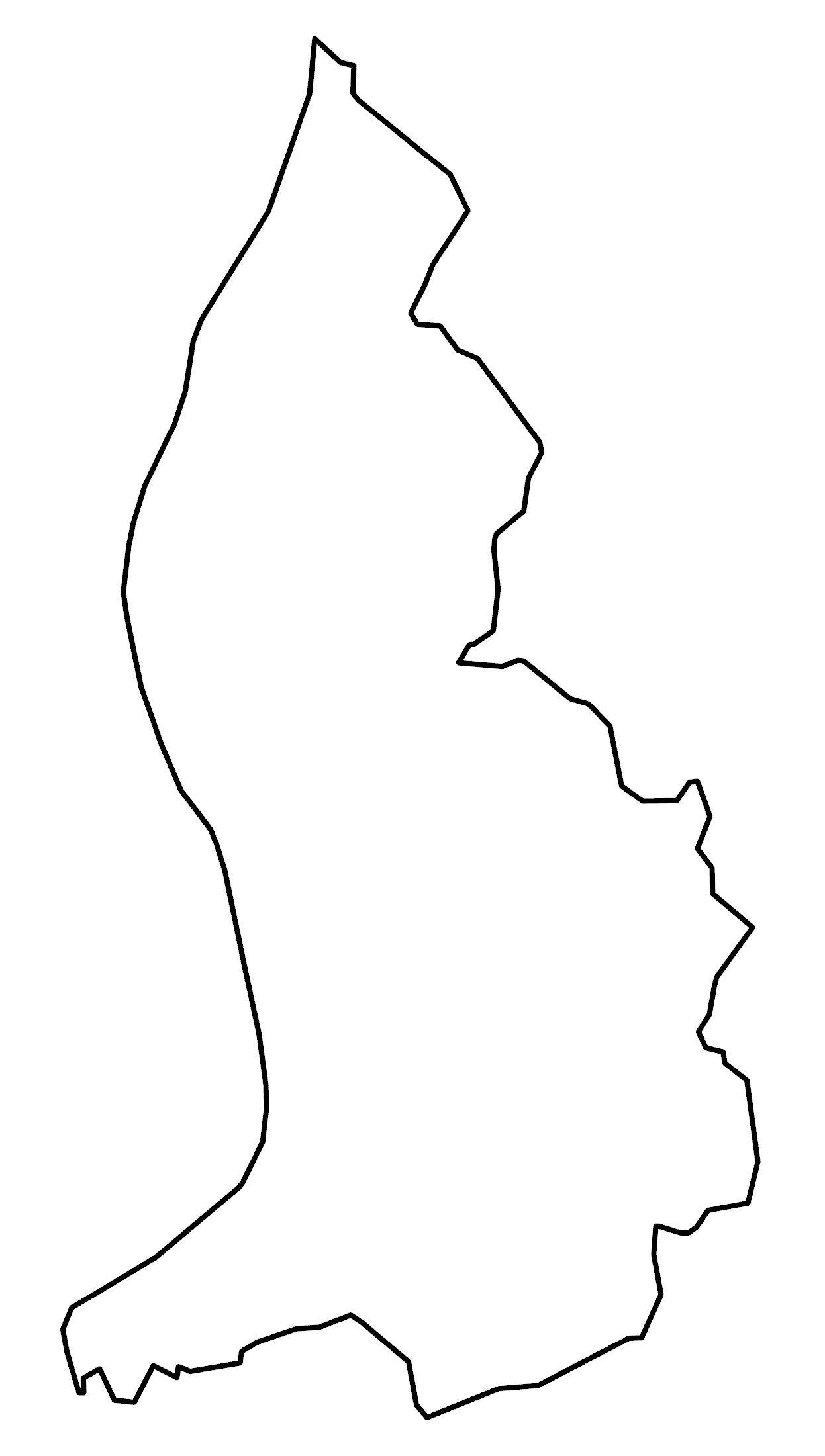
Map of Liechtenstein
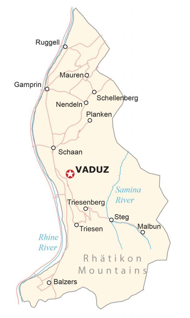
This map of Liechtenstein features its populated places, rivers, and highways. It includes a satellite map to view the rugged terrain of Liechtenstein that is located in the heart of Europe’s alpine region.
Liechtenstein map collection
You are free to use our Liechtenstein map for educational and commercial uses. Attribution is required. How to attribute?
About the map
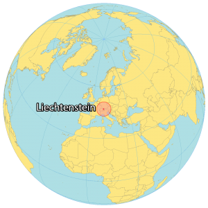
Liechtenstein is a small Central European country located between Switzerland and Austria. It’s Europe’s fourth-smallest country, with an area of just 160 square kilometers.
Liechtenstein is known for its alpine terrain, medieval castles, and sparsely populated villages. The population of Liechtenstein is just 38,750 people, making it one of the least populous in all of Europe.
Vaduz is the capital city of Liechtenstein. But the most populous city is Schaan with nearly 6,000 inhabitants. Overall, the size of Liechtenstein is about 8 times smaller than Los Angeles.
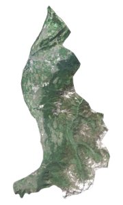
SATELLITE IMAGERY
Liechtenstein Satellite Map
The eastern region consists of the rugged foothills of the Rhätikon Mountains, which is part of the central Alps. The highest peak in Liechtenstein is Grauspitz, situated on the border between Liechtenstein and Switzerland. This mountain park stands 2,599 meters (8,527 ft) in height in the southeast of Liechtenstein.
Nearly 44% of Liechtenstein is covered in forest. The country’s landmass is slightly smaller than Washington DC, but also smaller than Andorra and Malta. While the Rhine River flows on the western boundary, the Samina River originates in Liechtenstein as one of its most notable rivers.

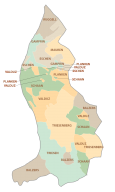
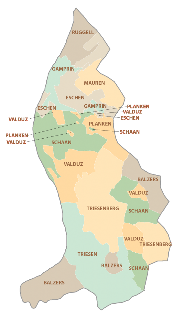
POLITICAL MAP
Liechtenstein Municipality Map
There are 11 municipalities in Liechtenstein, which are divided administratively and geographically. Most municipalities contain a single town or populated place. Five municipalities (Eschen, Gamprin, Mauren, Ruggell, and Schellenberg) are within the Unterland (the lower county) electoral district.
Whereas the remaining municipalities (Balzers, Planken, Schaan, Triesen, Triesenberg, and Vaduz) are within Oberland (the upper county).
Capital City
Vaduz
Populated places
Ruggell
Mauren
Gamprin
Schellenberg
Nendeln
Planken
Schaan
Samina
Steg
Triesen
Balzers
Malbun
Rivers
Triesenberg River
Rhine River
Landforms
Rhätikon Mountains