Cameroon Map – Cities and Roads
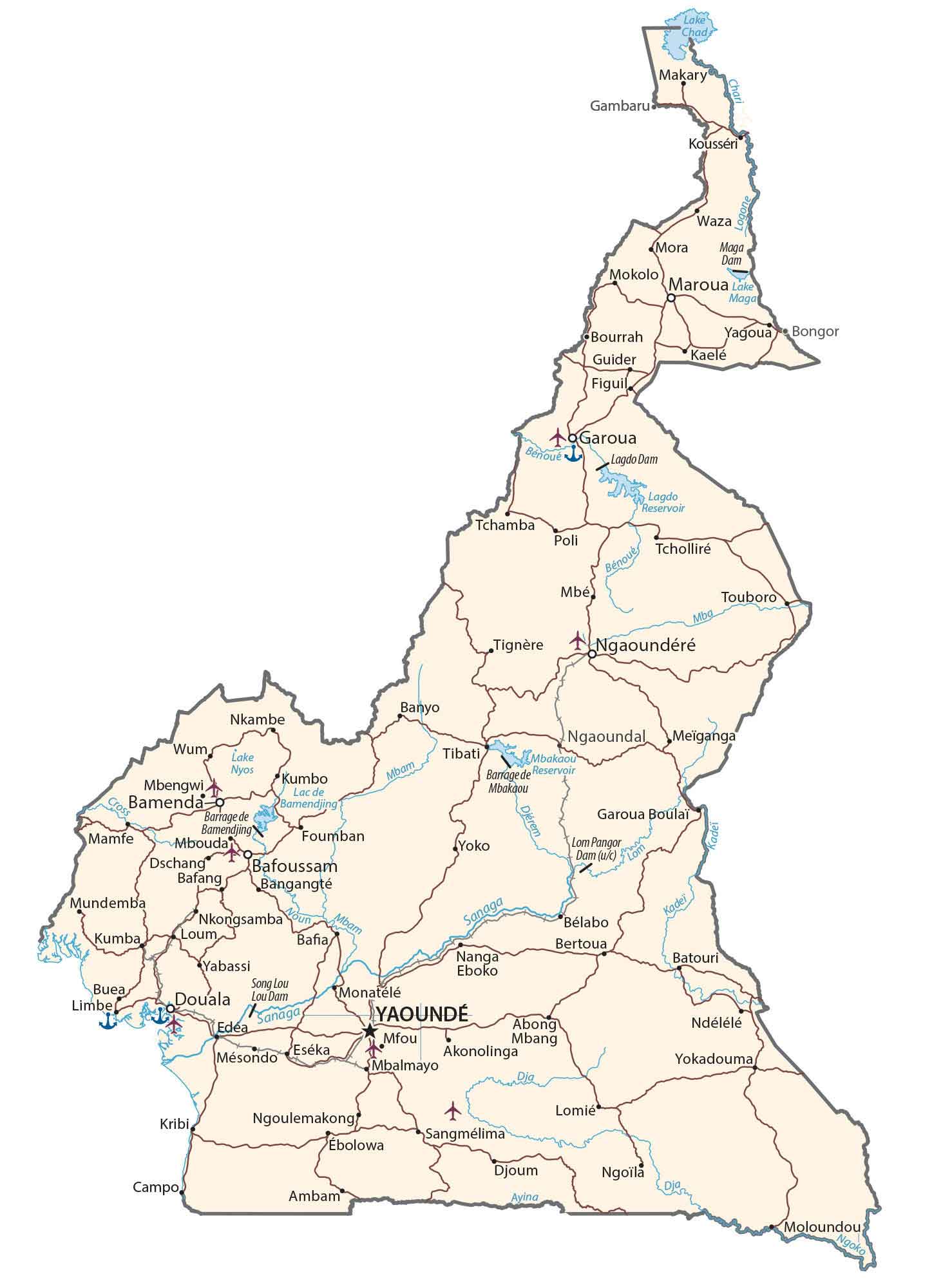
This map of Cameroon displays major cities, towns, roads, lakes, and rivers. It includes everything from its mountains to its plateau in satellite imagery and a physical map.
You are free to use our Cameroon map for educational and commercial uses. Attribution is required. How to attribute?
About the map
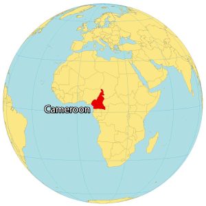
Cameroon has a very central geographic position in all of Africa. In fact, some consider Lobeke National Park in far southeastern Cameroon as the center of Africa.
On the other hand, it’s also like a hinge because it’s at a deflection point in the Gulf of Guinea. It borders six other countries.
This includes Nigeria to the northwest, Chad to the northeast, the Central African Republic to the east, as well as Equatorial Guinea, Gabon, and the Republic of the Congo to the south. Yaoundé is the capital city, but Douala is the largest metropolitan area.
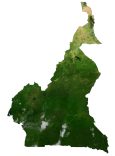
SATELLITE IMAGERY
Cameroon Satellite Map
Cameroon occupies an area of 475,442 square kilometers, which makes it larger than Sweden but smaller than Turkmenistan. The country lies slightly above the equator between 1° and 13°N latitudes. You can experience all types of climates and landscapes in Cameroon such as deserts, savanna, rainforests, mountains, and coasts.

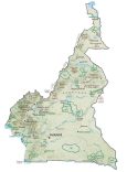
PHYSICAL MAP
Cameroon Physical Map
Cameroon has four major geographic regions. First, the coastal plain extends from the Gulf of Guinea. Next, the South Cameroon Plateau rises in elevation away from the coastal plain. Then, the Cameroon Range contains an irregular chain of mountains, hills, and plateaus.
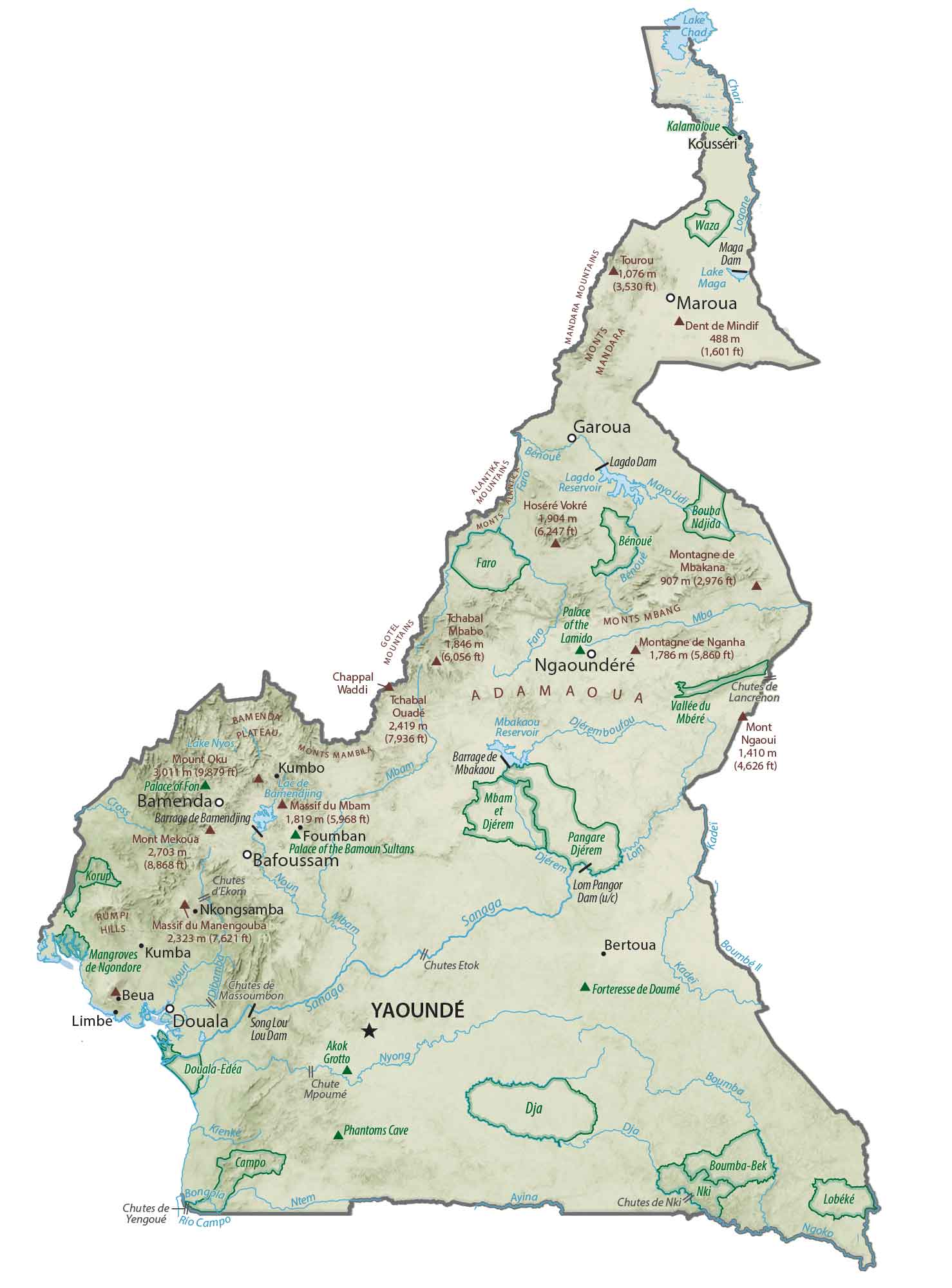
At 4,040 m (13,250 ft), this includes Mount Cameroon which is Cameroon’s highest point and an active volcano. Finally, the Adamawa Plateau lies in north-central Cameroon.
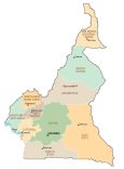
POLITICAL MAP
Cameroon Regions Map
There are 10 regions in Cameroon. Then, regions can be subdivided into divisions/departments. Next, the smallest level of administrative units is at the level of sub-divisions and districts.

Capital City
Yaoundé
Major cities and towns
Douala
Bamenda
Garoua
Bafoussam
Maroua
Ngaoundéré
Bertoua
Limbe
Cities and towns
Gambaru
Makary
Kousséri
Waza
Mora Maga
Mokolo
Maga
Bourrah
Yagoua
Bongor
Kaelé
Guider
Figuil
Bénoué
Tchamba
Poli
Tignère
Tcholliré
Touboro
Nkambe
Banyo
Wum
Tibati
Nyos
Mbengwi
Bamenda
Kumbo
Mamfe
Mbouda
Foumban
Yoko
Dschang
Bafang
Bangangté
Ngaoundal
Mbakaou
Pangor
Mundemba
Nkongsamba
Kumba
Loum
Bélabo
Yabassi
Buea
Song
Nanga Eboko
Batouri
Monatélé
Edéa
Mésondo
Eséka
Mfou
Mbalmayo
Ndélélé
Akonolinga
Yokadouma
Lomié
Kribi
Ngoulemakong
Sangmélima
Ébolowa
Djoum
Ngoila
Campo
Ambam
Moloundou
Lakes, rivers and creeks
Lake Chad
Maroua Lake
Lac de Bamendjing
Lake Nyos
Cross River
Chari River
Logone River
Lagdo Reservoir
Bénoué River
Mba River
Djerem River
Lom River
Kadei River
Sanaga River
Ayina River
Dja River
Ngoko River