Central African Republic Map
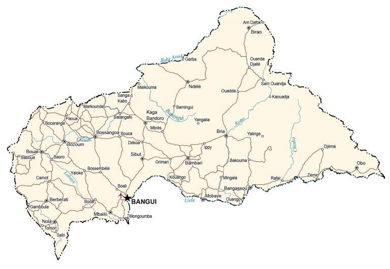
This Central African Republic map displays major cities, towns, and roads. Also, it includes an elevation map and satellite imagery that show the topography of the Central African Republic.
Central Africa Republic map collection
You are free to use our Central African Republic map for educational and commercial uses. Attribution is required. How to attribute?
About the map
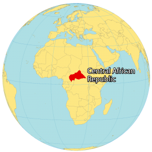
The Central African Republic is a landlocked country located in the interior of Africa. It borders Chad to the north, Sudan and South Sudan to the north and east, the Democratic Republic of Congo and the Congo to the south, and Cameroon to the west.
Between latitudes 2° and 11°N, the country lies just above the equator. Bangui is the capital and largest city of the Central African Republic. Approximately 4.75 million people reside in the Central African Republic.
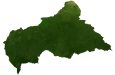
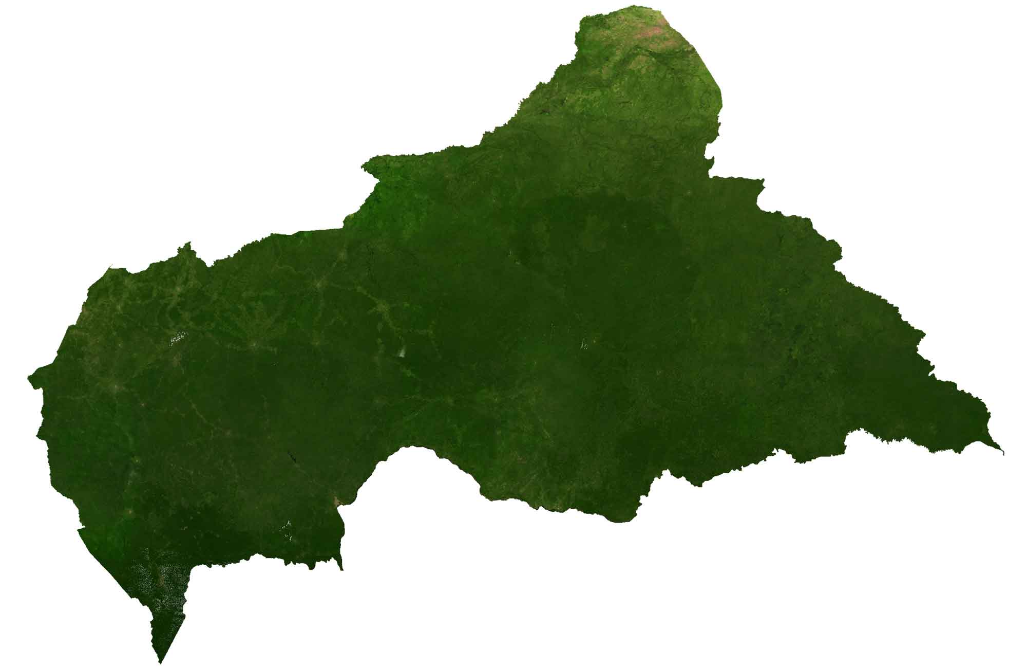
SATELLITE IMAGERY
Central African Republic Satellite Map
The Central African Republic occupies an area of 622,984 square kilometers (240,535 sq mi). In comparison, this makes it smaller than Somalia but larger than Madagascar. The longest rivers are the Ubangi, Kotto, and Mbomou.
The Central African Republic is situated on the Sahel, which marks the transition between the Sahara Desert to the north and the Sudanian Savanna to the south. Forests cover as much as 36% of the Central African Republic.
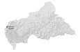
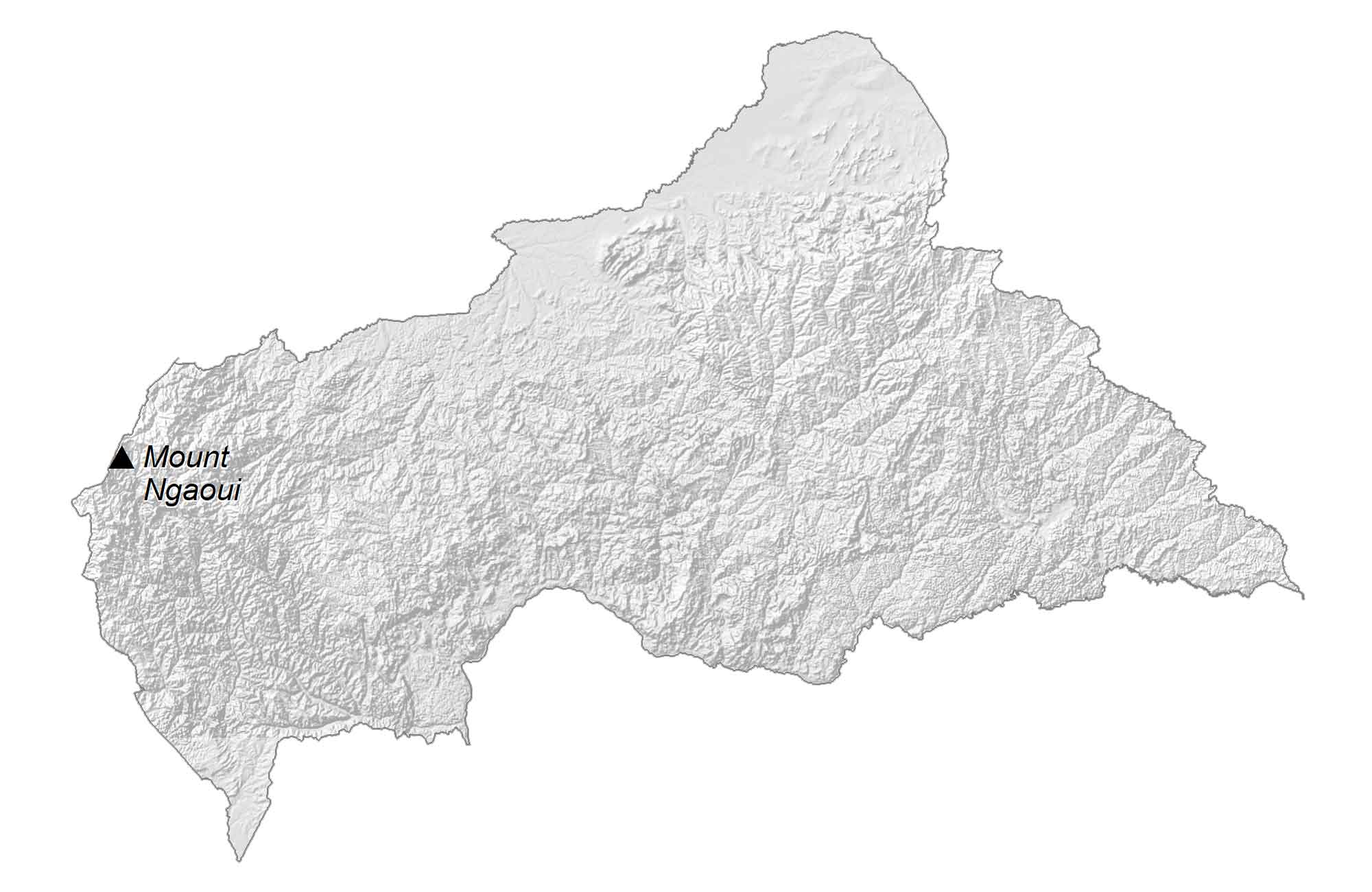
PHYSICAL MAP
Central Africa Republic Elevation Map
The terrain is mostly flat with hills and mountains in the northeast and southwest. For example, the Bongo Massif is a mountain range near the Sudan border in the north. Whereas the world’s second-largest river basin, the Congo Basin, occupies the south.
While the Fertit Hills lie in the northeast, the Karre Mountains are to the west. At 1,410 meters (4,626 ft), Mount Ngaoui is the Central African Republic’s highest peak located on the border with Cameroon.
Capital City
Bangui
Major cities and towns
Berberati
Birao
Bossangoa
Bouar
Bozoum
Bria
Carnot
Kaga Bandoro
Mbaïki
Nola
Ndélé
Cities and towns
Am Dafoko
Baboua
Bamingui
Bambari
Bangassou
Boda
Boali
Dékoa
Gamboula
Garba
Grimari
Ippy
Kaouadja
Kouango
Maïkouma
Markounda
Mobaye
Paoua
Quadda
Rafaï
Sam Ouandja
Sanga
Kabo
Salo
Sibut
Tomori
Vele
Yangalia
Yaloke
Yalinga
Zémio
Lakes, rivers and creeks
Chinko River
Kotto River
Bahr Aouk River
Bamingui River
Uele River
Lobaye River
Ouham River
Highest point
Mount Ngaoui