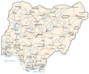
Nigeria Map – Cities and Roads
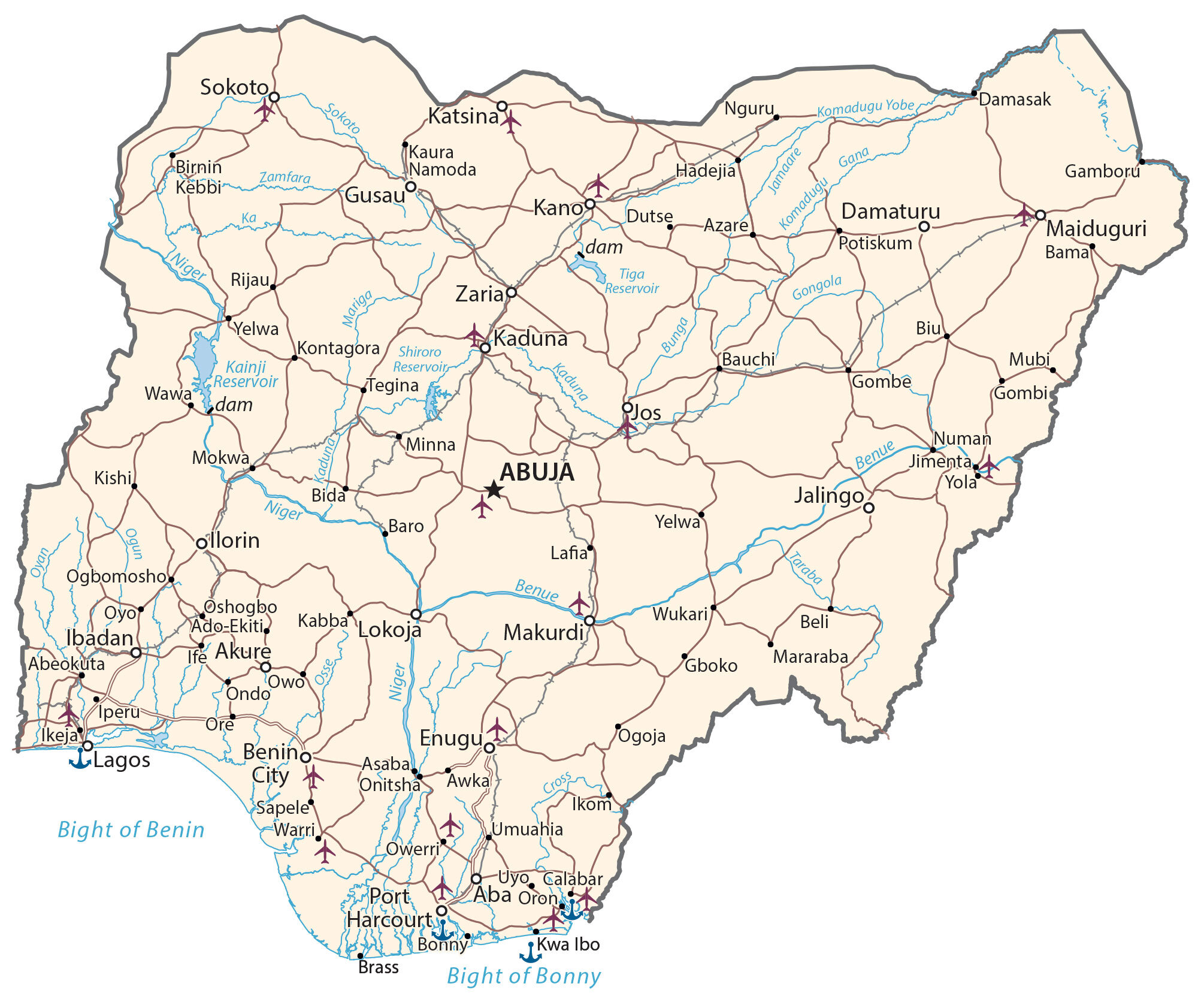
This map of Nigeria contains major cities, towns, states, roads, and rivers. It includes satellite imagery and an elevation map to view the topography and landscapes of Nigeria.
Nigeria map collection

You are free to use our Nigeria map for educational and commercial uses. Attribution is required. How to attribute?
About the map
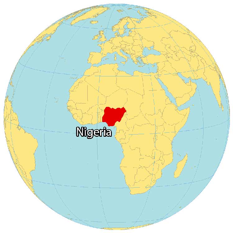
Nigeria is located in Western Africa next to the Gulf of Guinea to the south. It borders 4 other African countries including Cameroon to the east, Chad to the northeast, Niger to the north, and Benin to the west.
The country is known as the “Giant of Africa” because of its large landmass. It’s not only its area, but Nigeria also has the highest population out of all African countries.
Nigeria is unique from other African nations because of its multiethnicity, film industry, and its 725-meter tall monolith outside the capital of Abuja, Zuma Rock. While English is the official language, there are over 500 different languages. Abuja is the capital city of Nigeria. But Lagos is not only the most populous in Nigeria, but it’s also the most populous in all of Africa.
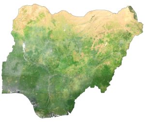
SATELLITE IMAGERY
Nigeria Satellite Map
Nigeria occupies an area of 923,769 square kilometers (356,669 sq mi), which is one of the largest countries in Africa. Although it’s larger than countries like Namibia and Mozambique, it’s still smaller than Egypt or Tanzania.
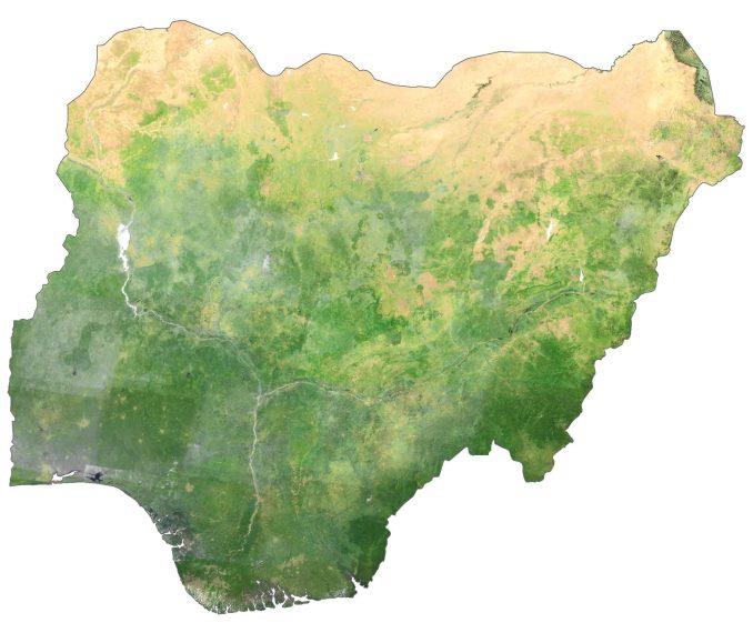
The Niger River is the longest in Nigeria, which flows from the northwest southward forming the Niger Delta where eventually it terminates into the Gulf of Guinea.
Its landscapes are mostly covered with plains and savannas. But it encompasses a wide mix of deserts, plains, swamps, mountains, and jungles. Three south of the country is indented with both the Bight of Biafra (Officially: Bight of Bonny) and Bight of Benin.
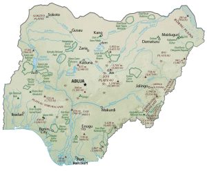
PHYSICAL MAP
Nigeria Physical Map
In general, Nigeria contains plains in the north. In the central region, it transitions to plateaus and hills. Finally, the southern region consists of coastal plains. Namely, the major elevation features are the Udi Hills, Plateau Yorubaland, and Jos Plateau in the central region.
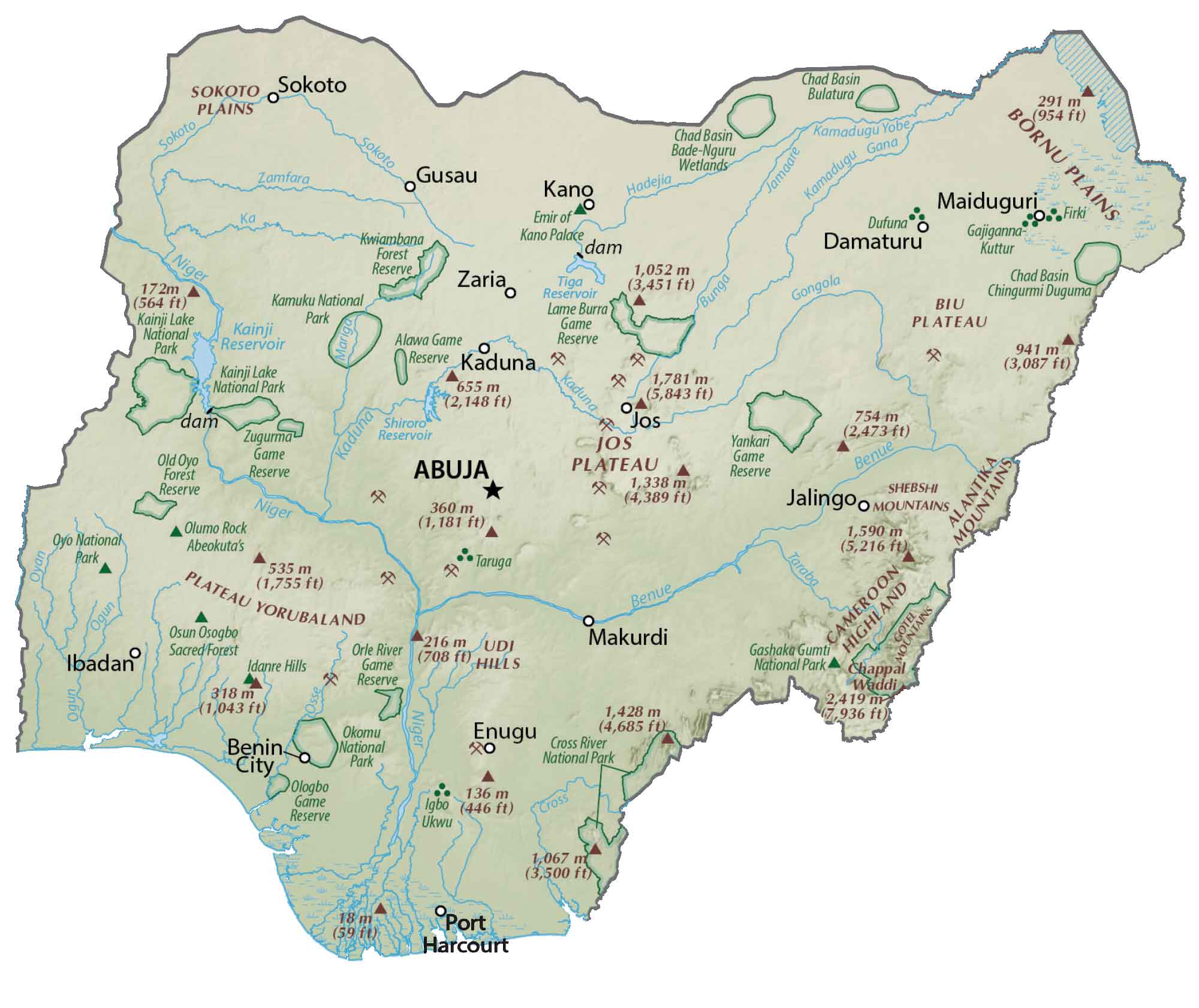
But there are also several highland areas in the southeast as well, bordering Cameroon. These include the Cameroon Highlands, Atlantika Mountains, and Gotel Mountains. The Bornu Plains are to the northeast beside Chad. Whereas Sokoto Plains to the northwest with Niger. At 2,419 meters (7,936 ft), Chappal Waddi is the highest point in Nigeria located along the eastern border with Cameroon.
POLITICAL MAP
Nigeria States Map
States are the first-level administrative unit in Nigeria. Currently, there are 36 states and 1 federal territory. States evolved from the broader regions. Also, states can be further subdivided into local government areas (LGA) in Nigeria.
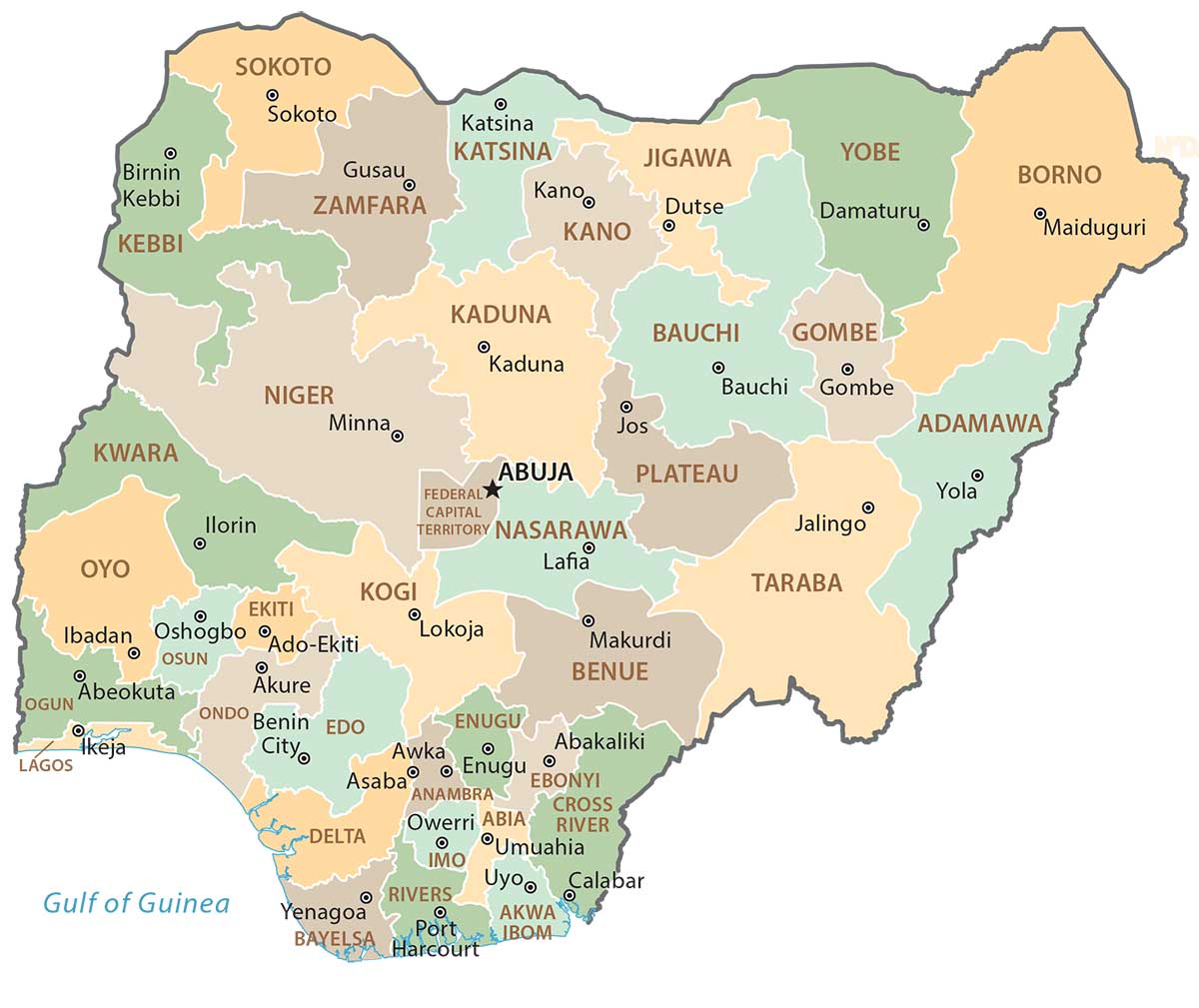
Capital City
Abuja
Major cities
Aba
Benin City
Enugu
Ibadan
Jos
Kaduna
Kano
Lagos
Ogbomosho
Port Harcourt
Sokoto
Zaria
Cities, towns and villages
Abeokuta
Ado-Ekiti
Akure
Asaba
Awka
Azare
Bauchi
Bida
Biu
Bama
Baro
Beli
Birnin Kebbi
Bonny
Brass
Calabar
Damaturu
Damasak
Dutse
Gboko
Gombi
Gombe
Gusau
Hadejia
Ife
Ikeja
Ikon
Jalingo
Jimenta
Kabba
Kainji
Kishi
Kontagora
Kaura Namoda
Katsina
Lokoja
Makurdi
Mararaba
Minna
Mokwa
Mubi
Nguru
Numan
Ondo
Onitsha
Ore
Oron
Oshogbo
Owo
Owerri
Oyo
Potiskum
Rijau
Sapele
Shiroro
Tegina
Wawa
Warri
Wukari
Yelwa
Yola
Lakes, rivers and water features
Benue River
Bight of Benin
Bight of Bonny
Bunga River
Cross River
Gana River
Gongola River
Jamaare River
Ka River
Kainji Reservoir
Komadugu Yobe River
Mariga River
Niger River
Ogun River
Osse River
Oyan River
Sokoto River
Tiga Reservoir
Zamfara River


