Gabon Map – Cities and Roads
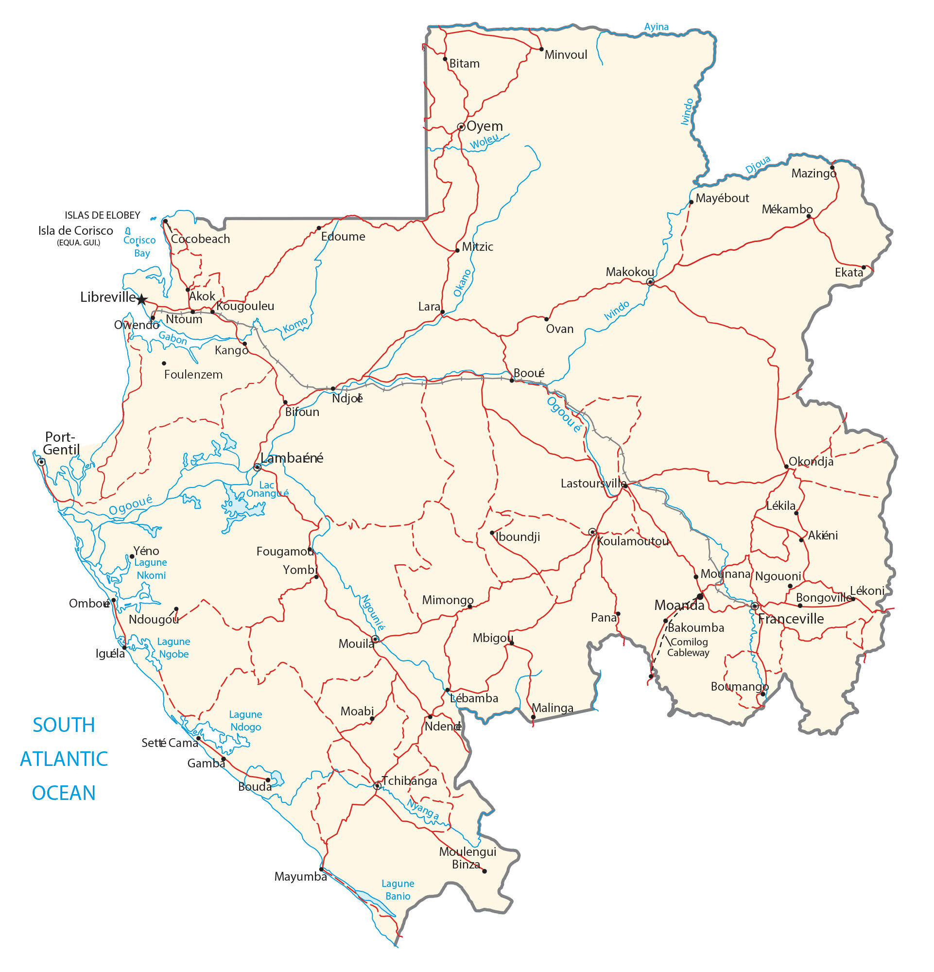
This map of Gabon contains reference features like cities, rivers, and lakes. Satellite imagery and a physical map of Gabon show everything from its savanna to its mountains and hills.
Gabon map collection
You are free to use our Gabon map for educational and commercial uses. Attribution is required. How to attribute?
About the map
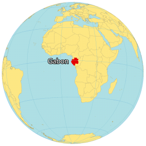
Gabon is located in Central Africa, along the Atlantic Ocean at the Equator. It borders just 3 countries.
First, Cameroon and Equatorial Guinea are situated to the north. Then, the Republic of the Congo wraps around Gabon from the south to the east.
Libreville is the capital and largest city just on the equator along the west coast. Its other major cities are Mandji, Masuku, and Oyem.
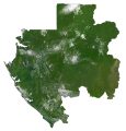
SATELLITE IMAGERY
Gabon Satellite Map
Gabon occupies an area of 267,667 square kilometers (103,347 sq mi), which makes it larger than Guinea but smaller than Burkina Faso. Savanna covers the east and south of Gabon, with hilly pockets within the interior of Gabon.
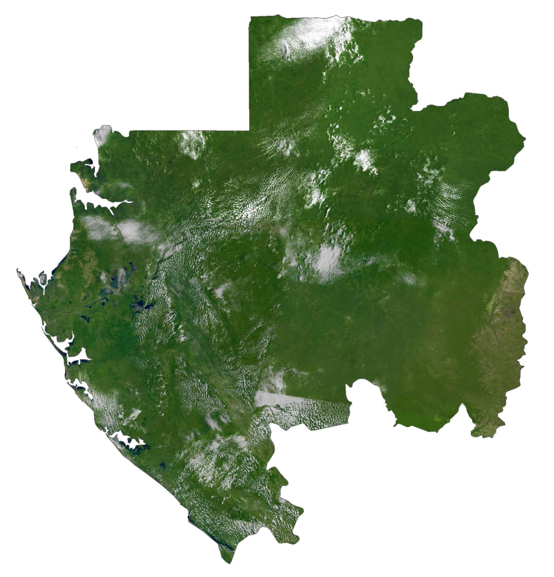
Because Gabon is on the equator, the temperature in Gabon is tropical and is hot year-round. According to the U.N. FAO, forests cover about 85% of Gabon making it one of the most heavily forested countries in the world. While Gabon’s longest river is the Ogooue River, Lake Onangue is one of its largest lakes.
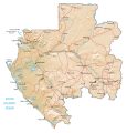
PHYSICAL MAP
Gabon Physical Map
Gabon has three distinct regions. First, the coastal lowlands are along the Atlantic Ocean and are characterized by their narrow mangroves. Whereas the east is mostly long strips of dry savanna and forest.
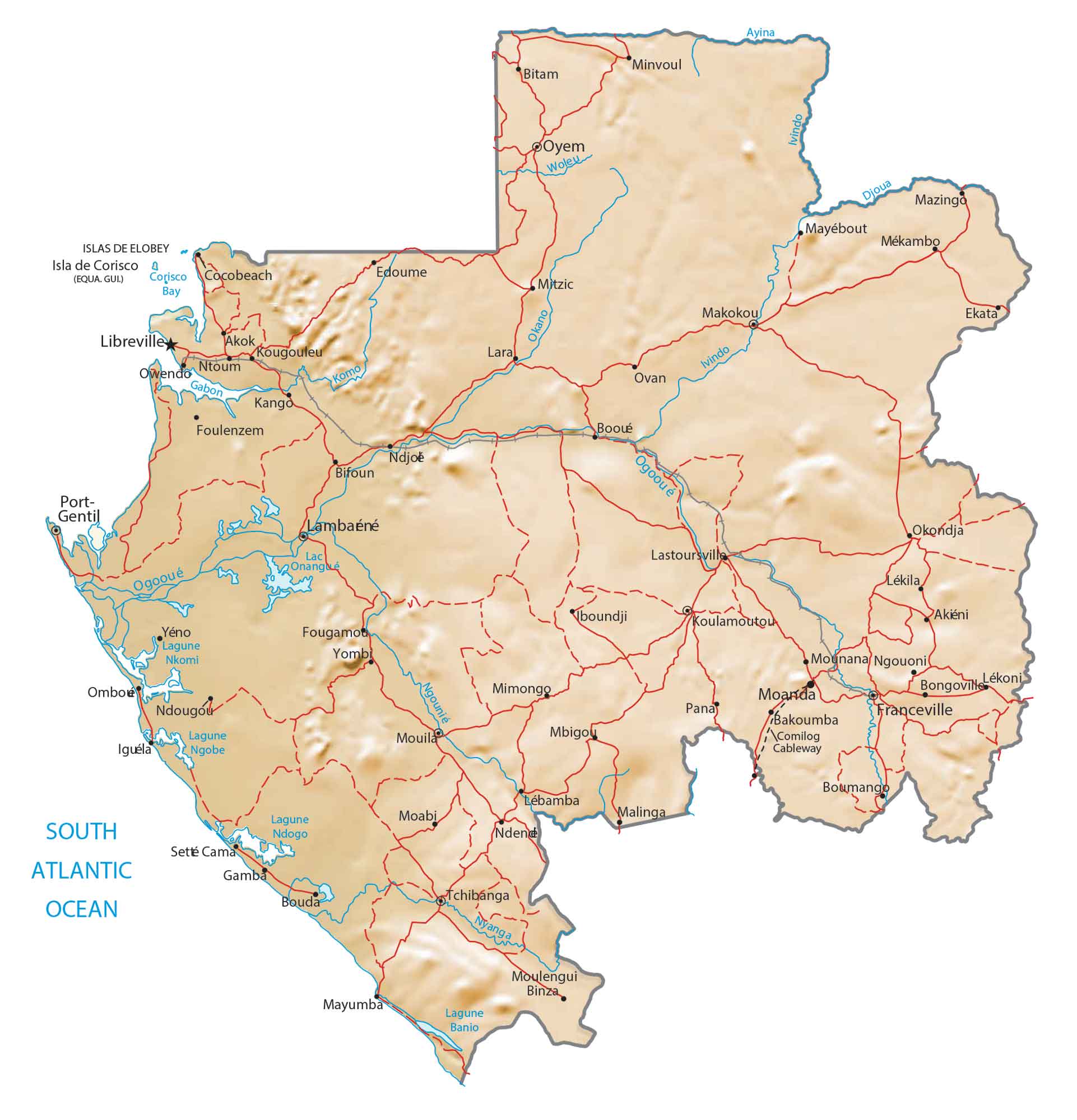
Lastly, the Cristal Mountains and Chaillu Massif lie within the interior. At 1,575 meters (5,167 ft), the highest point in Gabon is Mount Iboundji. But Mont Bengoué is also contested as Gabon’s most elevated peak as well.
Capital City
Libreville
Major cities and towns
Franceville
Makokou
Moanda
Mouila
Oyem
Port-Gentil
Tchibanga
Cities, towns and villages
Akok
Akiéni
Ayina
Bakoumba
Bifoun
Bitam
Bongoville
Boumango
Boundji
Booué
Djoua
Edoume
Ekata
Fougamot
Foulenzem
Gamba
Kango
Koulamoutou
Kougouleu
Lambarene
Lékila
Lastoursville
Lara
Malinga
Mimongo
Minvoul
Mbigou
Mitzic
Mounana
Ngouoni
Ndjoe
Ntoum
Okano
Ombou
Ovan
Owendo
Pana
Setté Cama
Woleu
Yéno
Lakes, rivers and creeks
Djoua River
Ivindo River
Lac Onangé
Lagune Ngobe
Lagune Nkomi
Lagune Ndogo
Komo River
Ogooué River
Okano River
Woleu River
South Atlantic Ocean