PyQGIS: How To Build a Python Script in QGIS
PyQGIS refers to the Python environment within QGIS. It allows users to automate workflow and extend QGIS with the use of Python libraries.
PyQGIS refers to the Python environment within QGIS. It allows users to automate workflow and extend QGIS with the use of Python libraries.
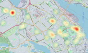
The following guide will provide you with instructions for creating QGIS heat maps and show some examples of how to use heat maps in GIS.

The Periodic Table for Spatial Analysis lists 90 tools for quantifying, finding patterns, and predicting outcomes in a geographic context.
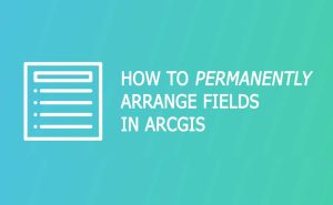
If you want to permanently reorder fields in ArcGIS, you can export your data and use the “field map” method. Secondly, you can use X-Ray for Catalog.
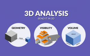
3D analysis is a growing trend because it better represents the real world. For some problems, 3D is sometimes the only way to solve it.

Augmented reality (AR) in GIS allows you to interact with the outside world by enhancing or adding 3D features to your phone’s display.

There are countless ways you can slice, dice and edit data in GIS. That’s why we’ve created this visual guide with the GIS editing tools.
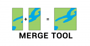
The Merge Tool combines data from multiple sources and puts them into a new data set with the same shape type (points, lines, or polygons).

Python libraries are the ultimate extension in GIS because it allows you to boost its core functionality. Here are the best Python libraries in GIS/mapping.
In this step-by-step guide, we show you how to download, use QGIS tools and map with confidence. Use it like a blueprint for how to use open source QGIS 3.