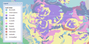
What Is a Map Legend?
A map legend is used to define features in a map. Point, line and polygon symbols in a legend key is the driving-force to understand what is found in a map.
A map legend is used to define features in a map. Point, line and polygon symbols in a legend key is the driving-force to understand what is found in a map.
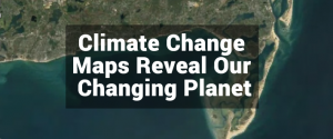
From crop production to melting glaciers, these climate change maps help your grasp a clear understanding of our transforming climate.
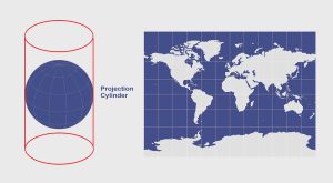
When you place a cylinder around a globe and unravel it, you get the cylindrical projection like the Mercator, Transverse Mercator and Miller projections.
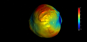
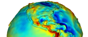
The geoid measures mean sea level and gravity. The GRACE and GOCE satellites are providing the most accurate measurements of the geoid to this date.
A vertical datum is a reference surface of zero elevation to which heights are referred to. Datums are used to measure height and depth from mean sea level.
Ellipsoids, survey benchmarks and triangulation – these are the ingredients for geodetic datums. NAD27, NAD83 and WGS84 are common datums in North America.
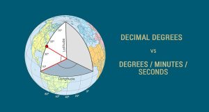
We can find any location on Earth using latitude and longitude coordinates. And we measure those coordinates with decimal degrees or degrees/minutes/seconds

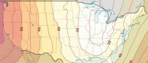
The Greenwich Meridian (or Prime Meridian) is a zero degrees longitudinal It is the start-point which we measure 180 degrees east and west.
5 Halloween Maps. Almost all cultures recognize spirits aka the dead. So we bring these 5 maps for the dead to get you in the spirit of Halloween.

The best way to represent the Earth is with a globe. But map projections can be awfully useful too. Find out why cartographers use map projections in GIS.