US Election of 1804 Map
In the 4th presidential election in American history, incumbent Thomas Jefferson wished for re-election against Charles Pinckney of the Federalist party.
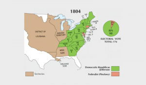
In the 4th presidential election in American history, incumbent Thomas Jefferson wished for re-election against Charles Pinckney of the Federalist party.
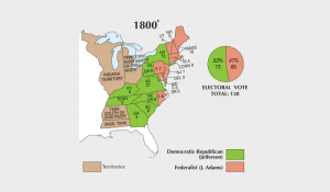
Although the results were disputed, Thomas Jefferson became the third president in American history after gaining 73 electoral votes in the election of 1800.
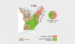
This election was a very tight race between John Adams and Thomas Jefferson. But Adams became the 2nd president of the United States with 71 electoral votes.
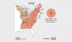
In 1792, George Washington served his second term as president. He didn’t have any opposition after winning 132 total (or 100%) of electoral votes.
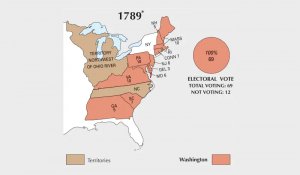
The election of 1789 was between the Federalists & Anti-Federalists. Both factions sided with George Washington as he unanimously became the first president.
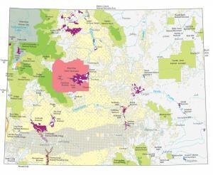
A Wyoming State Map showing major landmarks, populated places, national forests, military bases, parks, wildlife refuges and other federal lands in Wyoming.
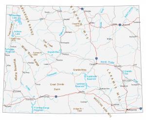
This Wyoming map contains cities, roads, rivers and lakes. Casper, Laramie and Cheyenne are some of the major cities in this map of Wyoming.
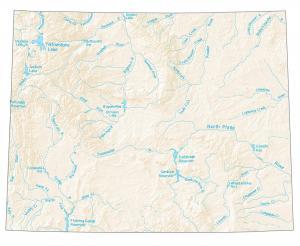
A map with major rivers, reservoirs and lakes in Wyoming like Yellowstone Lake, Snake River, Green River, and the North Platte River.
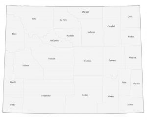
This Wyoming county map displays its 23 counties. Laramie, Natrona and Sweetwater County are the most populated counties in Wyoming.
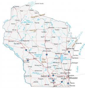
This Wisconsin map contains cities, roads, rivers and lakes. Green Bay, Milwaukee and Madison are major cities shown in this map of Wisconsin.