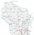
Map of Wisconsin – Cities and Roads

About the map
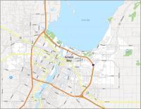
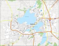
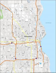
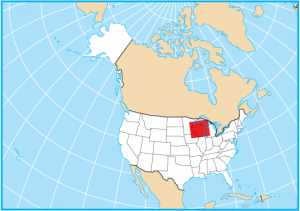
This map of Wisconsin contains cities, roads, rivers, and lakes. For example, Green Bay, Milwaukee, and Madison are major cities shown in this map of Wisconsin. The state of Wisconsin is in the northeast of the United States along Lake Michigan and Lake Superior.
Wisconsin, known as the “Badger State” is characterized as easy-going and as America’s Dairyland. It’s also renowned for its dairy industry, producing high-quality cheese (this is where the term “cheeseheads” originate for fans of the Green Bay Packers football team). Wisconsin Dells is the water park capital of the world with some of the longest water coasters in the United States.
It’s part of the Great Lakes Region and it shares a border with four other states including Minnesota, Iowa, Illinois, and Michigan. The state is also known for its picturesque landscapes, including the scenic Door County peninsula and the stunning Apostle Islands National Lakeshore.
Wisconsin map collection
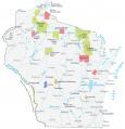
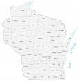

You are free to use our map of Wisconsin for educational and commercial uses. Attribution is required. How to attribute?
State capital
Madison
Major cities and towns
Milwaukee
Green Bay
Madison
Appleton
Beloit
Eau Claire
Fond du Lac
Janesville
Kenosha
La Crosse
Manitowoc
Oshkosh
Racine
Sheboygan
Superior
Waukesha
Wausau
West Bend
Menomonee Falls
Wauwatosa
West Allis
Antigo
Ashland
Bayfield
Beaver Dam
Black River Falls
Chippewa Falls
De Pere
Eagle River
Hayward
Hurley
Kaukauna
Marinette
Marshfield
Menomonie
Merrill
Monroe
Park Falls
Platteville
Portage
Prairie du Chien
Rhinelander
Rice Lake
Shawano
Spooner
Stevens Point
Tomah
Tomahawk
Two Rivers
Viroqua
Watertown
Wisconsin Dells
Wisconsin Rapids
Sturgeon Bay
Kewaunee
Pembine
St Croix Falls
Brule
Ojibwa
Crandon
Oconto
Plymouth
Waupun
Fort Atkinson
Richland Center
Dodgeville
Sparta
Osseo
Interstate highways
Interstate-39 (I-39)
Interstate-43 (I-39)
Interstate-90 (I-90)
Interstate-94 (I-94)
Lakes, rivers and creeks
Chippewa River
Menominee River
Wolf River
Black River
St Croix River
Wisconsin River
Lake Winnebago
Green Bay
Mississippi River
Lake Michigan
Lake Superior
Petenwell Lake
Chippewa River
Landmarks in Wisconsin
Gogebic Range
The Dells
Door Peninsula
Timms Hill
Apostle Islands