Map of Saint Helena
A map of Saint Helena – the remote collection of islands in the Atlantic Ocean with points, bays, settlements, airports, roads, and mountains.
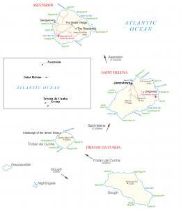
A map of Saint Helena – the remote collection of islands in the Atlantic Ocean with points, bays, settlements, airports, roads, and mountains.
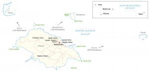
A map of Pitcairn Island with its one major settlement, Adamstown, and its four major islands – Pitcairn, Henderson, Ducie, and Oeno.
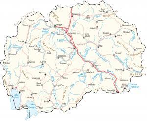
A map of North Macedonia that features its major cities, towns, lakes, rivers, roads, highways, mountains with satellite imagery and elevation.
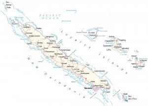
A New Caledonia map with satellite imagery, settlements, roads, highways, seaports, bays, capes, islands, points, and airports.
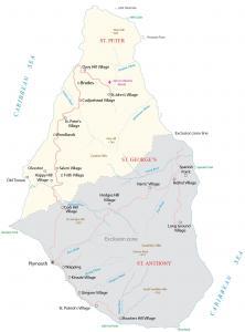
A Montserrat map with satellite imagery, settlements, exclusive zone, islands, points, highways, roads, streams, mountains, and airports.
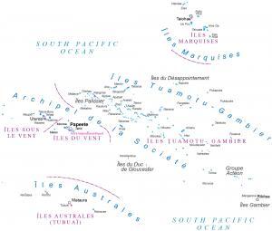
A French Polynesia map with satellite imagery, settlements, seaports, bays, islands, points, harbors, and its international airports.
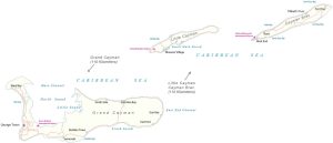
A Cayman Islands map with satellite imagery, settlements, seaports, bays, islands, points, harbors, and its international airports.
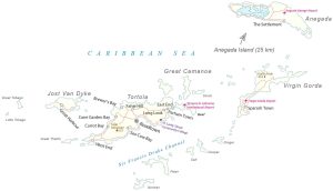
A British Virgin Islands (BVI) map with satellite imagery, settlements, seaports, bays, islands, points, harbors, and its international airport.
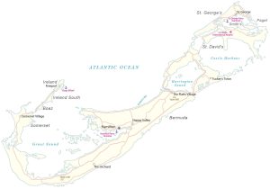
A map of Bermuda with satellite imagery containing settlements, seaports, bays, islands, points, harbors, and its international airport.
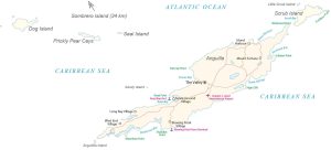
A map of Anguilla with satellite imagery containing settlements, seaports, bays, islands, points, harbors, and its international airport.