Anguilla Map and Satellite Imagery
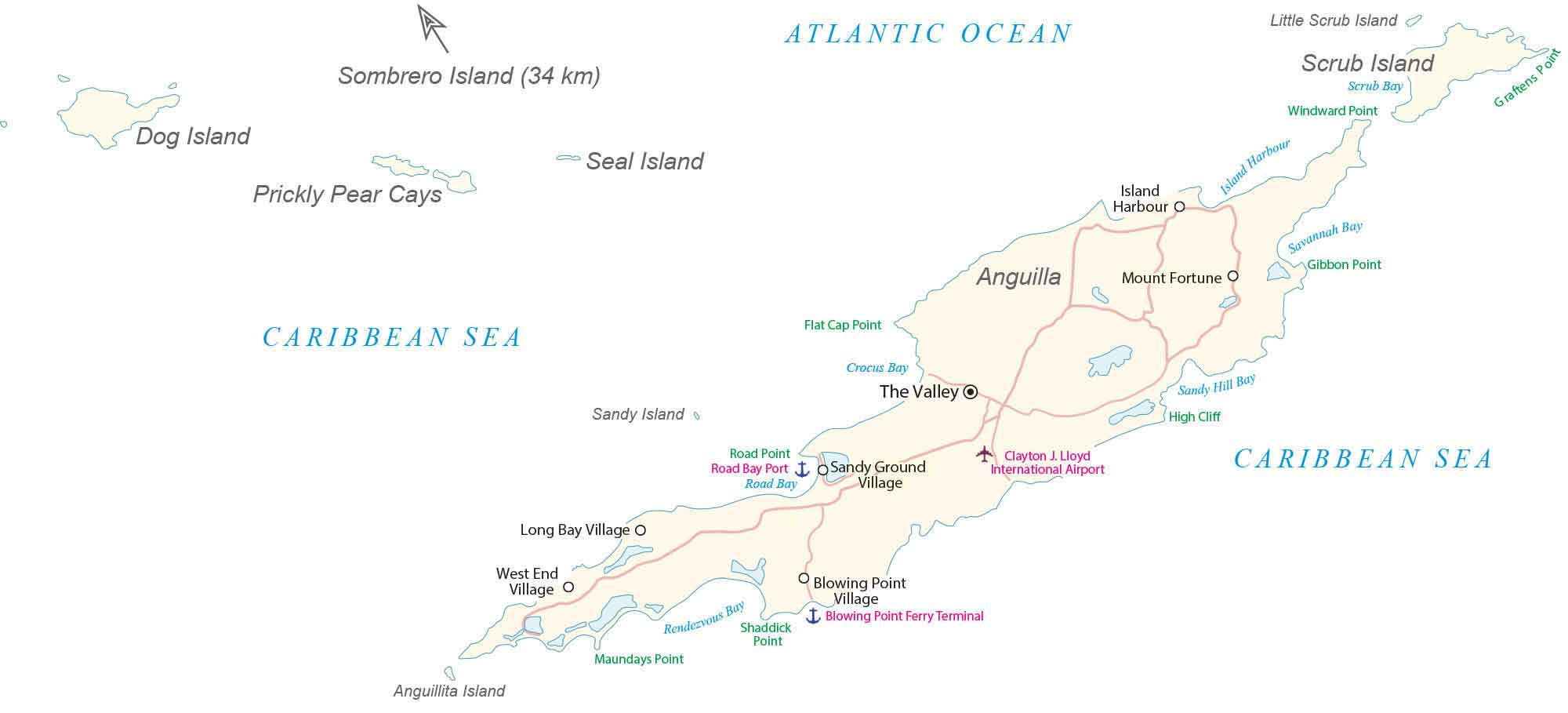
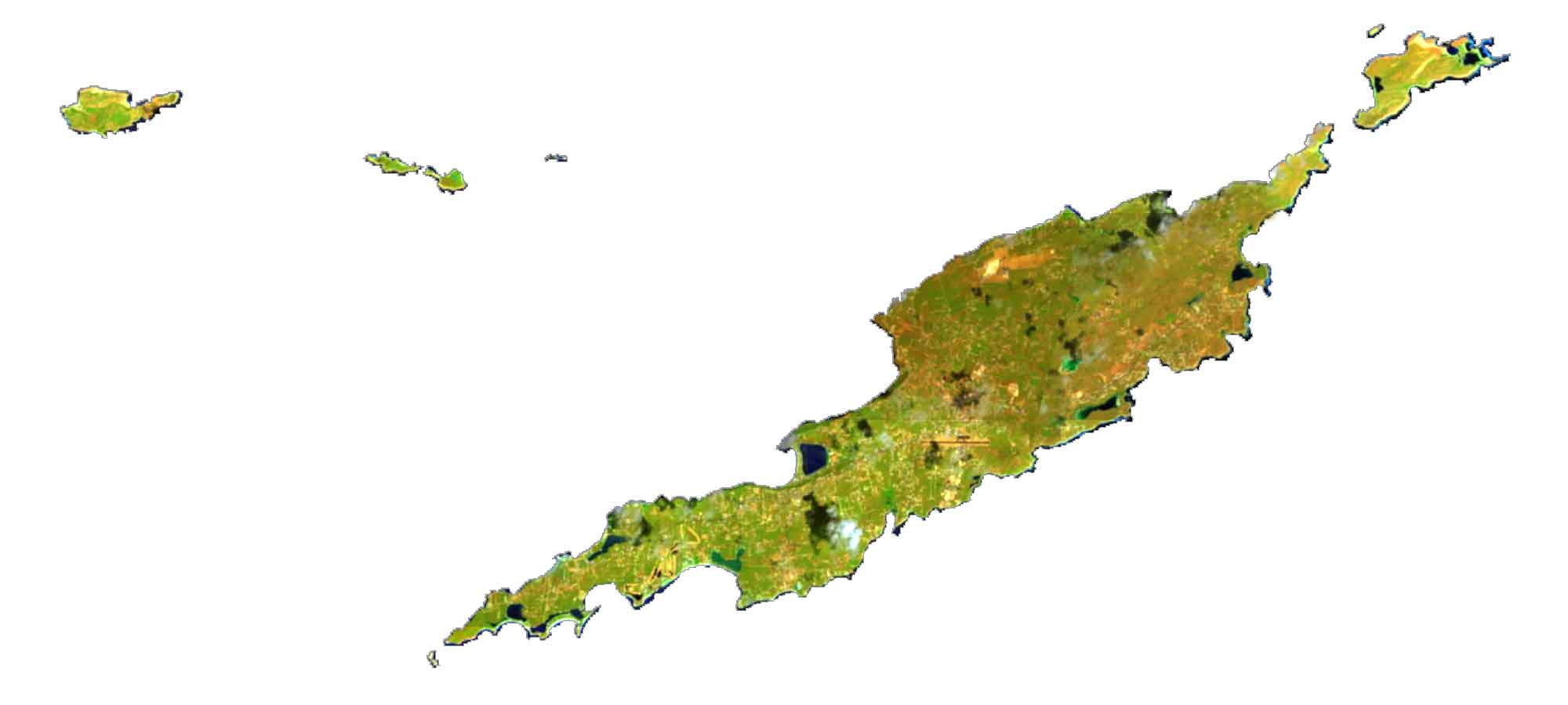
This map of Anguilla has satellite imagery, settlements, seaports, bays, points, harbors, and its international airport. The map of Anguilla includes islands like Scrub Island, Prickly Pear Cays, and Dog Island in the Caribbean Sea.
You are free to use our Anguilla map for educational and commercial uses. Attribution is required. How to attribute?
Anguilla map collection
About the map
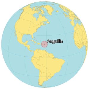
Anguilla is a British Overseas Territory located in the Caribbean. It consists of the main island of Anguilla and several other smaller islands. The island is generally low-lying and made up of limestone and coral.
Anguilla lies north of the Leeward Islands and is part of the Lesser Antilles. It’s situated east of Puerto Rico and the Virgin Islands, as well as north of Saint Martin, separated by the Anguilla Channel.
The Valley is the capital of Anguilla and is the main town of the island. At 73 meters (240 ft), Crocus Hill is Anguilla’s highest peak, situated near The Valley.
Altogether, Anguilla occupies a total area of 91 square kilometers (36 sq mi). In comparison, it’s slightly larger than Saint Martin but smaller than Montserrat. Its size is approximately 26 kilometers (16 miles) long by 5 kilometers (3 miles) wide.
SATELLITE IMAGERY
Anguilla Satellite Map
Anguilla contains several smaller islands. For example, Scrub Island and Little Scrub Island are to the northeast of the main island known for their resort and marina. To the southwest, Anguillita Island is a small rocky, uninhabited island. Sandy Island is situated to the northwest. Additionally, it includes Prickly Pear Cays, Dog Island, and Seal Island further to the northwest.
Capital City
The Valley
Towns and Villages
Island Harbour
Sandy Ground Village
Long Bay Village
West End Village
Blowing Point Village
Islands
Sombrero Island
Dog Island
Seal Island
Prickly Pear Cays
Anguillita Island
Little Scrub Island
Scrub Island
Sandy Island
Points/Bays
Windward Point
Flat Cap Point
Crocus Bay
Road Point
Sandy Hill Bay
Savannah Bay
Gibbon Point
Maundays Point
Shaddick Point
Graftens Point
Other Places
Blowing Point Ferry Terminal
Mount Fortune
Clayton J. Lloyd International Airport
Road Bay Port
Blowing Point Ferry Terminal
Atlantic Ocean
Caribbean Sea
Caribbean


