Map of French Polynesia
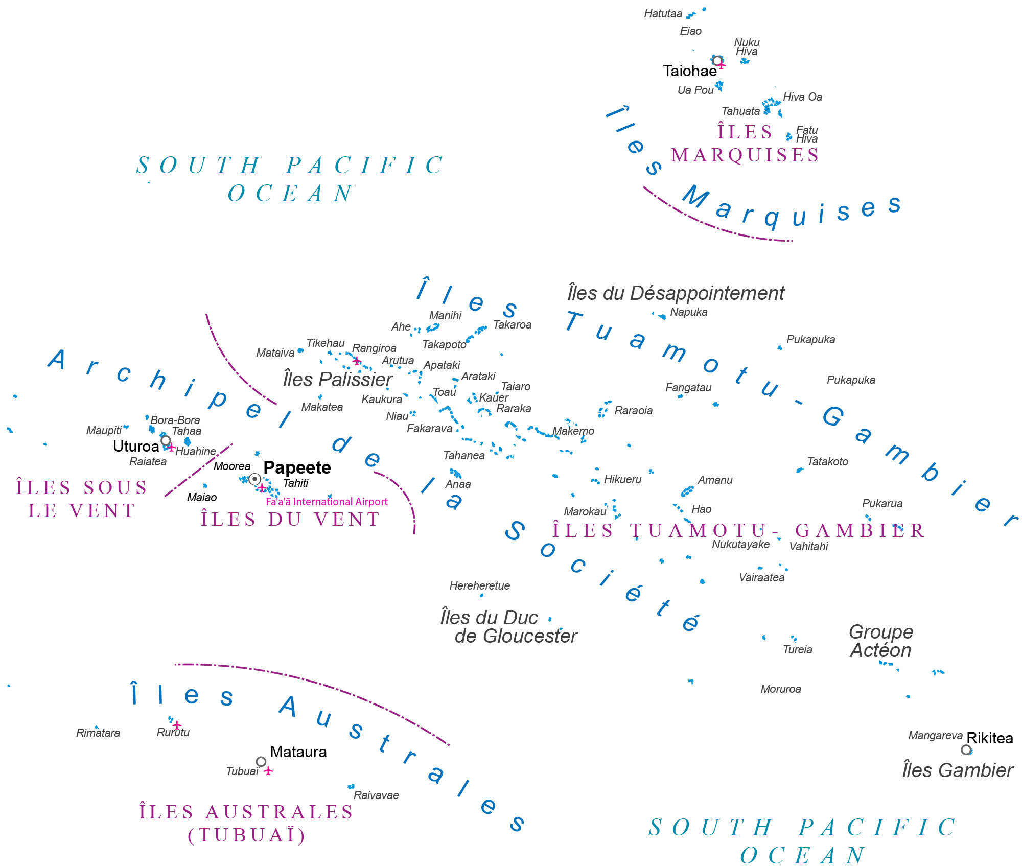
This French Polynesia map contains satellite imagery, settlements, seaports, bays, islands, points, harbors, and its international airport. The island nation of French Polynesia is a territory of France in the South Pacific Ocean.
You are free to use our map of French Polynesia for educational and commercial uses. Attribution is required. How to attribute?
About the map
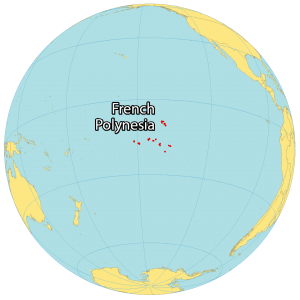
French Polynesia is a multi-island overseas territory of France consisting of 118 islands and atolls extending for more than 2,000 kilometers (1,242 mi). The islands are located in the South Pacific Ocean 550 kilometers (342 mi) south of Kiribati.
It contains five separate groups of islands including the Tuamotu Archipelago in the center, the Society Islands to the west, the Austral Islands to the southwest, the Gambier Island to the southeast, and the Marquesas Islands to the northeast.
More than half of the islands are inhabited, which includes the island of Tahiti in the Society Islands group, which holds more than two-thirds of its population. Its three largest communities are Faaa (the largest), Punaauia, and Papeete, the capital of French Polynesia. French Polynesia occupies a total area of 4,167 square kilometers (1,609 sq mi).
In comparison, it’s larger than Samoa but smaller than Trinidad and Tobago. French Polynesia is in the middle of the Pacific Ocean. At 2,237 meters (7,339 ft), the highest point is Mount Orohena on Tahiti.
Capital City
Papeete
Major Islands
Archipel de la Société
Groupe Actéon
Îles Australes
Îles Australes
Îles du Duc de Gloucester
Îles du Désappointement
Îles du Vent
Îles Marquises
Îles Palissier
Îles Sous le Vent
Îles Tuamotu-Gambier
Communities
Mataura
Rikitea
Tahiti
Uturoa
Islands
Ahe
Amanu
Anaa
Apataki
Arataki
Arutua
Bora-Bora
Eiao
Fakarava
Fangatau
Fatu Hiva
Hao
Hatutaa
Hereheretue
Hikueru
Hiva Oa
Huahine
Kaŭer
Kaukura
Maiao
Makatea
Makepo
Mangareva
Manihi
Marokau
Mataiva
Maupiti
Moorea
Moruroa
Napuka
Niau
Nuku Hiva
Nukutayake
Pukapuka
Pukapuka
Pukarua
Raiatea
Raivavae
Rangiroa
Raraka
Raraoia
Rimatara
Rurutu
Tahaa
Tahanea
Tahuata
Taiaro
Taiohae
Takapoto
Takaroa
Tatakoto
Tikehau
Tubuai
Tureia
Ua Pou
Vahitahi
Vairaatea
Other points of interest
Fa’a’a International Airport
South Pacific Ocean


