Map of Saint Helena
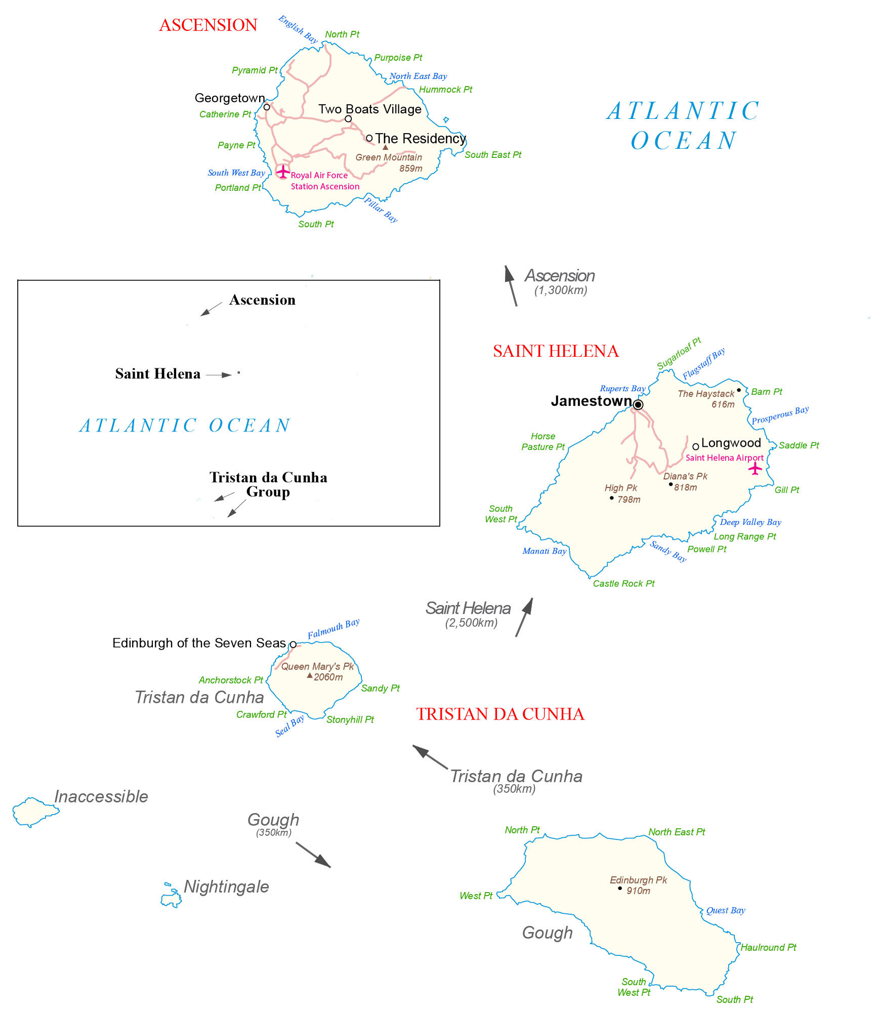
Saint Helena is a remote collection of islands in the Atlantic Ocean between Africa and South America. This map of Saint Helena contains points, bays, settlements, airports, roads, and mountains.
You are free to use our Saint Helena map for educational and commercial uses. Attribution is required. How to attribute?
About the map
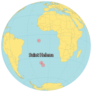
Saint Helena is a British Overseas Territory in the South Atlantic Ocean. It consists of 4 main islands spread out 3,650 kilometers from north to south – Ascension, Saint Helena, Tristan de Cuhna, and Gough.
Ascension is the northmost island, located 2,300 kilometers off the coast of Brazil to the west. Secondly, Saint Helena is the center island, approximately 1,850 kilometers away from Angola, Africa to the east.
The capital of Saint Helena is Jamestown. However, Half Tree Hollow, a suburb of Jamestown, is the largest settlement. The archipelago of Tristan da Cunha includes Gough Island, which is the southernmost island, 2600 kilometers away from South Africa.
While Nightingale Island is an active volcano, Inaccessible Island is an extinct volcano. Both of these minor islands are situated close to Tristan da Cunha. Overall, the islands are between 7°S and 40°S latitude from Ascension to Gough Island.
Capital City
Jamestown
Major towns
Georgetown
Towns and villages
Edinburgh of the Seven Seas
Longwood
The Residency
Two Boats Village
Islands
Ascension Island
Gough Island
Inaccessible Island
Saint Helena Island
Nightingale Island
Tristan da Cunha Group
Bays and water features
Atlantic Ocean
Deep Valley Bay
English Bay
Falmouth Bay
Flagstaff Bay
Manati Bay
North East Bay
Prosperous Bay
Pillar Bay
Quest Bay
Ruperts Bay
Sandy Bay
Seal Bay
South West Bay
Points
Anchorstock Point
Barn Point
Castle Rock Point
Catherine Point
Crawford Point
Gill Point
Haulround Point
Horse Pasture Point
Hummock Point
Long Range Point
North East Point
North Point
Payne Point
Pillar Bay
Portland Point
Powell Point
Pyramid Point
Purpoise Point
Saddle Point
Sandy Point
South East Point
South Point
South West Point
Stonyhill Point
Sugarloaf Point
West Point
Peaks
Diana’s Peak
Edinburgh Peak
Green Mountain
High Peak
Queen Mary’s Peak
Places of interest
Royal Air Force Station Ascension
Saint Helena Airport


