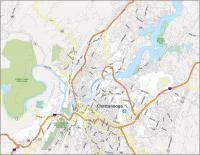
Map of Chattanooga, Tennessee

Map of Chattanooga
This Chattanooga map collection features a road map, landmarks, and things to do. Also, it includes an interactive map of Chattanooga to view the city and surrounding areas.
Chattanooga is known for its pristine nature. This includes anything from hiking, mountain biking, and climbing. For example, Lookout Mountain and Ruby Falls are top attractions near Chattanooga, Tennessee.
Chattanooga has a population of roughly 180,000 people. This makes it the 4th most populous city after Nashville, Memphis, and Knoxville. Our map collection features several printable maps of Chattanooga to help you explore it.
Jump To: Interactive Map | Printable Road Map | 10 Things to Do | Reference Map
Chattanooga map collection
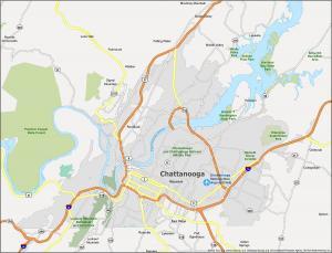
Interactive Map of Chattanooga
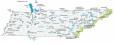
This interactive city map is the perfect accompaniment for your trip to Chattanooga. Situated in the southern part of the state, Chattanooga borders the state of Georgia. Due to its location along the Tennessee River and in the Appalachian Mountains, this city has a scenic view of the surrounding hills and valleys. Find out where to go, what to do, and what to eat in Chattanooga.
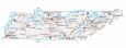
Chattanooga Road Map
This road map is designed to show you interstates, highways, and major roads. For example, it includes I-24, I-75, and state highways. Discover this lovely city with this map and the rest of the state with the Tennessee road map.
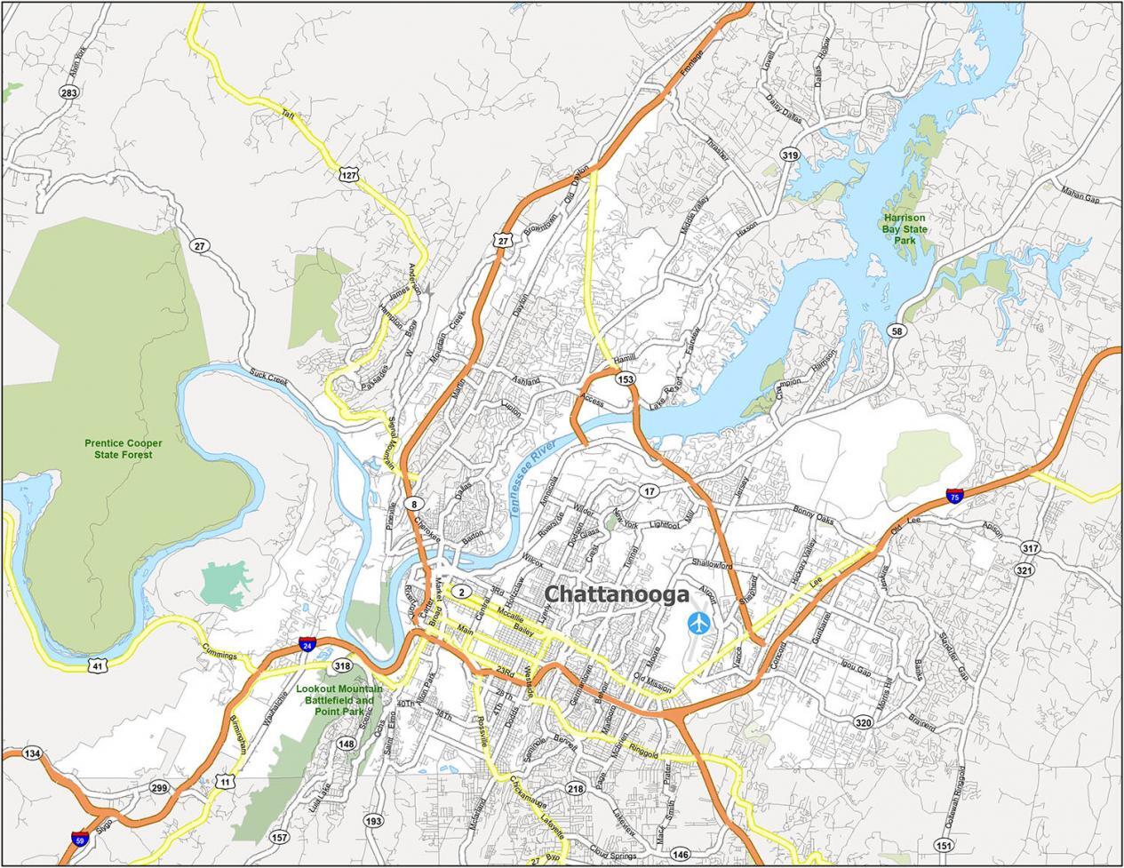
Interstate Highways: I-24, I-75
US Highways: 2, 8, 11, 17, 27, 41, 58, 127, 317, 319, 320, 321, Amnicola Hwy, Birmingham Hwy, Cummings Hwy, Old Us Hwy 27, Old Lee Hwy, Lee Hwy
Parkways/Expressways: Riverfront Pky, Scenic Hwy
Major Roads: 9th St, 20th St, 23rd St, 40th St, Alton Park Blvd, Apison Pike, Bailey Ave, Barton Ave, Bonny Oaks Dr, Brainerd Rd, Broad St, Campbell St, Central Ave, Cherokee Blvd, Dayton Blvd, Dodds Ave, Dodson Ave, Frazier Ave, Georgia Ave, Glass St, Hickory Valley Rd, Hixson Pike, Jenkins Rd, Lookout Mountain Blvd, Lyerly St, Main St, Market St, Martin Luther King Blvd, Mccallie Ave, Old Wauhatchie Pike, Riverside Dr, Rossville Blvd, Saint Elmo Ave, Signal Mountain Rd, Suck Creek Rd, Tennessee Ave, Veterans Bridge, Washington St
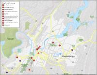
10 Things To Do in Chattanooga
Chattanooga is a city that is home to many attractions for tourists. It includes a famous zoo, aquarium, and botanical gardens. There are also many recreational options like Lookout Mountain and in the nearby Appalachians. With this map, you can quickly and easily explore Chattanooga.
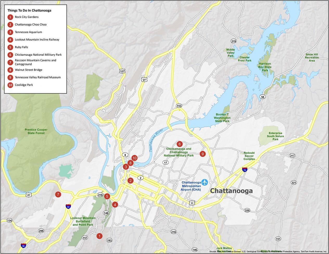
Our list of recommendations for Chattanooga, which is known for its beauty and nature.
- Rock City Gardens
- Chattanooga Choo Choo
- Tennessee Aquarium
- Lookout Mountain Incline Railway
- Ruby Falls
- Chickamauga National Military Park
- Raccoon Mountain Caverns and Campground
- Walnut Street Bridge
- Tennessee Valley Railroad Museum
- Coolidge Park
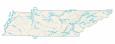
Chattanooga Reference Map
If you’re looking for a map of Chattanooga that details the city’s attractions and city layout, this map is the best choice. It offers a simple layout that can be used whether you’re driving, walking, or riding a bike. Chattanooga has a lot to offer, so there’s no better day to plan your trip to Chattanooga, Tennessee.
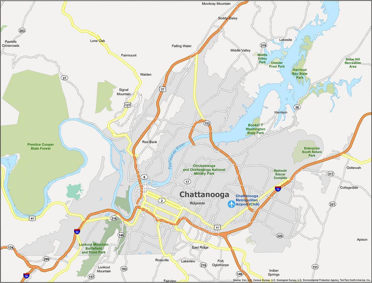
Cities: Chattanooga, Collegedale, East Ridge, Fort Oglethorpe, Lakesite, Lookout Mountain, Red Bank, Ridgeside, Rossville, Soddy-Daisy
Towns: Lookout Mountain, Powells Crossroads, Signal Mountain, Walden
Census-designated place (CDP): Apison, Fairmount, Fairview, Falling Water, Harrison, Indian Springs, Lakeview, Lone Oak, Middle Valley, Mowbray Mountain, Ooltewah