Drive Time Map: Building an Isochrone Map
How To Build an Isochrone Map
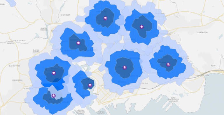
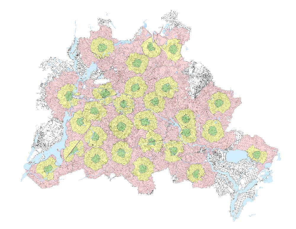
The drive time map is a type of isochrone map that shows you how far you can go based on a start location and an allotted amount of time.
An isochrone is different from a buffer. Instead, it can identify all the streets that can be reached from a starting point.
A drive time map is a great way to visualize how far a can travel in all directions and can even incorporate speed limits, barriers, time of day, and more.
Today, you’ll learn more about drive time maps, also known as isochrone maps. But first, let’s explore some of their use cases.
Drive Time Tools
Are you interested in performing a drive time analysis of your own? From commercial software to open source and web-based tools, we list some of the top tools for constructing your own drive time analysis.
ArcGIS Service Areas
If you have access to a network analyst license in ArcGIS, then you can use the ArcGIS service areas tool to estimate drive time. What you need is a road network dataset, facilities for start points, and any type of barriers or impediments.
Once you have your data layers prepared, it’s just a matter of solving it and letting the tool do the rest. Here’s a tutorial on how to use the ArcGIS service areas tool.
QGIS Service Areas (Network Analysis)
Instead of doing this type of analysis in paid commercial software, why not just do it for free using QGIS 3? As part of its default network analysis tools, QGIS provides the service areas algorithm. Similar to ArcGIS, this tool requires a road network, a starting point (x,y), travel cost, and any boundary nodes.
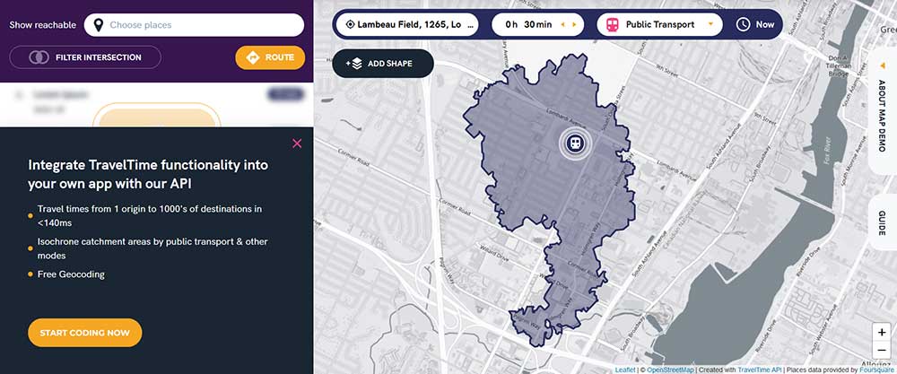
Travel Time App
The Travel Time App serves as a convenient web-based tool to estimate travel time based on an input address. Once you feed an address into the app, it generates a layer for all reachable locations in a designated time frame. Interestingly, you can choose your mode of transportation such as public transportation, cycling, driving, and walking.
Use Cases for Drive Time Maps
As you can guess, drive time maps are popular tools in the transportation industry. But it also is extremely useful in urban planning as well for city services like fire and ambulances.
SERVICE COVERAGE: Because it’s the drive time that will tell you how far a fire truck can reach on a road network from a fire station, it’s possible to identify locations that lack sufficient services.
OPTIMAL LOCATIONS: You can use isochrone maps to determine the optimal locations for any city services. When you propose any type of new service location, you can use drive time maps to model the coverage, and new stations will be able to service.
SITE SELECTION: But it’s not only for city services, you can apply this concept to site selection of office space, retail stores, or picking the best location to live in a city. The focus of drive time maps is how reachable anything is from a starting location in an allotted amount of time.
Drive Time Maps
Isochrones or drive times are a specific type of spatial analysis that helps you understand the reachable distance between specific points in time and space.
These types of maps reveal the geographic extent to which one can travel. If you start at a given point, it determines how far you can travel within an amount of time.
For example, fire stations measure their drive-time distances using a city’s road network. If they know which areas they have difficulty providing service for, it gives insight into where there is sufficient or insufficient access to service neighborhoods. Then, you can use drive time maps to determine the optimal locations to build new stations.
Do you have any questions about drive-time maps? If you do, please let us know with a comment below.


