Easting and Northing Coordinates

Easting and Northing Coordinates
Northing and easting coordinates work together for positioning on maps. They create a grid system on maps, allowing us to pinpoint precise locations.
While northings run vertically, eastings spread horizontally. This system is especially useful because anyone, anywhere can understand and use them.
UTM Coordinates – Easting and Northing
Before we get into the details of eastings and northings, you have to know how the UTM system works.
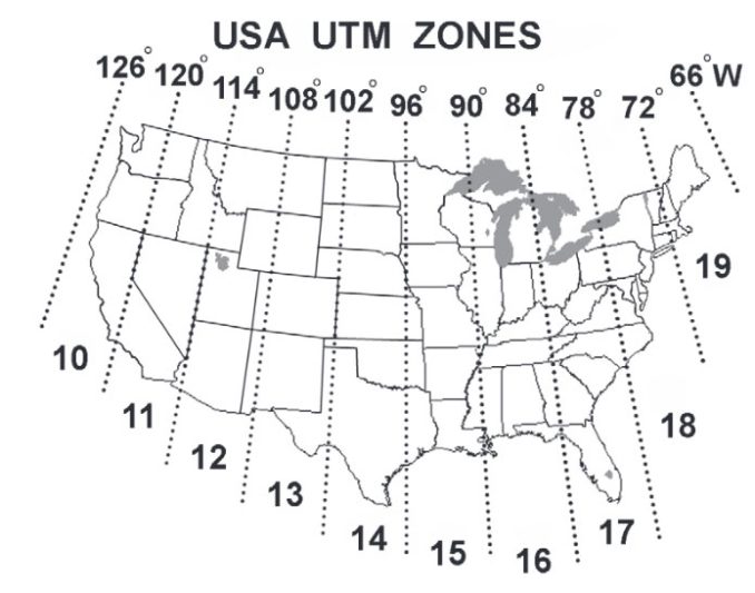
The Universal Transverse Mercator (UTM) system divides the Earth into a series of zones. Each zone is 6 degrees of longitude wide, providing detailed mapping.

This system uses a two-dimensional Cartesian coordinate system. Similar to other map projections, it projects the Earth’s surface onto a flat plane,
When it comes to northings and eastings, the UTM system uses these as its core coordinates.
Map Coordinates in UTM
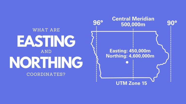
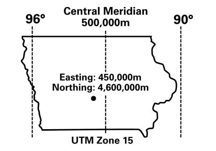
Let’s zoom in a bit on the state of Iowa. As you can see in the reference image above, Iowa is in UTM zone 15 (90° to 96°).
When you cut this UTM zone directly down the middle, this forms a Central Meridian. The easting value at the Central Meridian is 500,000m. It’s the same for each UTM zone.

The point on the map is the city of Des Moines. So, it’s slightly to the west of the Central Meridian. Because it’s to the west, its easting coordinate is 450,000m.
Northings indicate how far north or south you are from the equator. Des Moines is relatively far from the equator so its northing coordinate is 4,600,000m.
Latitude and Longitude to Northing and Easting

First, what’s the difference between latitude/longitude and northing/easting? The main difference is that latitude and longitude coordinates are in a geographic coordinate system. Whereas northings and eastings are in a projected coordinate system.
So, let’s say you’re using a GPS and you mark a waypoint. coordinates. Because GPS uses the World Geodetic System (WGS84), this waypoint will likely be in latitude and longitude.
But for mapping, we often use a projected coordinate system. So, in this case, you’ll have to convert latitude and longitude to northing and easting. But how do you do that? Most GIS software can do this for you.
UTM Coordinates in ArcGIS Pro
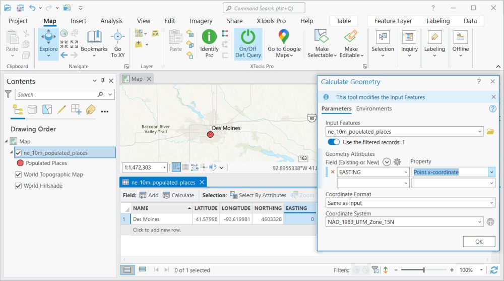
Here’s a screenshot of the “Calculate Geometry” tool in ArcGIS Pro.

If you want to calculate northing and easting coordinates in ArcGIS Pro, you’ll have to first open the attribute table. Next, create fields for northing and easting. Right-click on the northing field and select “Calculate Geometry”.
- Input Feature: Select your input feature class.
- Field: Choose the easting or northing field, depending on which one you want to calculate.
- Coordinate Format: Same as input.
- Coordinate System: NAD_1983_UTM_Zone_15N (But this depends on the coordinates of your input dataset).
Eastings and Northings in UTM Coordinates
Alright, so there you have it. Today, you learned about the difference between northings/eastings and latitude/longitude coordinates. Plus, I also explained how to convert back and forth.
Do you have any questions about easting and northing coordinates? We’d love to hear from you in the comment section below.


So, how would a homeowner, for example, who’s given the Eastings & Northings coordinates of the ‘surveying’ pins (that define the ‘corners’ of a property &c), convert those to longitude and latitude, without the ArcGIS software.
IE: what are the formulae or routines to do this? And vice versa!
Thank you.
Dennis Revell.
Hi Dennis. This is a great question. You can definitely do it using open source QGIS. It’s very similar to Esri ArcMap. The basic steps are… 1) Create new field for latitude and longitude, 2) Right-click and calculate field and 3) Select X-coordinate and Y-coordinate and calculate in WGS84
The formula would be difficult as there are many UTM zones. You’re best to use software, and QGIS is the #1 option
Nicely explained