GIS Agriculture Technology: How To Win the Farm
Agriculture Technology from Location
Today’s farmers use sophisticated agriculture technology because they can save time and money.
Because crops are location-based, this makes Geographic Information Systems (GIS) an EXTREMELY relevant tool for farmers.
For example, farmers use precision GPS on the field to save fertilizer. Also, satellites and drones collect vegetation, topography, and weather information from the sky.
All this data can go into agriculture maps for better decision-making. Let’s look at some other agriculture technology examples.
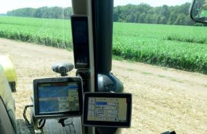
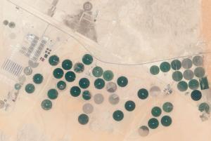
1. Data from the Machine – Precision Farming
Farmers use precision agriculture because they can reduce the amount of fertilizer applied to the field.
Not only do farmers save money on fertilizer, but they save the environment from over-application. This is because a lot of the excess fertilizer tends to end up in streams and rivers by runoff.
Precision farming applies fertilizer only where it’s needed. It’s site-specific.
Sensors on a machine gather information about the crops. Also, the GPS gives you the exact position on the field. Precision farming then applies a variable rate of fertilizer to nutrient-deficient sites.
The farmer who uses precision farming can save anywhere in the ballpark of 2-15$ per acre. Over time, this makes an incredible investment.
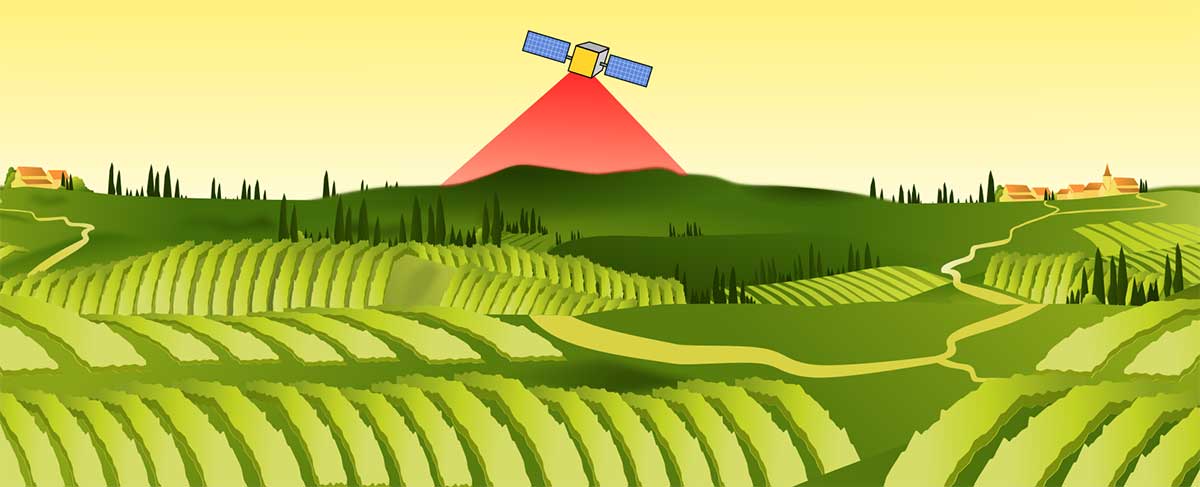
2. Data from the Sky – Satellites and Drones
What do crops need to grow? Other than sunlight and nutrients, plants need the right amount of water. Too much (flooding) or little (drought) water impacts crop growth.
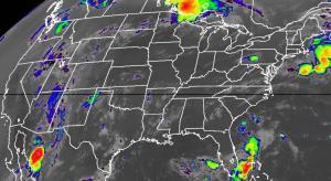
Satellite technologies like Soil Moisture Ocean Salinity (SMOS) collect real-time microwave energy from the Earth’s surface. This can better forecast crop production and monitor drought and flooding.
Landsat satellites analyze the greenness of vegetation using indices like the Normalized Difference Vegetation Index (NDVI). We have a local and global estimate of crop productivity for the entire planet from a long list of satellites orbiting the Earth.
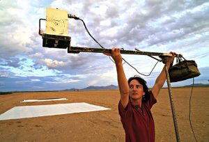
What can drones collect on a field?
- Plant height, count, and biomass estimates
- Presence of disease and weeds
- Plant health and field nutrients
- 3D elevation and volumetric data
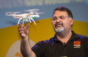
Instead of workers scouting fields, drones can cover more ground. Drones can inspect crop health from the sky and where plant stress is occurring.
Farmers can make actionable decisions on applying nitrogen and monitoring yields. Farmers can use precision watering sensors because they know where it’s needed most. They can combat the spread of pests by identifying critical intervention areas.
One small drone can help make some VERY powerful decisions for farmers.
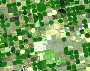
3. Data online – Real-time mapping
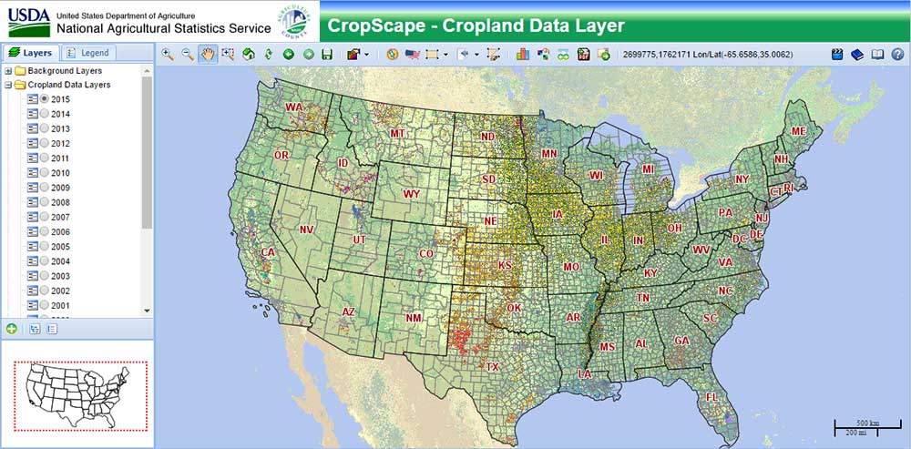
The United States Department of Agriculture (USDA) National Agricultural Statistics Services (NASS) developed the mapping application CropScape where farmers can obtain acreage estimates of crop types.
In the application, farmers can see what crops are growing where and how much. In addition, the government has also used CropScape on issues like food security, land cover change, and pesticide control.
On a global scale, the Food and Agriculture Organization of the United Nations AgroMap breaks down primary food crops with its global spatial database of agricultural land-use statistics.
For large-scale planning, online tools like plant hardiness define suitable climatic growing areas for different types of crops.
Likewise, the Canadian Land Inventory was the first GIS data set produced. Its purpose was to classify the varying potential for agricultural production in Canada.
Modeling and Mashing data sets
Researchers are mashing together various inputs to better model and understand crop production.
The Crop Assimilation Model (CAM) and Soil-Water-Air-Plant (SWAP) in GRASS GIS serve as crop productivity monitoring tools by simulating soil, water, and crop processes.
The Length of the Growing Period (LGP) is when crops meet the full evapotranspiration demands of precipitation and soil moisture-holding capacity. Each crop type has specific moisture requirements making LGP difficult to calculate.
The Erosion-Productivity Impact Calculator (EPIC) models crop yields and irrigation requirements for climate change. While the Agricultural Non-Point Source (AGNPS) Model predicts the effects of agriculture on water quality.
…And the Versatile Soil Moisture Budget (VSMB) simulates soil moisture conditions of cropland areas taking into account evapotranspiration, rainfall, runoff, and other factors.
Geographic Information Systems assist decision-support. Reducing Emissions from Deforestation and forest Degradation (REDD) by IDRISI determines the opportunity cost of potential agricultural revenue versus deforestation.
Aspect and microclimate can locate potential areas that can be harvested like the south-facing slopes of the Swiss Alps. The south-facing slopes shelter from cold and dry winds which is critical to successful crop growth.
Meeting Future Food Demand
How can we fulfill the needs of a growing and increasingly affluent population? Agriculture technology is helping diagnose food security like in this Feeding the World Story Map.
Can we learn from historical imagery and data? Landsat satellite data provides a unique view of historical agricultural land. When you plot historical trends of land use over time, is there enough arable land to serve a growing population?
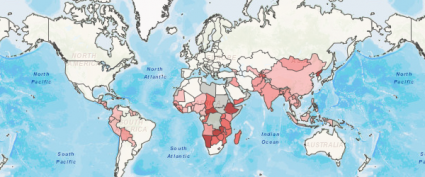
Maps serve the purpose of raising awareness about global hunger and places that are in need like the FAO Hunger Map and World Food Programme Food Security Analysis.
Overall, satellite, mobile collection, and GIS data are safeguarding food-insecure populations by establishing underlying causes.
Summary: Agriculture Technology
Precision farming, satellites, drones, web maps, and sophisticated models – this list represents some of the agriculture technologies that farmers and researchers use today.
The modern-day farmer needs to understand a lot more than just what to seed – soils, weeds, nutrients, weather, insects, disease, machinery, and climate.
These emerging trends provide the location intelligence farmers need to get the job done faster and with more knowledge.
What are some of the other growing trends in agriculture technology that you know of?


Indeed everything you have shared is absolutely correct and it will be helpful in the agricultural revolution.
First time learn about GIS. Thank you so much for making it so interesting and informative. May I know can GIS help in property facilities maintenance management and how? Please help
Very enthusiastic information that can help farmers to mitigate some of the challenges they come across in their life during crop production. I am looking for a firm that can help me sharpen my brain in this field of GIS.
Very effective and learning information about farmers. I also am working with thousands of farmers in districts on land water management to develop agriculture for FTC ATMA and RSeti
Not sure why someone would ever try to state that you need to fix anything in this article. This was a great piece to read, and I think anyone willing to read the article will find it very informational and accurate. Thanks a lot and keep doing what you do.
Thanks for the information, it was quite helpful
Give me a break, everyone is so politically correct and super sensitive. The 21st century filled with weak spines, everyone so worried about everyone thinks of them.
“Instead of men scouting fields,…” Men? How about joining the 21st century in the use of gender-neutral terms in order to more accurately represent what is actually happening in the real world? “Scientists scouting the fields.” “Farmers scouting the fields.” “Workers scouting the fields.”
Thanks I fixed it