Fishnets in GIS: An Overview

DEFINITION:
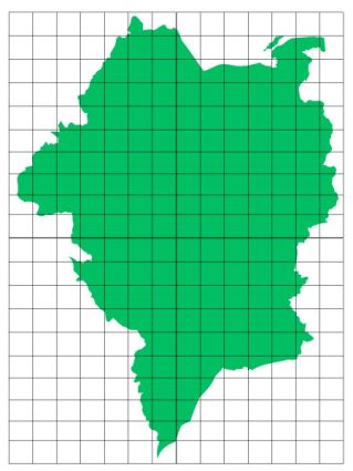
Fishnets are grid-like patterns made up of rows and columns of cells (usually squares or rectangles) that cover a geographic area.
Fishnets are just another way to explore spatial relationships. But what exactly are fishnet grids in GIS? And how do we use them to better understanding geographic data?
What is a Fishnet in GIS?
Fishnets are a type of grid that we use to overlay a feature on a map. These grids are rectangular or square cells, resembling a fishnet, hence the name.
We use them for organizing spatial data into manageable, comparable units. This segmentation allows users to aggregate data within each cell.
For example, you can count the number of homes in a cell. But it’s also possible to calculate the area of land cover or any type of geodata.
Applications of Fishnets
Fishnets have applications across various fields. Here are a few examples:
- Environmental Monitoring: Environmental scientists use fishnets to study deforestation, wildlife habitats, or pollution dispersion. They divide the area of interest into cells and analyze changes over time.
- Urban Planning: Planners use fishnet grids to analyze land use patterns. By understanding infrastructure distribution, they can better plan services and utilities efficiently.
- Public Health: In epidemiology, fishnet grids help in mapping disease outbreaks. Once you build a grid in an area, it’s easier to understand the spread and identify hotspots for interventions.
These are just a couple of examples of fishnets. But I’ve seen them used all over the place on GIS.
Creating Fishnets in GIS Software
Both QGIS and ArcGIS offer tools to create fishnet grids. The process involves specifying the origin point and setting the dimensions of the grid cells.
While fishnets are useful tools, they come with their own set of challenges. GIS professionals have to consider the appropriate cell size for their analysis.
If it’s too large, you might miss subtle spatial variations. But if it’s too small, the data may become too noisy to manage. You can also consider hexagonal binning, as it again has its own advantages.

Summary: Fishnets in GIS
Fishnets in GIS help analyze spatial data effectively. When it’s in grid format, it makes it easier to study patterns and trends. But remember that choosing the right grid size is key.
Do you have any questions about fishnet grids? Please send us your comments below.


