10 GPS Apps For Navigation [Android and iOS]
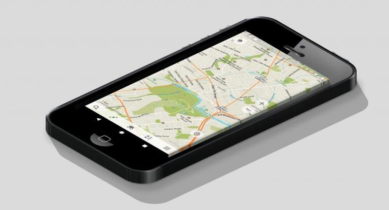
10 GPS Apps For Your Phone [Android and iOS]
Today, we’re going to reveal the top 10 GPS apps for your phone.
Some of these apps will steer you away from trouble like crashes, construction, and the cops.
Others provide real-time traffic information, voice navigation, and intelligent re-routes.
And some… Well, we have no idea why anyone would even use them. But people still do! More on that later.
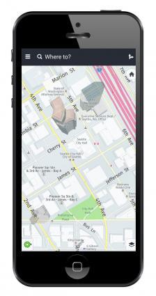
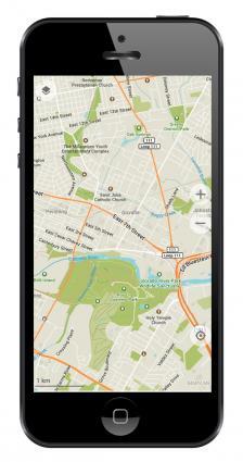
1. Google Maps
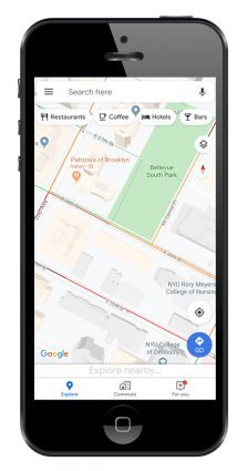
Google Maps takes the top spot for GPS apps. And with good reason. Google Maps covers more of the world than anyone else. Hundreds of millions of places are on the map in 220+ countries. So wherever you live in the world, Google is the most complete map you can find.
By using machine learning, it’s how Google keeps its base map fresh and relatively error-free. Not only this, but they use the power of AI to navigate you through heavy traffic with real-time data. So when you’re on the move, no better GPS navigation app delivers like Google Maps.
Another key feature is Google Street View which captures panoramic views of the outdoors. Or if you want to step inside shopping malls, restaurants, and museums, you can do this with its indoor mapping capabilities.
#1 app for live traffic and navigation.
#1 app for the freshness of geolocation information.
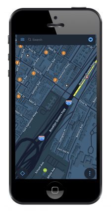
2. Waze
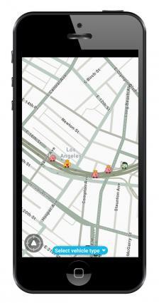
Google acquired Waze some time ago. But they still operate quite differently. Let me explain. You should think of Waze as entirely community-driven. It’s like the Wikipedia of GPS apps because it’s the Waze community that determines its success. If there’s a crash, Wazers have each other’s backs by pinpointing its location.
So when you’re behind the wheel, Waze helps get you where you want to go faster. By using Waze, you can avoid traffic jams because it instantly changes your route in real time. If you need an app for this specific purpose, there’s nothing better than Waze.
But what I love the most about Waze is how you can see other Wazers behind the wheel. Even right next to you, there might be another Wazer. As you keep contributing to it, your emoticon evolves. This incentive-driven app is what keeps people motivated and using it.
#1 app for alerts (crash, construction, and cops).
#1 app for long highway drives.
3. Apple Maps
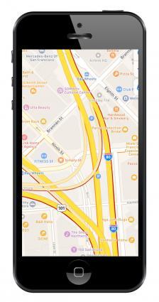
I’ll be honest with you: I didn’t like Apple Maps when it first came out. Cities and towns weren’t very detailed. The maps were boring and bland. And some key features were absent. But over the last couple of years, Apple Maps has made a big push to rectify these shortcomings.
For example, map details have greatly improved. In fact, just recently Apple Maps had even added stop signs and traffic lights in limited areas. There are more businesses, restaurants, and places of interest. But it’s still not completely there yet. Try zooming at different scales, it’s missing businesses in other parts of the world.
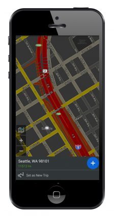
The second reason I like Apple Maps is that its real-time traffic has significantly improved. Thick, red lines shout out where traffic is heavily congested. If you’re in a hurry, try your best to avoid these areas. If you have a route in your app, the app intelligently helps you dodge the worst of the worst.
Finally, the last reason I like Apple Maps is that it’s boosted the number of features. For example, it displays speed limits, parking spot reminders, and advanced lane guidance for turning. All we’re missing is integration with Apple indoor maps for places like airports and large shopping malls.
#1 navigation app for CarPlay.
4. Here WeGo
I really like HERE WeGo maps. When I tested it, its biggest selling point was its beautifully designed base map. HERE maps feel clean with a focus on legibility at different scales. Other positive features are its live traffic, speed limits, and voice guidance.
I particularly enjoyed how HERE’s base map displays 3D buildings by default. But the only downside here is that some of the OpenStreetMap buildings can be unfortunately a bit out-of-date. Overall, it completely depends on where you are in the world.
Unlike some of the alternatives in this list, a nice feature for HERE WeGo maps is that you can download your maps offline. By doing this, you can avoid data consumption or finding Wi-Fi hotspots. Not to mention it’s perfect for areas where you can’t get a strong enough wireless connection.
#1 for offline map navigation.
5. TomTom Go Navigation
There are a lot of users who prefer the TomTom Go Navigation app over some of the alternatives. Though, I’m still a bit struggling to understand why. Don’t get me wrong. The base map is visually pleasing. And for anyone who wants to avoid speeding fines, it gives advanced notifications where cameras are located en route.
But it comes with a couple of downsides as well. For example, as soon as you download the app, it only allows you to travel 75 kilometers with it. Even though it reloads every month, you’ll have to pay a subscription fee if you want to travel anything beyond that. It also asks for a ton of permissions like access to your contacts, phone numbers, and photos. This is more than I like to hand out to any app developer.
The core idea of TomTom as a company is its handheld GPS receivers. But lately, more users are simply using their smartphones for navigation. So TomTom has adapted to this shifting segment of the market. The TomTom Go Navigation app is a carbon copy of what you can find on their stand-alone devices. For those existing users, it’s nice they already have some familiarity.
#1 app for speed camera alerts.
6. Sygic
200+ million drivers from around the world use Sygic. The biggest reason for its popularity is because of its car connectivity. For example, it’s completely compatible with Apple CarPlay. This is a big plus. So when using Sygic, instead of just seeing the map on your phone, you see it in your car’s built-in infotainment.
Sygic is one of the top-rated apps with over 200 million drivers using it. It’s good for speed limits, traffic information, and speed cameras. For services, it gives you gas stations with fuel prices as well as parking services.
Overall, we found Sygic a decent choice for car navigation. Its developers back the app quite well with frequent releases. It has millions of places of interest with several updates per year. But what you’re getting is just a trial period. Afterward, you have to pay for the premium app.
#1 app for car connectivity.
7. OSMAnd
OSMAnd was built using two of the largest collaborative databases in the world. First, it leverages the massive volunteer effort of OpenStreetMap (OSM) for its underlying base map. After you download the app, the free version of OSMAnd gives you a limit of 7 location downloads.
The second database it incorporates is Places of Interest from Wikipedia. Again this comes with limitations. With a subscription to OSMAnd+ at a cost, you have access to Wikipedia and WikiVoyage articles at your fingertips.
OSMAnd puts a nice twist on GPS apps. Some of the best features of OSMAnd are its display for foot, hiking, skiing, and bicycle paths. It’s also a nice feature that you can download individual map tiles to avoid filling your phone’s memory card.
#1 app for open source.
8. Maps.me
If you’re traveling off the beaten path, Maps.me is a great GPS navigation companion tool. In fact, some hikers use this app because they can take it offline and find trails that wouldn’t have been able to find without it. So, this app was perfectly designed for those who like to get lost.
But it’s for city use too. The live traffic information is a bit laggy. Nevertheless, these are some of the bugs the developers I’m sure will iron out in upcoming releases. This includes its out-of-sync voice navigation.
The ads on Maps.me can be overwhelming at times. You can remove ads with a paid subscription. But overall, it’s a great travel app. This is especially true for driving, cycling, and walking too.
#1 app for traveling off the beaten track.
9. CoPilot
CoPilot is one of our least favorites on the list. You start with a free trial by registering with your email. On startup, it immediately starts asking for you to buy it. It’s kinda like being in your local Radio Shack with a pushy salesperson hovering over top of you the whole time. Not a pleasant experience.
Don’t get me wrong. CoPilot is a neat concept in itself. It customizes your experience whether you drive a car, truck, or RV by finding restrictions on the road. The key is that it’s for safety and for better preparing for your long journey. I’m sure there’s a market for it. I’m sorry. But it’s just not us.
The other questionable feature is how it uses geo-locations from Yelp. Let me preface this by saying, Yelp has millions of places of interest. But it does come with its fair share of flaws and trust issues. CoPilot does have a couple of bright spots like its offline maps, real-time traffic, and road restrictions. But you can find most of this in other apps mentioned on this list.
#1 app for road width and restrictions detail.
10. MapFactor
It’s the curious case of MapFactor’s highest rating in free GPS apps. Don’t get me wrong. It does the job for offline maps. But the free version is absolutely littered with advertisements. There’s an advertisement on startup. Another one on shut down… Even if you look at it the wrong way, an advertisement will pop up.
MapFactor isn’t exactly loaded with features. It uses an open source data set as its base map with monthly updates. That in itself is not an issue. But you can optionally add TomTom maps, which is a bit of a step up. But why not buy TomTom, to begin with?
My only question is: Why? Why use this app when the top 4 in our list are available for free. MapFactor somehow crawled to the #10 spot in our rankings. Overall, we find it a questionable navigation app at best.
#1 app for best rating
Top 10 GPS Apps For Your Phone [Android and IOS]
To recap, we highly recommend the top 4. GPS apps like Google Maps, Apple Maps, Waze, and Here WeGo are as reliable as they come.
Things start going a bit downhill after the 4th spot. But these niche GPS apps still have their time and place.
Finally, things really start getting iffy as you move downwards from the eighth spot. I don’t want to say they fall off the planet. But we’re getting there.
So, this about wraps things up. We’ve tried and tested each app. We liked some. And we disliked a couple. That’s how we see the world of navigation apps. Now, it’s your turn.
What do you use as your GPS navigation app? What’s good about it? Which features would you like to see? Please let us know with a comment below.


I am disappointed your review of TomTom navigation. They’re a lot of apps that require accessing your data. But going a bitI further then this and a brief note about road radars alerts and pretty visual sidethere is nothing on your review concerning the practical side. Seems like you’ve never used the app. I think it has a very good display of road conjunctions and lane assistant, something that gMaps doesn’t offer and one can find himself driving past the turn.
Greetings from the borderlands of Arizona.
Our interests in mapping here are mainly off the pavement – places where the agile 4runner can take us for some exploring or hiking. Are there apps that do well with this aspect of GIS info, and are there some that Android phones can download? Thanks for any help – comparative reviews are always interesting!
If you are a OSM contributor there is no better app than OsmAnd. If you have enough OSM edits you get unlimited map updates. Also, the annotation features and customizable interface helps a lot. :-)
Need to measure land
Have you ever checked Magic Earth? Compared to others except for the top 3, this is so far the best offline navigation map. Clean and fast—even for Bicycle routes—straightforward and completely free. Another 1 next to this and way above the others mentioned is Mapy.cz. This is supposed to be primarily for Czech users, but being in the Philippines and using this for a few years directly comparing to Maps.me, this has more details and information, more fast and clean, though bested only by ME (mentioned above) for bicycle route use. For car navi on long travel I prefer this over google maps because it’s offline and sticks on the road even while under a concrete skyway. Please check and make a review if possible.
I had Sygic on my iPad a number of years ago (until the iPad broke) and at the time, it was by far the best navigation software I had found. I really liked the resident map feature that didn’t require continuous internet communication to load the map while driving as it uses up my monthly data allowance rather quickly on a long trip. Previously, I had a Magellan and a Garmin, but at times these failed to route me via most efficient way. I later had a Boss Audio system in my car which had the N-Drive mapping software. It was the worst of all. So, I decided to buy an Android tablet and dedicate it as a GPS device and purchase the Sygic again. So I bought the full version with all the bells and whistles. What a mistake! It appears that the original Sygic was sold out to some third-world company and the downloadable maps were totally useless. They didn’t have 5% of the locations right in my own town that have been on the map for decades.
I wonder why you are so negative about Mapfactor. I like and use this app especially for offline navigation to spare my data. I have not had problems with it.
There are not that many ads as you describe at all! I see an ad only when I am online and only by the app exit or during map download (which I download when while on Wi-Fi connection and the ads do not bother me here at all). No ads disturb me during navigation or at the start?!
Mapfactor has recently changed the menu design. I had to get used to if first, but it made navigation set up faster. I like it.
I would expect way more from a site that is called “gisgeography”.
You only list couple of apps that you picked on google play/whatever IOS uses the most downloaded/used apps.
There’s many more alternatives than this list.
For example excellent choice is Locus. You can use free OSM maps – either standard or modified like the hike and bike maps… You can even create your own maps, you can also project your shapefiles on the map or use this app for mapping – tracking your location, drawing shapes, adding POIs, adding comments and taking pictures of the posis then export it and work on in in your GIS software.
For my country, there’s a superior app map than all the mentioned apps as all are nearly unusable.
What a lame article, as I said, I would expect waaay more apps than just listing the most known and used ones.
I love Google maps, I think its the best. Though Apple maps is rated so much and always recommended by many. Keep up…
Hello.
I have tried several offline navigation applications.
The 3 that were reasonably satisfactory for offline road navigation were Magic Earth (best one, has been forgotten by the article)), Mapfactor (not bad in offline mode, but doesn’t offer alternative routes), and Maps.me (not as good as Magic Earth as it doesn’t offer alternative routes, offline search results are significantly poorer than Magic Earth and Mapfactor, administration of offline maps is more complicated than Magic Earth and Mapfactor).
The 3 allow offline navigation with voice guidance and offline search and adds are not a problem offline.
I haven’t tried Here We Go due to the many negative comments from users on GooglePlay.
For off road navigation, the article has forgotten to mention two excellent Android applications: Locus maps and Orux maps. Both are significantly more difficult to master, but offer a very large scope of possibilities (you can use practically any map with them, and the databases for tracks and points are powerful). Free versions are available for both, and Locus paid version is very cheap. They are not well suited for road navigation, although Locus offers something usable.
How about Karta GPS? Offline maps, advanced routing algorithm, traffic info and a lot more.