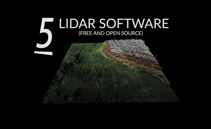
5 Best Free LiDAR Software Tools and Viewers
Download open source LiDAR software
Free LiDAR software can be a bit like finding Bigfoot…
Mysterious in nature. Fuzzy sightings. Some people may even think it’s folklore.
But to your surprise, open source LiDAR software does exist. And unlike the Sasquatch, we have proven that it exists.
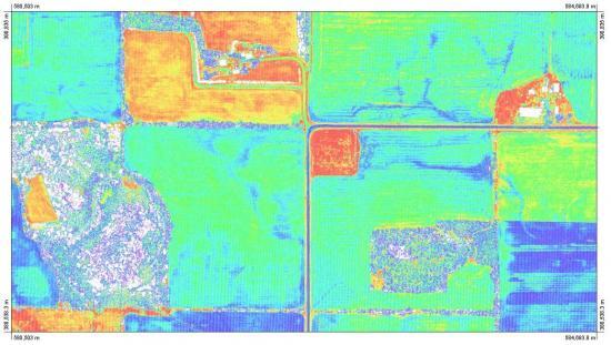
It all starts with my number one “go-to” geospatial analysis toolbox.
Let there be light detection and ranging.
1. QGIS 3
#1 LiDAR software for 3D point cloud viewing
4.5 stars
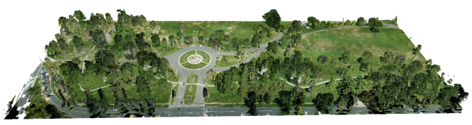
Introducing: LiDAR in QGIS 3. The point cloud visuals are impressive as you can now natively zoom, pan, and fly around in a 3D environment.
First, we like that you can drag and drop LAS and LAZ files. There’s no need to transform to an intermediate format because QGIS 3 can handle the raw point cloud format.
There are options to symbolize point clouds based on class, height, and RGB attributes. But it doesn’t have much for LiDAR analysis just yet.
2. Fugro Viewer
#1 freeware LiDAR software for ease of use and 3D viewing
3.5 stars
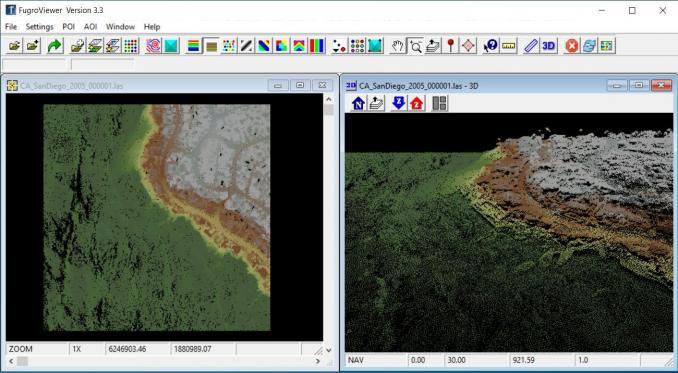
This LiDAR freeware package is something you can just pick up and go with. It’s the type of software that you point and click to make things happen. For example, you can do the following with the Fugro Viewer:
- Displays contours or TIN shaded relief
- View point cloud data by elevation, classification, etc.
- Build two-dimensional profiles and measure distances
- Create side-by-side viewports in 3D and 2D
When you download this software, just keep in mind that this LiDAR viewer is freeware. The strings attached are that the license ends and you will have to renew it.
So enjoy it when it lasts. For viewing purposes, we’ve rated it as the highest because of its unique 3D capabilities. I personally like the point-and-click options.
3. Plas.io
#1 web-based LiDAR viewer with neat visualization utilities
3.0 stars
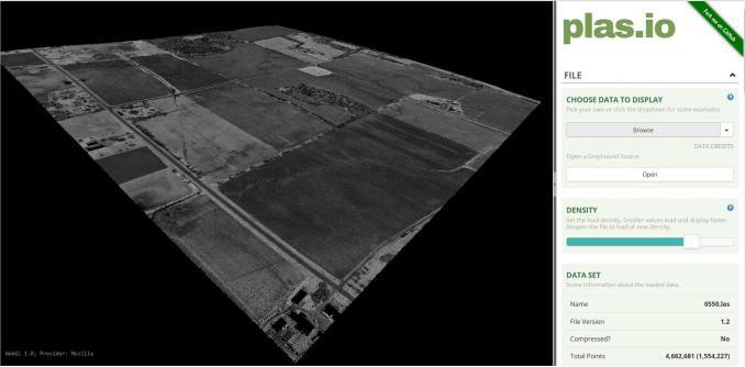
How about viewing LiDAR data in a browser? Is this possible? Plas.io is the only browser-based LiDAR viewer to consume point cloud data (LAS or LAZ).
Some of its highlights include:
- Exaggerating vertical heights (z-values)
- Choosing an attribute to display such as height, classification, or RGB
- Functional implementation of the ASPRS LAS format
When you add a LAS file, visualization is smooth leveraging WebGL. As you switch your camera angle, you can choose perspective, orthographic, or a top-down view.
PRO TIP: Test out the inundation utility at the bottom of the right panel. As you turn up the water levels in the slider, the display shows where inundation occurs.
4. SAGA GIS (System for Automated Geoscientific Analyses)
2.0 stars
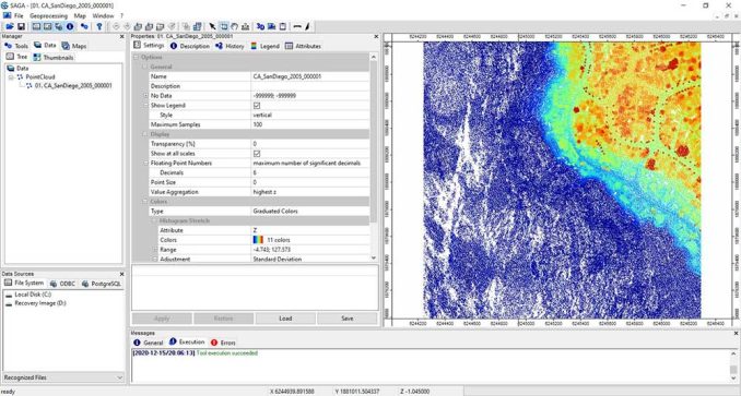
SAGA GIS is not a point cloud data specialist. But if you have LiDAR data, SAGA GIS can import them into the application. Further, you can update its color ramp, and change the value you want to display your LiDAR data.
It does not have a thorough list of LiDAR tools. Albeit, they’re not organized very well. For instance, you cannot natively transform a LAS file into a 3D view.
Instead, you have to convert it into a grid format. Once you have it in this format, it’s this raster format where possibilities are endless in SAGA GIS.
SAGA GIS (System for Automated Geoscientific Analyses) | Download SAGA GIS
5. GRASS: Geographic Resources Analysis Support System
2.0 stars
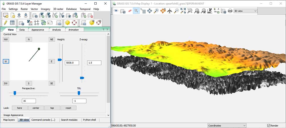
v.in.lidar is how to convert a LAS file into a GRASS vector. You can filter LiDAR points, create contours, and generate DEMs. Next time you see a LAS file, see what GRASS can do with it.
It’s the setup that kills me for GRASS GIS. I just want to get out and run. But when you start the application, there are a million parameters you have to set up on the start screen.
Listen, I love GRASS GIS as much as the next guy. The tools are impressive, but they can be a bit clunky at times as we’ve shown in our review for GRASS GIS.
6. Whitebox GAT
#1 LiDAR software for analysis and point cloud manipulation
4.5 stars
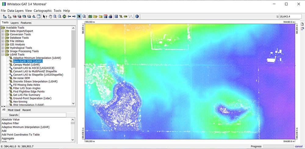
WhiteBox GAT (Geospatial Analysis Tools) has outstanding LIDAR tools! For an open source toolbox, it deserves much more attention than it currently gets.
As you can see, it puts a lot of emphasis on its LiDAR tools. Here’s some of the stuff you can do:
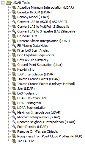
- Create Bare-Earth DEM or canopy models
- Convert LAS to ASCII, shapefile, or multipoint
- Adaptive Minimum Interpolation or IDW
- LiDAR histogram, summaries
- Hex-binning, LAS footprint, point density
It all starts by dropping your LAS file into the map. The display is intuitive as there is a range of display options including – elevation (z), intensity, class, scan angle, and GPS time. However, it does not have any 3D viewing capabilities (yet).
When you run a tool, check that you have all the necessary inputs. It can be a bit finicky in this regard. During a processing operation, the progress is displayed in the bottom right corner to show how much longer you have to wait.
After the process finishes running, the output will be added to your map. You can check it in the “Layers” tab in your table of contents. The layout is like any typical GIS software except that your tools, layers, and features are in the same panel.
Best Free LiDAR Software and Viewers
From viewers to desktop applications, these are the best free LiDAR software tools.
And if you’re looking for some data just to work with, try out our free LiDAR data sources and UAV imagery.
Or maybe you’re just looking to find out what LiDAR is? Then, check out our Guide to Light Detection and Ranging (LiDAR).
Thanks for reading, and of course please give us your thoughts in our comment section below.


Blender, Meshlab and Siemens Solid Edge Community Edition are missing ;)
Also Leica has Cyclone 3DR Viewer (Solid memory, management if you want to open multiple files and formats) e.g. 10GB e57files and a dwg in the background no problem.
Faro used to have a free viewer as well but I forgot the name.
Sketchup when is was still in Googles hands also was free e.g. Version 7.0.10247
With these programs you can be on the same level as payed programs, just a little more time to invest for sure.
cheers
LAStools should definitly be on this list. There is an open-source & a licensed part, but all licensed tools can be used for free up to the point limit. The new visualizer (laslook) is also free (without point limits). https://rapidlasso.de/.
The true value of LiDAR is unlocked through post-processing, if you’re really looking for valuable analysis of your data, then paid is still the way to go. I use LiDAR360 by GreenValley International, honestly, it’s really affordable and I’ve made comparisons with all the major software (Terrasolid, Riegl et.) and LiDAR360 is by far the easiest to get started with. Highly recommended.
Great resource platform. I’m a geoscientist ( mineral exploration geologist)
I think PDAL must be on the list.
Cloud Compare beats all these for functionality (as far as I can tell by looking at the descriptions written up) and is free.
Perhaps you can also have a look at FUSION with its LDV viewer developed by the Forestry Service of the USDA. It is free, can work with LAS (for this is relies on las tools) and LAZ files as well its own uncompressed LDA format and comes with a host of online command tools such as for instance the conversion of formats.
see:
http://forsys.sefs.uw.edu/fusion/fusion_overview.html
http://forsys.sefs.uw.edu/fusion/fusionlatest.html
Thanks for the helpful post.
I found ArcGIS and GrassGIS as great tools for geospatial data management, geoprocessing, spatial modeling, and visualization.
GrassGIS has an online browser version too.
To be released in a couple of weeks, QGIS 3.18 will allow viewing of lidar data in 2D and 3D:
https://github.com/qgis/QGIS-Enhancement-Proposals/issues/194
And hopefully later this year QGIS will also integrate lots of algorithms from PDAL!
Yes, I am very excited about this update.
I will be writing about it. Also, I’ll include in this list of 5 best free LiDAR software.
Thanks, Martin!
Sorry, but LAStools must be included in this list.
+info: https://rapidlasso.de/
This is a list of free LiDAR software. LAStools is great LiDAR software, but it’s only available for for licensing.
An individual license costs EUR 1500 which is the equivalent to about 1800 USD