HydroSHEDS GIS Data For Water Management
What is HydroSHEDS GIS Data?
HydroSHEDS is a free GIS data source for water resources management and decision-making.
This database provides detailed information on hydrological features. For instance, it has watersheds, sub-basins, rivers, lakes, water treatment plants, and waterfalls.
HydroSHEDS data can help water resources management, planning, and development. It can also identify areas of vulnerability to water-related risks.
HydroSHEDS GIS data can also help assess the impacts of climate change on water resources. Just to name a few applications.
How Can You Use HydroSHEDS?
HydroSHEDS stands for Hydrological data and maps based on SHuttle Elevation Derivatives at multiple Scales. This data is a geospatial representation of hydrological features, including their associated characteristics.
This source of data contains rivers, lakes, streams, water bodies, and watersheds. It also contains information on the surrounding landscape and climate conditions. The hydrological data spans the entire globe, which you can download in a geodatabase or shapefile format.
Types of HydroSHEDS GIS Data
HydroSHEDS is a database of hydrological information and GIS data. It’s designed to provide users with an easy-to-use and detailed global map of the world’s drainage networks and associated data. As listed below, here are the various types of hydrological data:
HydroSHEDS Core Data
The HydroSHEDS core version 1 data consists of a void-filled DEM, conditioned DEM, flow direction, flow accumulation, flow length, and land mask.
Each one is based on the SRTM 3 arc-seconds (90m) DEM. But you can also download lower resolution versions at 15, and 30 arc seconds.
Although this resolution is a bit coarse, there will be an updated higher resolution HydroSHEDS core data set available soon. Instead of being based on the SRTM, HydroSHEDS version 2 will use the TanDEM-X DEM. This means that the resolution can increase up to 12 meters.
1. HydroAtlas
The HydroAtlas is composed of a collection of hydro-environmental characteristics of global sub-basins. With HydroATLAS, users can access characteristics such as physiography, climate, land cover, and geology.
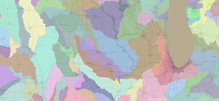
2. HydroBasins
The HydroBasin is a set of geo-referenced sub-basin boundary data products for all countries and river basins across the globe. It provides seamless sub-basins at 15 arc-second (approximately 450 meters) resolution, using a coding system of 12 hierarchically nested sub-basins.
3. HydroRIVERS
The HydroRIVERS contains vectorized rivers for the entire globe, extracted from a 15-arc-second resolution DEM layer. Altogether, it provides approximately 36 million kilometers of rivers globally, including characteristics such as stream order and river reach length.
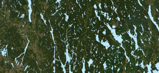
4. HydroLAKES
The HydroLAKES dataset contains global lakes with a surface area of a minimum of 10 hectares in size. Altogether, this dataset contains 1.4 million lakes or reservoirs. This represents an area of 2.67 million km² or a volume of 181,900 km³.
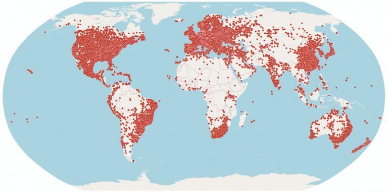
5. HydroWASTE
The HydroWASTE dataset provides the locations of 58,502 wastewater treatment plants throughout the world. This dataset was created by merging various data sources at a national and regional level. However, the attributes lack key details like the number of people it serves and other characteristics.
6. Global River Classification (GloRiC)
The Global River Classification (GloRiC) contains the river types and sub-classifications from the HydroRIVERS dataset. As part of this dataset, you will get acquainted with the physio-climatic and geomorphic characteristics of 8.5 million river reaches around the world.
7. HydroFALLS
The HydroFALLS dataset contains over 4,000 waterfall locations. Each one has either been validated remotely or in the field. The source of this data is from national and regional sources, which were merged into one final dataset.
Benefits of HydroSHEDS GIS Data
Water managers can use HydroSHEDS GIS data to protect water resources and promote sustainable development. Here are some of the benefits of using the HydroSHEDS GIS data:
Conclusion
HydroSHEDS is a source of geospatial information for understanding our global hydrological system. It contains a wide range of data sources, from rivers to sub-basins and waterfalls.
Overall, HydroSHEDS can help water resources managers make informed decisions. This can help preserve water resources, while also promoting sustainable development.
Don’t forget that if you’re looking for more free GIS data, take a look at some of the resources below.


