15 Free Satellite Imagery Data Sources
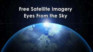
If you’re searching for free satellite imagery, we rank the best sources of free satellite data from authoritative sources like NASA, USGS and Maxar.
If you’re searching for free satellite imagery, we rank the best sources of free satellite data from authoritative sources like NASA, USGS and Maxar.

So many college GIS certificate programs to choose in Canada, eh? You can’t discount going to a college to earn your very own college GIS diploma.

We give you a job profile of the modern cartographer. Cartographers specialize in graphic design, color history and often Geographic Information Systems
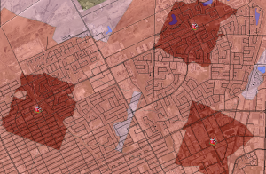
The ArcGIS Network Analyst Service Area analysis tool is perfect finding out just how far your cities firefighters, ambulance or paramedics can service.
Ellipsoids, survey benchmarks and triangulation – these are the ingredients for geodetic datums. NAD27, NAD83 and WGS84 are common datums in North America.
Imagine you can earn a GIS online certificate at some of the best institutes in the world without leaving your country… or even the comfort of your own home.

Dark object subtraction, radiative transfer models and atmospheric modelling are common techniques used to for atmosphere correction in remote sensing.
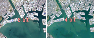
Bit depth is the amount of detail in each pixel expressed in units of bits. 1-bit rasters contain 2 values while 8-bit rasters range from 0-255
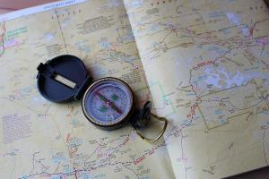
This guide is like your compass – these 33 mapping tips will guide you in the right direction and show you how to create stunning cartographic maps.

In the world of geography, two disciplines are often mistaken as the same one. But Geomatics and Geographic Information Systems are different.