QGIS2Web: Publish a Web Map from QGIS
What is QGIS2Web?
QGIS2Web takes your desktop GIS so you publish it interactively for the web. If you have your own server, then this plugin creates all the supporting files you need without any server-side software installed.
Not only does it replicate the symbology and cartographic aspects of your current QGIS Desktop, but you have the option to export a web map to either OpenLayers, Leaflet, or Mapbox GL JS.
Additionally, you can set the web map to have popups, clusters, and a variety of properties and widgets to make them more appealing to your audience.
If you want to learn how to publish a web map from QGIS Desktop, let’s take a closer look at the QGIS2Web plugin.
Install the QGIS2Web Plugin
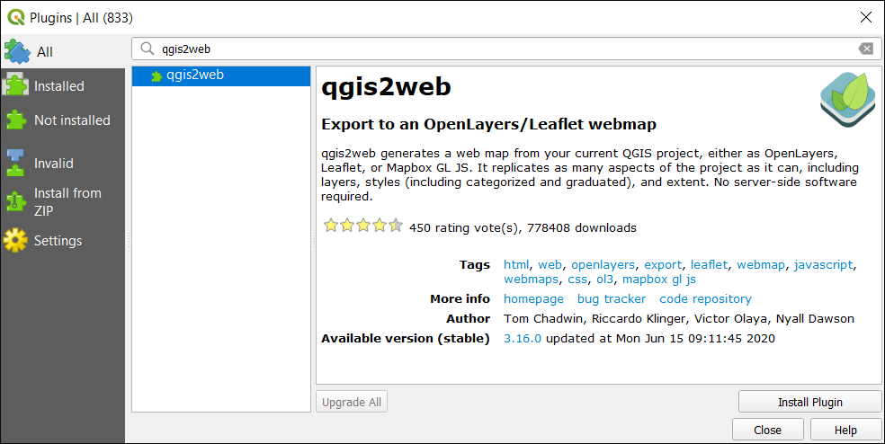
First, you need to download and install the QGIS plugin. You can download a plugin by going to the “Plugins” menu at the top of QGIS Desktop.
Plugins > Manage and Install Plugins…
Search for the QGIS2Web plugin. Once you find the plugin in the repository, download, install, and activate it.
How to use the QGIS2Web Plugin
Basically, the purpose of this plugin is to take all of the layers in your map and create all the supporting files to build a web map. If you have your own server, then all you have to do is upload them.
To access the QGIS2Web plugin, you will be able to find it in the top horizontal menu under “Web”.
Web > QGIS2Web > Create web map
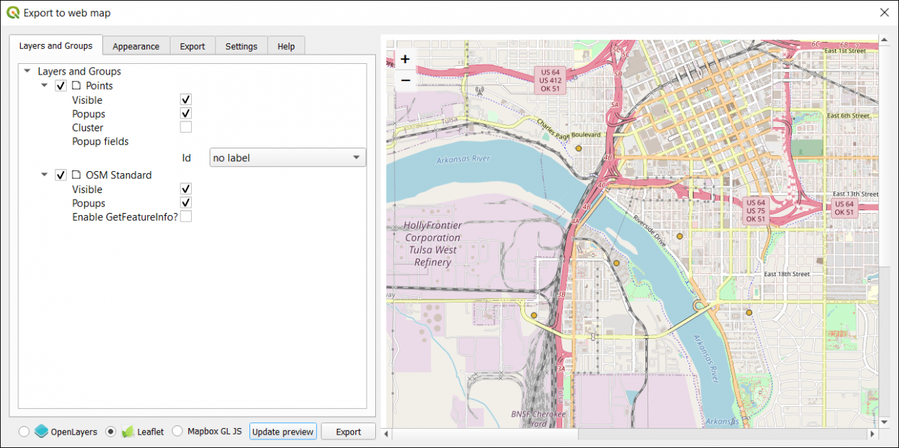
This will prompt a form that you need to fill in. There is a whole of customizations that are available including the following:
- Layers and groups to display
- A radio button for either OpenLayers or Leaflet type of map
- Basemap choice
- Data export path
- Popup fields labels
- Scale/zoom levels
In addition, there are several widgets available as well to add to your web map. For example, this includes everything from a measuring tool, layer search, layer list, address search, show pop-ups, and highlight on hover.
Once you’re OK with all the settings, click “Export”. Next, it will build a web map package to the folder location you select. After it finishes exporting, it packages all the contents and settings you selected into a folder.
The folder contains all of the supporting files and folders. For example, it also contains any images, layers, resources, and styles. But it also has an index file, which has all of the HTML that gets presented on the screen.
If you double-click the index.html file, this will open your browser and display everything from your setup from the QGIS2Web plugin. From here, you will have to upload the contents from QGIS2Web into your web server so the public can view your new web map.
Summary: QGIS2Web
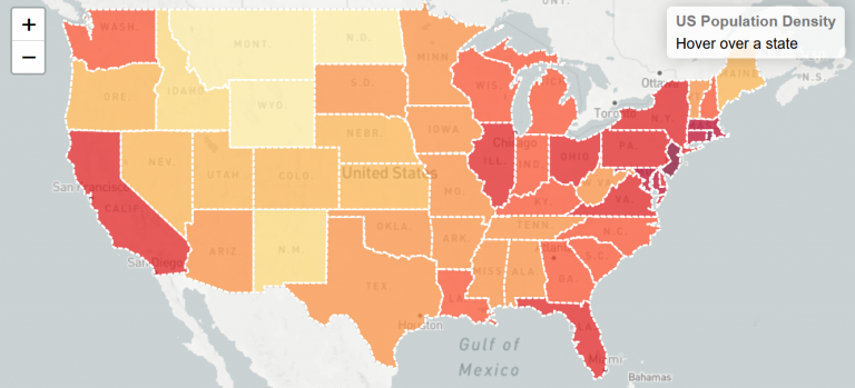
QGIS2Web is a simple plugin for QGIS that allows you to export your map so you can view it interactively on the web without any programming skills. If you don’t have your own web server, then QGIS Cloud offers this service with a free version available.
With this tool, you will be able to convert your QGIS projects into an interactive web map. But you can add other features to it as well.
For instance, you can change the colors, fonts, add layers, and associated data fields or metadata so that your users have access to it.
QGIS2Web is a top 10 plugin in the repository and has an average rating of over 4 with over 450 votes. Do you use QGIS2Web? Please let us know what you like/dislike with a comment below.


