Spatial Resolution vs Spectral Resolution
Spatial Resolution vs Spectral Resolution
What’s the difference between spatial resolution and spectral resolution?
Spatial resolution is a measurement of how detailed objects are in an image based on pixels.
Whereas spectral resolution is the amount of spectral detail in a band based on the number and width of spectral bands.
Let’s get into both concepts of image resolution with a bit more detail.
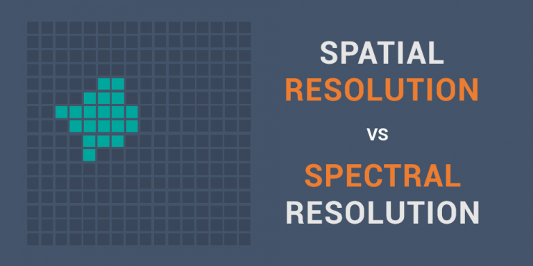
What is Spatial Resolution?
For spatial resolution, imagine gradually descending from a hot air balloon. As you descend, your eyes start recognizing features because everything is sharper. For any type of sensor, this means the spatial resolution is becoming finer.
Spatial resolution is the detail in pixels of an image. High spatial resolution means more detail and a smaller grid cell size. Whereas, lower spatial resolution means less detail and larger pixel size.

Typically, drones capture images with one of the highest spatial resolutions. Even though satellites are highest in the atmosphere, they are still capable of 50 cm pixel size or greater like Worldview-3.
Overall, spatial resolution describes the quality of an image and how detailed objects are in an image. If the grid cells are smaller, this means the spatial resolution has more detail with more pixels.
What is Spectral Resolution?
Spectral resolution describes the amount of spectral detail in a band. High spectral resolution means its bands are more narrow. Whereas low spectral resolution has broader bands covering more of the spectrum.
For example, a multispectral image breaks light into 4 to 36 bands. Then, it assigns those bands names such as red, green, blue, and near-infrared. Each band may span 0.05 um in the electromagnetic spectrum.
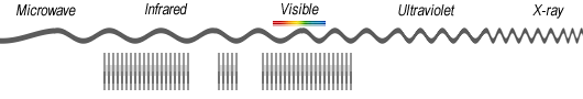
Similarly, hyperspectral imaging captures a spectrum of light. But it divides the light into hundreds of narrow spectral bands. For hyperspectral images, spectral resolution is very high.
Spatial and Spectral Resolution Example
For example, Landsat-8 produces 11 images and each band consists of the following spectral resolution:
| Band Number | Description | Wavelength | Resolution |
| Band 1 | Coastal / Aerosol | 0.433 to 0.453 µm | 30 meter |
| Band 2 | Visible blue | 0.450 to 0.515 µm | 30 meter |
| Band 3 | Visible green | 0.525 to 0.600 µm | 30 meter |
| Band 4 | Visible red | 0.630 to 0.680 µm | 30 meter |
| Band 5 | Near-infrared | 0.845 to 0.885 µm | 30 meter |
| Band 6 | Short wavelength infrared | 1.56 to 1.66 µm | 30 meter |
| Band 7 | Short wavelength infrared | 2.10 to 2.30 µm | 60 meter |
| Band 8 | Panchromatic | 0.50 to 0.68 µm | 15 meter |
| Band 9 | Cirrus | 1.36 to 1.39 µm | 30 meter |
| Band 10 | Long wavelength infrared | 10.3 to 11.3 µm | 100 meter |
| Band 11 | Long wavelength infrared | 11.5 to 12.5 µm | 100 meter |
Each band has a spatial resolution of 30 meters except for bands 8, 10, and 11. While the panchromatic band has a spatial resolution of 15 meters, its thermal bands have a 100-meter pixel size.
Summary: Spatial Resolution vs Spectral Resolution
The difference between spatial resolution and spectral resolution is from pixel size and spectral detail.
Spectral resolution describes how much spectral detail is in each band such as hyperspectral or multispectral imaging.
Whereas spatial resolution represents the amount of detail of objects based on their pixel size.
Now that you’ve mastered these two concepts, learn more about remote sensing and image classification with some of our helpful articles below.


Good job
Why not add the unit of spectral resolution.