What Are Contour Lines on Topographic Maps?
DEFINITION:
Contour lines connect points of equal elevation, showing how high or steep the terrain is on a map.
Which trail would you take?
Imagine. You’re out mountain climbing with your friends.
You pull out your map and see two hiking trails.
The first route has closely spaced contour lines.
But the second route has widely-spaced spaced contour lines.
Which hiking trail would YOU take?

For the slow-and-steady climber, you’d pick the second route because widely-spaced contour lines mean the slope is gradual. But if you picked the first route, you’re the type of free climber who scales mountains with just a pickaxe. This is because when contours are close together, it means that the slope is steeper.
For a quick definition, a contour line joins points of equal and constant values. For example, contours on an elevation have constant heights that are the same on each line in a topographic map.
Are there contour lines mountains or depressions?
When you have a closed contour like the one below, this means there is a hill/mountain or depression.
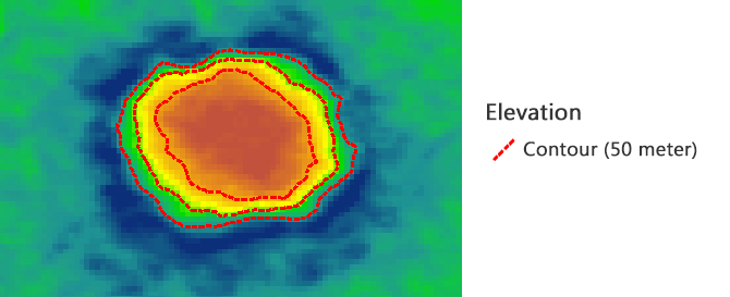
You don’t really know unless there is a label on the contour line. In the example below, we’ve added labels and it should be clear that it’s a depression.

And this isn’t just any depression. This is the massive meteor crater that struck Arizona a long time ago.
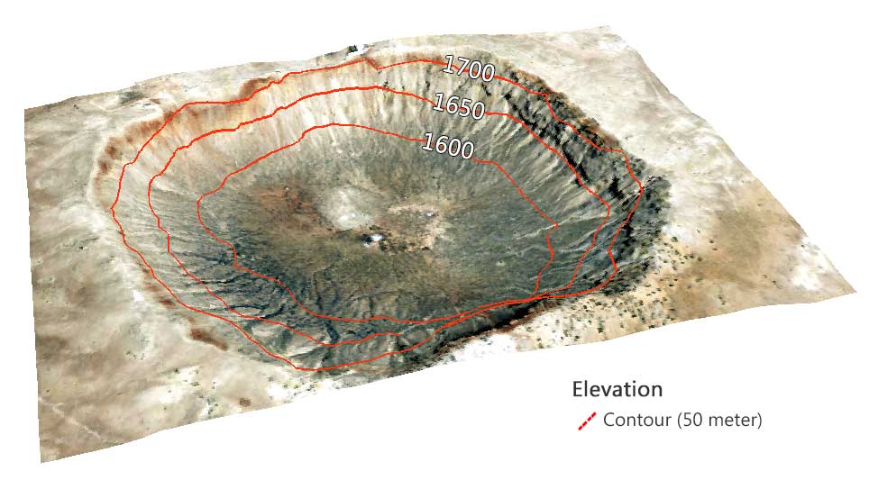
On some maps, cartographers use teeth marks or hachures for depressions at craters or volcanoes because they mark the elevation going up or down.
READ MORE: A Topographic Profile of Arizona’s Massive Meteor Crater
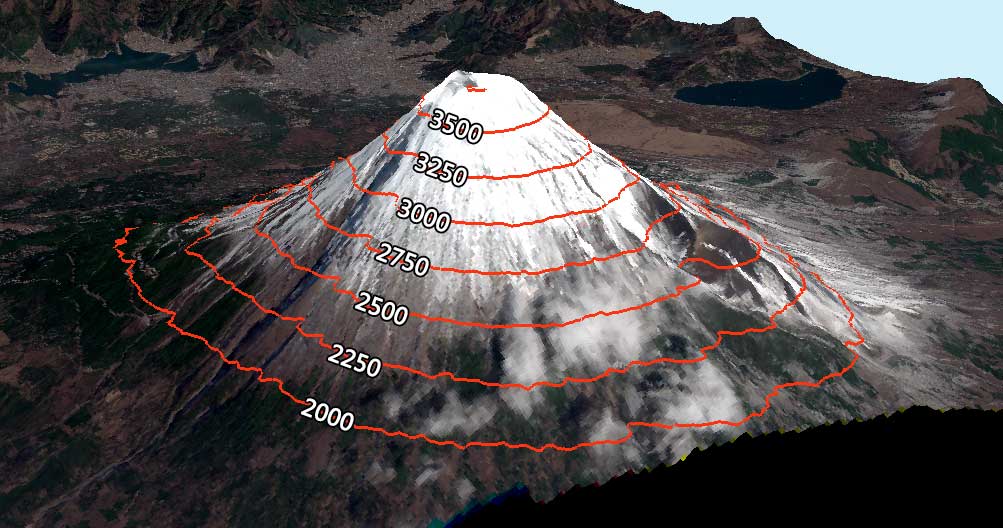
What do Mount Fuji’s contour lines look like?
In this case, closed contour lines indicate a mountain. The beautiful Mount Fuji stands 3,776 meters tall above sea level. At 250-meter spacing, here’s how the contour lines look:
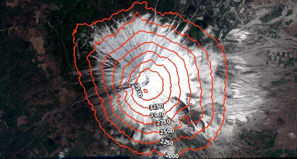
When you see Mount Fuji in 3D, you can see that it’s quite steep as the contours are relatively closely spaced together.
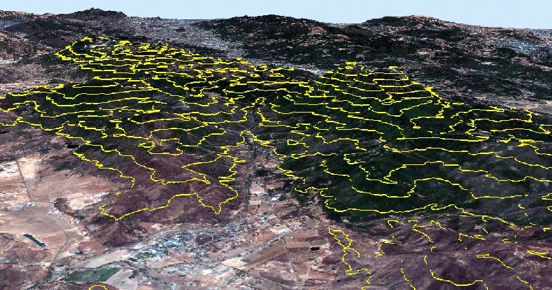
So far, we’ve seen examples of two types of closed contours, but what do contours look like in valleys?
The rule of V and U-shaped valleys
Valleys are elongated low-lying depressions usually with a river flowing through them. You know that you’re looking at a valley bottom when contour lines are V or U-shaped.
Here is an example of a 3D view of the picturesque Collayomi Valley in California:
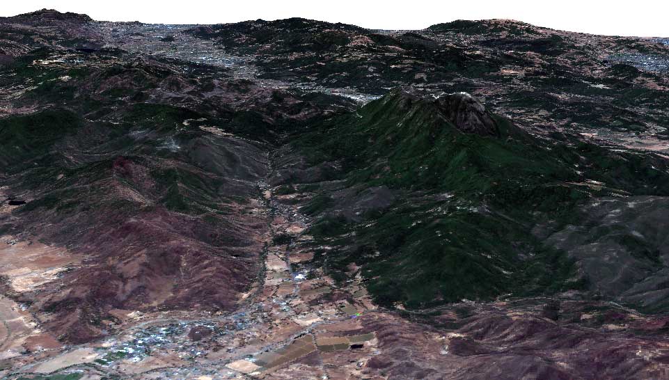
All rivers flow downhill from higher to lower elevations, perpendicular to the contour line above them. As a rule of thumb, the V-shaped contour is pointing upstream (the opposite direction from the flow of a stream or river).
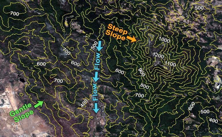
The “V” shape contours indicate streams and drainage. As you can see, the “V” points uphill to a higher elevation. Generally, you can connect the apexes of the upward-pointing, “V” shaped contour lines to delineate a stream. Further to this, you can estimate a stream gradient by counting the number of contours that cross a stream with the contour interval.
The slope is always perpendicular to contour lines. The less separation between contour lines means a steeper slope and vice versa. When there are evenly spaced contours, the slope is uniform.
At a stream junction, contour lines form an “M” or “W” shape. This can be interpreted as two “V-shaped contours intersecting.
What about ridges and gullies?
Over time, gullies form through the erosion of running water on hillsides. A consequence of two eroded gullies is a spur at the center on the face of a hillside that sticks out. Both gullies and spurs run from ridgelines to valley bottoms.
Gullies (or draws) are characterized by “U” or “V” shaped contour lines with their closed-end pointing towards higher elevation. On the other hand, spur contour lines point toward lower elevation.
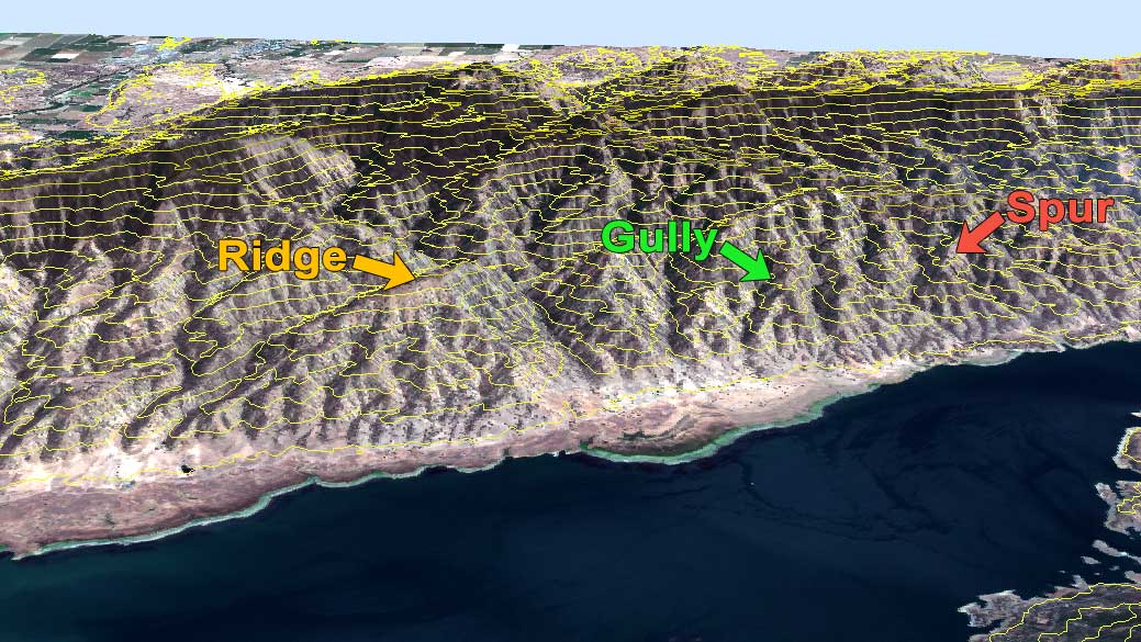
In 2D, these valley landscape features are a bit more difficult to see. But it’s key to remember how ridges point downslope and gullies point upslope.
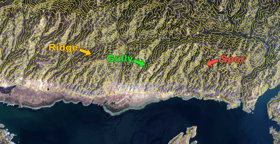
This topographical feature plays a crucial role in understanding the natural flow of water and erosion patterns in the landscape.
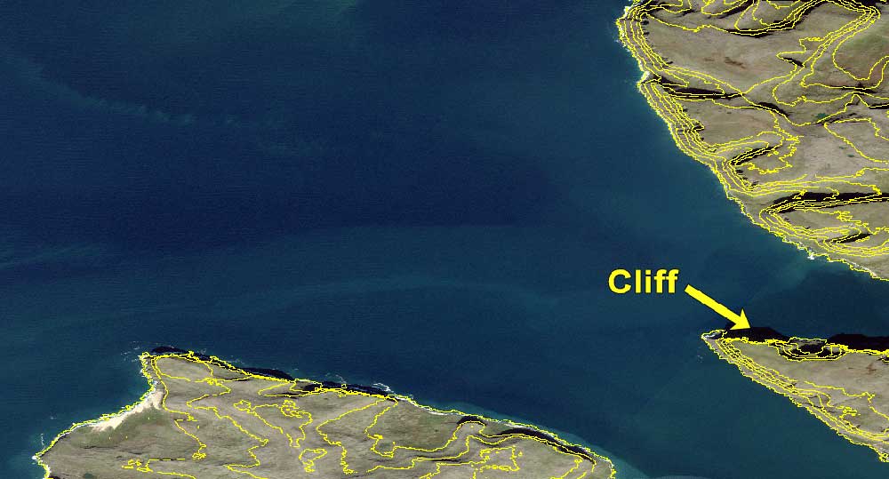
Why do contour lines never cross?
It’s unlikely that contours cross, but sometimes they do. When the terrain is an overhang or cliff, contour lines will cross or touch.
The cliffs in Látrabjarg, Iceland are up to 440 meters tall. When you generate 100-meter contours, they are very close to converging.
In 3D, you can see how steep these cliffs are. So if these contours did cross, it’s very likely an overhang. Or it could be an error in the program.
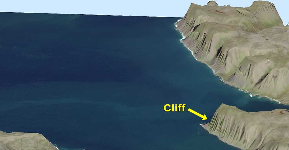
If you use your imagination, picture an overhang where the terrain hangs outward. This would be a rare exception when two contours that cross.
How to draw contour lines manually?
You can easily generate contour lines with the click of a button in CAD or GIS software. But what if you want to draw it by hand?
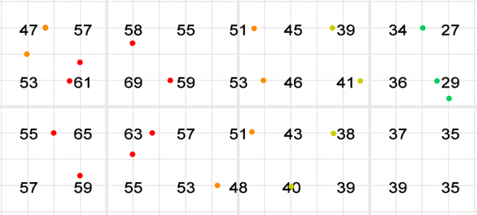
First, you have to choose a contour interval. For example, we’re going to use a contour interval of 10 meters. So this means that there will be a contour every 10 meters.
Between transition points of ten (30, 40, 50, etc), add markers where to draw lines. Basically, draw or interpolate between the lines.
Now that we have points to connect, let’s draw smooth contour lines for each interval. Essentially, we are connecting the points with lines.
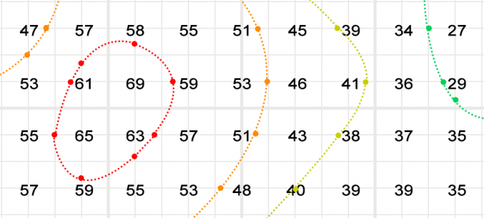
And there we have it. Keep in mind that this is our best estimate for where to draw contour lines. GIS software would be the most precise way to generate contours in an automatic way.
What do we use contour lines for?
In our example, contour lines represented constant elevation and showed the topography of the landscape.
But meteorology (isopleth), magnetism (isogon) and even drive-time (isochrones) also use contours for different purposes.
The closeness of contours indicates slope. Irregular contours mean rugged terrain. It’s rare in nature for contours to cross. But they can for overhangs and cliffs.
What are some other types of contours you’ve seen in nature?
References
Topographic Maps: The Basics, Natural Resources Canada, 2020. Reproduced with the permission of the Department of Natural Resources, 2020.


Very useful. Thank you so much
Extremely good!
I need to know what the broken lines on a contour map represent.
Can anyone show how to sketch a contour shape of a landform feature (steep,convex slope) on a topographic map.