QGIS Tutorial: How To Use QGIS 3
In this step-by-step guide, we show you how to download, use QGIS tools and map with confidence. Use it like a blueprint for how to use open source QGIS 3.
In this step-by-step guide, we show you how to download, use QGIS tools and map with confidence. Use it like a blueprint for how to use open source QGIS 3.
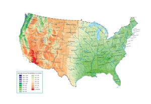
How much rain falls in the United States? Take a close look at this US precipitation map to see where it falls the most and least. You’ll see it fluctuates.
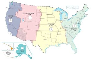
This US time zone map shows the six time zones of the United States such as the Eastern, Central, Mountain, Pacific, Alaska and Hawaii-Aleutian time zones.
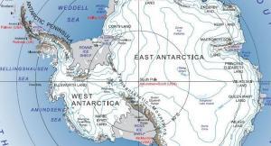
If you’re searching for an Antarctica map to hang on your wall, then we have the trick for you. We’ll unveil satellite, animals and more maps of Antarctica.

This post is dedicated to Antarctica data. If you’re trying to find data for the South Pole, then we have research stations, satellite imagery and much more.

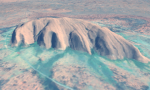
DigitalGlobe’s cutting-edge high resolution Worldview satellite carves out ridiculously crisp imagery at 31 cm in 8 spectral bands.
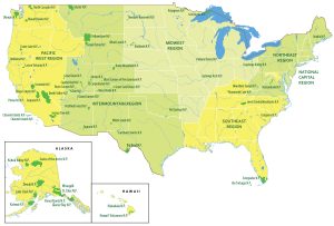
A US national parks map that displays the 5 regions and 62 national parks of the United States. Hawaii and Alaska have inset maps with outlines and names.
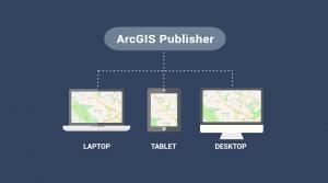
ArcGIS Publisher makes it easy to share digital versions of maps and data by publishing maps in PMF format that are accessible in ArcReader.

From scripting to cartography, our list of 7 free Esri training courses and MOOC will help you build a solid foundation for your career.
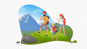
Geocaching is a treasure hunt style game using a GPS receiver. Geocaches are meaningful places that someone hand-picked to become a hiding spot.