Free Points of Interest (POI) GIS Data
What Are Points of Interest (POI)?
In GIS, points of interest (POIs) are special locations on a map. They show places like restaurants, parks, or museums.
Because they mark where things are, people can find places easily. For example, a GPS uses POIs to help you find a nearby coffee shop.
Typically, each POI has a latitude and longitude coordinate. So, next time you use a map app, those little markers are POIs guiding you.
Points of Interest GIS Data
Looking for points of interest that you can use for your maps? Don’t worry we got you covered.
Take a look at the GIS data sources to download your own collection of POIs.
1. OSM Points of Interest
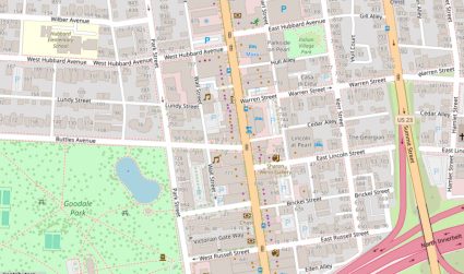
OpenStreetMap (OSM) is like the Wikipedia of maps. What do I mean by that? I mean that it’s the largest free, editable map of the world. It’s made by people everywhere.
In OSM, Points of Interest (POIs) are key places marked on the map. These include things like schools, hospitals, and shops. Because everyone can add to OSM, it’s always growing. Here’s how to download OSM data.
This makes OSM a great GIS data source for finding out about new and interesting places. So, when you use a map app that pulls from OSM, you’re seeing a map built by a huge community.
2. Overture Maps
I have some good news and bad news for Overture POI data. The good news is that it’s open data that has nearly 60 million places worldwide.
The bad news is that they don’t make it easy to download for GIS users. First, it’s in GeoParquet format. Next, it’s stored on AWS or Azure. You’ll have to write some queries to extract your data.
But once you download the POI, it actually looks pretty clean. You’ll find POIs like coffee shops, apartment blocks, and churches. It’s worth a look and it’s recently been updated
3. USGS Gazetteer (GNIS)
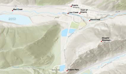
This isn’t your traditional POI dataset. But it can really complement your maps by adding it as reference information.
The USGS Gazetteer contains the Geographic Names Information Systems. So, it won’t have shopping malls and restaurants. Instead, it will help you label features like lakes, rivers, mountains, etc.
How do you download this open data? Go to the National Map Download Application. Next, select your area of interest. Finally, choose GNIS names and add them to your cart. It’s free though. You’ll have to convert this text file to a geospatial format.
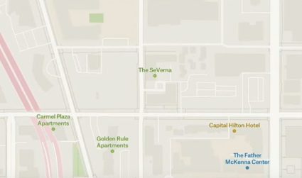
Google Maps POIs
Google Maps, by far, is the most comprehensive and updated POI dataset that I know of. How come you can’t grab yourself a copy?
In a way, you can access their geocoded locations via the Google Places API. However, this has a cost associated with it.
But no, raw GIS data from Google Maps it’s not available to the public. On a side note, don’t forget to check out our list of geocoding services.
Other POI Data Sources
Although these POI datasets are quite thorough, sometimes it’s best not to risk using them for your business.
There are other POI data sources out there. But I can’t verify the quality of them. If you are willing to pay, I’d recommend Google, Bing, HERE Maps, and Precisely.


How to download your dataset? I see this paper and your progress is really very satisfying and I really want to work on your dataset. I’m glad if u give me link of dataset to download it directly
I’ve provided links for each source in the article