7 Aerial Imagery and Photography Sources (Free and Paid)
Explore the world from new heights with aerial imagery. In this article, you’ll learn about our top seven sources of aerial photographs. Each one is taken from the air using a high-resolution camera.
Try your local government first
Before I start, I just want to say that usually, it’s best to check your local or regional government first. So don’t pull out your wallet just yet because most aerial photography is becoming open source. But in some cases, you’ll still have to pay.
It’s impossible to list them all out. Just search for your city or state and include “open data portal” or “geospatial library”. Here’s an example of Florida’s Geospatial Open Data with imagery and basemaps.
1. NAIP Imagery
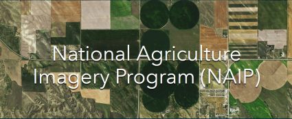
NAIP stands for the National Agriculture Imagery Program. Since 2003, the NAIP program has captured 1-meter resolution imagery during the peak agricultural growing season.
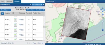
NAIP imagery is made available to the public through the USGS Earth Explorer. Here’s our guide on how to download data from the USGS Earth Explorer.
Just make sure to select the “Aerial Imagery” drop-down to find the NAIP image collection. Each photo is georeferenced. You can also view aerial photography on the NAIP Geohub website.
2. Open Aerial Map
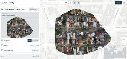
I’ve always been a fan of open data. Open Aerial Map (OAM) is the equivalent of open source aerial photography (and it’s been gaining lots of traction lately).
This collection of openly licensed imagery contains 14,500+ images from 1,250 providers. It’s a mixture of imagery from satellites, unmanned aerial vehicles (UAVs) and other types of aircrafts.
The user interface is where it shines. First, search by location. Next, filter out by time, resolution, or data type. Finally, download your product. But before you start, you have to register for an account.
3. Vintage Aerial
Vintage Aerial is a specialist for historical imagery. This repository houses over 18 million photos. Most images are from 1950 to the year 2000.
This repository is perfect for anyone looking for historical imagery in a rural area or small township. One key benefit is getting a unique glimpse of how your property and the surrounding area looked decades ago.
How do you download aerial photos from Vintage Aerial? First, select your state and county. Alternatively, zoom into the map to check its coverage. You can either download the digital file (JPEG or TIFF) or print it for upward of $100.
4. The National Archives Catalog
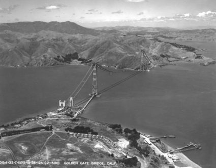
The National Archives Catalog has 250,000+ aerial photographs available. None of them are georeferenced but the selection is extraordinary.
Just a simple search of “San Francisco Aerial” retrieved 125 photos. This includes this beauty of the Golden Gate Bridge being constructed in 1936.
The list of contributors is vast. You can find photos contributed by the Department of Defense, Agriculture, Interior, Post Office, and many more.
5. Canada’s National Air Photo Library
Canada’s National Air Photo Library (NAPL) is a collection of aerial photographs managed by Natural Resources Canada (NRCan). This library houses an extensive archive of historical aerial imagery throughout Canada.
Aerial photos are available with EODMS at a cost. Prices range from $15 CDN for monochrome to $150 for contact print enlargements. I should note that some photos are free. However, most have a price tag.
Once you add an aerial photo to your cart and purchase it, you’ll be able to download it through your confirmation email. Images are typically TIF/JPG formats at resolutions of 300 to 1200 dpi. One of the unfortunate things about NAPL photos is that they are not all georeferenced.
6. NOAA Data Access Viewer
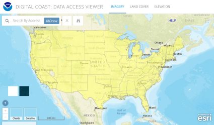
The NOAA Data Access Viewer (DAV) allows anyone to download aerial photos along the coastal United States. Although you can download aerial photography, it also stores elevation (LiDAR) and land cover data.
NOAA DAV consists of images in digital format using a flatbed scanner. NOAA has also georeferenced images in multiple file formats, projections, and datums.
The purpose of this viewer is to better understand the coastal environment such as shoreline erosion and sea level rise. So if you’re looking for historical coastal imagery (emphasis is coastal), this repository should be the first place you look.
7. Public Domain Aerial Photography

Sometimes, just any aerial view is good enough! That’s where public domain aerial image sources might come in handy.
Some of the most popular copyright-free photos are Pexels, Unsplash, and Pixabay. But one of the best things about it is its free HD/4K videos.
One simple search on Pixabay retrieves 5,000+ aerial photos. But the only problem is where in the world are they located? It’s impossible to know without the proper metadata.
Aerial Imagery and Photography Sources
Helicopters, airplanes, balloons, UAVs, even pigeons… Aerial photography captures landscapes from various angles and in historical context.
But remember that other options exist. Check out some of our other lists of imagery data sources:
We hope you can find what you’re looking for with these 7 aerial photo data sources. Got any questions? Please let us know with a comment below.


