Global Forest Maps to See the Forest for the Trees
Satellite and mapping technologies tell a story of our trees and forests. These 4 global forest maps will help you start seeing the forest for the trees.
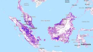
Satellite and mapping technologies tell a story of our trees and forests. These 4 global forest maps will help you start seeing the forest for the trees.

How would you like to wave your magic wand and find out how far everything is away from you? No magic wands necessary. This is how LiDAR works.
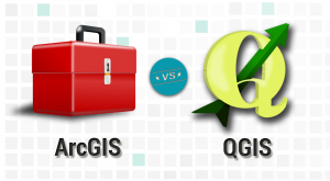
It’s a head-to-head GIS software showdown with the star-studded lineup in the GIS industry- ArcGIS vs QGIS. Discover the differences between ArcGIS and QGIS
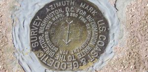
If you’re serious about geocaching, than you’ve probably heard of benchmark hunting. A survey benchmark is a disk in the ground with a latitude & longitude.
TIGER GIS data has transformed the GIS environment because it was the first nationwide digital map. It stimulated projects like MapQuest, Yahoo & Google.
In this QGIS 2 review, we see how this open source GIS software stacks up against others in mapping, editing, analysis, and data management.

Data storage, crisp graphic cards, powerful processing and input and output devices – these harware components are essential to a GIS workstation.
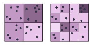
The modifiable areal unit problem (MAUP) is a statistical bias that occurs when you aggregate point data such as the scale and zonal effect.
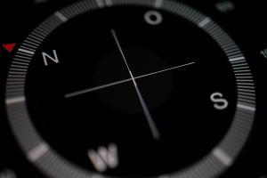
The Magnetic North Pole is a point in Northern Canada where the northern lines of attraction enter the Earth. Compass needles point to the magnetic north.
Map algebra is a cell-by-cell combination of stacked raster grids. It uses math-like functions with arithmetic, statistics and trigonometry operators.