A Complete Guide to TIGER GIS Data

There was a time when maps were only found on paper. GIS data wasn’t readily available. And every map you wanted cost an arm and a leg.
Back in the 1960s, GIS was just starting to take off. The US Census Bureau envisioned capturing a national geographic database for all the digital linework in the United States.
This dream became a reality in the late 1980s.
What is TIGER GIS Data?
TIGER GIS data files (Topologically Integrated Geographic Encoding and Referencing) formed the basis as being the first database to capture the 1990 census population count (decennial census).
From there, TIGER GIS data has really transformed the GIS environment:
- TIGER GIS data became the first nationwide digital map of roads, railroads, and census boundaries.
- TIGER stimulated technological developments like MapQuest, and Yahoo Maps, followed by Google.
- The data formed a base for OpenStreetMap in the United States in 2005.
- Even the Waze navigation system used it as a basis for road names.
Where Can You Download United States Census Data?
The US Census website is the central hub for free TIGER GIS data. Data is available without cost because the U.S. government releases these publications into the public domain.
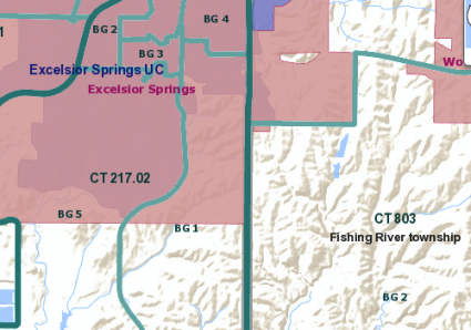
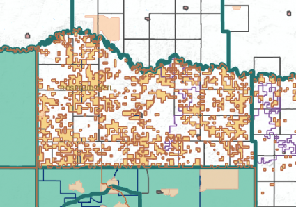
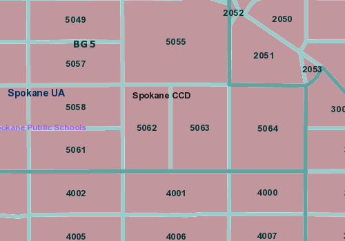
The TIGER website stores spatial data related to rivers, lakes, buildings, and roads. It also includes geographic areas like political areas, cities, counties, and zip codes. There’s also free TIGER GIS data for the United States and several territories like Samoa, Puerto Rico, and Guam.
The TIGER files do not contain the census demographic data, but merely the geospatial/map data. We use GIS software to join census demographics or other data sources with the TIGER files.
View TIGER GIS Data in Web Map Services
The US Census Bureau has also made its data accessible through the TIGER web mapping services. TIGERWeb allows you to examine TIGER data in any web browser online. If you’re interested in the types of features that the US Census Bureau collects, TIGERWeb is a tool to see those map features.
Regardless of your GIS skills, users can generate choropleth maps by theme using the interface. Users can also select the number of classes and classification type (quantile, equal intervals and manual).
That is pretty neat.
Geography is Key to TIGER Data
The US Census Bureau has clearly stated the need for a geographical focus on TIGER GIS data. All of their data products have geographic ties with shapefiles, keyhole markup language (KML) or geodatabases.
TIGER has been releasing TIGER/Line files for over 20 years. In the 1980s, the US Census Bureau pioneered the creation of GBF/DIME coverage files. Dual Independent Map Encoding (DIME) was the encoding structure to store the geographic data. The file format developed for keeping the DIME-encoded data was the Geographic Base Files (GBF).
During this same era, the USGS was developing its own GIS data called Digital Line Graphs (DLGs) at a scale of 1:100,000. For example, it included United States transportation and hydrography boundaries. The two federal agencies collaborated to build a national geospatial database merging their data. GBF/DIME coverage files included DLG features.
This is when the US Census Bureau replaced the data format with Topologically Integrated Geographic Encoding and Referencing (TIGER) in 1990.
Topology is key for TIGER data
TIGER GIS data interlocks as a single physical file. It integrates the geometry of spatial features with their associated attributes. Data connects to points. Points connect to lines. And lines connect to polygons.
Topology is the mathematical language that relates states, counties, and census tracts with real-world features. For example, it connects with transportation maps and hydrological networks. Topology ensures structure and accurate geographic data without any gaps or overlaps.
When there are inconsistencies between TIGER data and other data, there are topological data requirements in TIGER. There are relationships between features with everything integrated as a single layer.
When TIGER makes a change to one feature, it has a topological rule that requires a change to another feature. This is why it’s difficult for TIGER to use individual layers from the government and update data sets. Although topological rules slow down updates to TIGER GIS data, they guarantee quality control.
Past, Present and Future of TIGER Data
The US Census Bureau improves TIGER GIS with new updates every year. For example, the 2020 census will bring new advancements. Here are some of the ways the US Census Bureau is finding smarter ways serving TIGER GIS data:
1. Web Feature Service: TIGERWeb is a Web Mapping Service (WMS). In short, a WMS shows cached tiles over the internet. When you request a map, the server sends you pieces of that map in images for pre-determined tiles. A Web Feature Service allows you to ingest over the internet as lines, points, polygons. Users can edit GIS data using a WFS. This is how TIGER’s online web interface may change in the future.
2. Quicker Updates: It’s a lengthy process for TIGER to update datasets with the local government because of the topological relationships between other layers. It has to integrate any differences with new features. TIGER hopes to receive updates and improve their data continuously using local governments’ feature additions.
3. Accuracy Improvements: The US Census Bureau annually improves its GIS data. Accuracy, up-to-date, and timely information is essential to TIGER GIS data. Some of the ways it improved accuracy is through better geocoding and address locations.
What is FIPS?
FIPS stands for Federal Information Processing Standard. It is a code used to define political or physical features in the United States. It was created because it could be used as a unique identifier in data processing.
There are FIPS for each state and county. FIPS county codes are 5-digit federal information processing standard code that uniquely identifies county and county-equivalent in the United States.
The first two digits are the state code and the last three digits are the county code. FIPS 6-4 was replaced with INCITS 31:2009.
US Census Bureau Free TIGER GIS Data Sets
The primary mission of the Census Bureau is to conduct the U.S. Census every ten years.
A big reason for this is because the US House of Representatives seats are allocated based on state population
Over the last half-century, TIGER GIS data has revolutionized the way it captures census data.
Not only can we estimate area and census tract data with ease, but the data can also be mapped, analyzed, and stored efficiently.


