British Virgin Islands Map
A British Virgin Islands (BVI) map with satellite imagery, settlements, seaports, bays, islands, points, harbors, and its international airport.
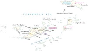
A British Virgin Islands (BVI) map with satellite imagery, settlements, seaports, bays, islands, points, harbors, and its international airport.
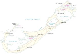
A map of Bermuda with satellite imagery containing settlements, seaports, bays, islands, points, harbors, and its international airport.
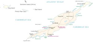
A map of Anguilla with satellite imagery containing settlements, seaports, bays, islands, points, harbors, and its international airport.

The Periodic Table for Spatial Analysis lists 90 tools for quantifying, finding patterns, and predicting outcomes in a geographic context.
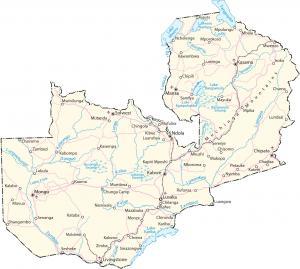
A Zambia map (Republic of Zambia) with cities, highways, satellite imagery, and elevation – a landlocked country in central/eastern Africa.
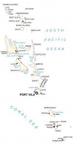
This Vanuatu map shows populated places, roads, islands, and atolls. Vanuatu consists of roughly 83 islands and atolls (65 uninhabited).
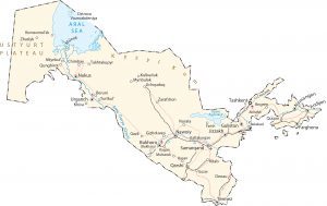
An Uzbekistan map with cities, highways, water, satellite imagery, and elevation. Uzbekistan is a dry, landlocked country in Central Asia.
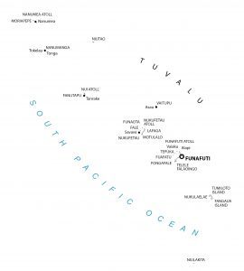
This Tuvalu map shows populated places, islands, and atolls. Tuvalu consists of 9 island atolls within the Polynesia region of Oceania.
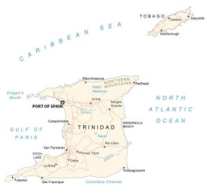
A Trinidad and Tobago map with cities, roads, satellite imagery, and elevation – the southernmost country in the Caribbean near Venezuela.
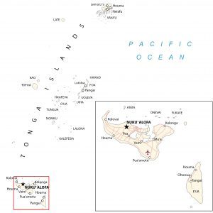
A Tonga map with islands, places, roads, and imagery. Tonga is a group of about 170 islands (mostly uninhabited) in the South Pacific Ocean.