Map of Tuvalu – Islands and Atolls
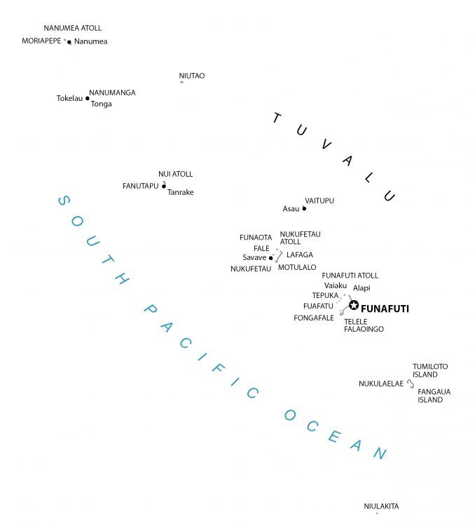
Tuvalu is a small island nation located in the South Pacific Ocean within the British commonwealth. This reference map of Tuvalu displays the settlements, islands, atolls, and water features of Tuvalu.
You are free to use our Tuvalu map for educational and commercial uses. Attribution is required. How to attribute?
About the map
This Tuvalu map (formerly Ellice Islands) shows populated places, islands, and atolls. Tuvalu consists of 9 islands and atolls (3 reefs and 6 atolls) in the South Pacific Ocean.
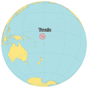
Tuvalu is located in the Polynesia region of Oceania. The Fiji Islands are situated to the south, Vanuatu to the southwest, the Solomon Islands to the west, and Nauru to the northwest.
The population is sparse with only approximately 10,500 people. Funafuti is the capital and largest city of Tuvalu. It occupies an area of just 26 square kilometers (10 sq mi) making it one of the smallest countries in the world.
Populated places
Nanumea
Tanrake
Tokelau
Tonga
Asau
Savave
Vaiaku
Alapi
Atolls
Funafuti Atoll
Nanumea Atoll
Nui Atoll
Nukufetau Atoll
Islands
Falaoingo
Fale
Fangaua Island
Fanutapu
Fongafale
Fuafatu
Funafuti
Funaota
Lafaga
Moriapepe
Motulalo
Nanumanga
Niulakita
Niutao
Nukufetau
Nukulaelae
Telele
Tepuka
Tumiloto Island
Tuvalu
Vaitupu
Water
South Pacific Ocean


