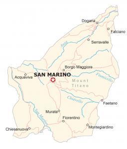
Map of San Marino
A map of San Marino with towns, villages, roads, water, satellite imagery, and elevation – a small microstate country, surrounded by Italy.
A map of San Marino with towns, villages, roads, water, satellite imagery, and elevation – a small microstate country, surrounded by Italy.
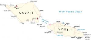
A map of Samoa (formerly Western Samoa) displays places roads, water, and imagery – two islands (Savaii and Upolu) in the South Pacific Ocean.
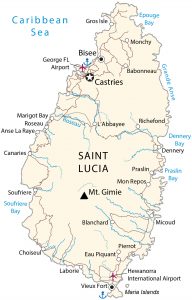
A Saint Lucia map with towns, villages, roads, water, imagery and elevation. Saint Lucia is an island in the Caribbean Sea and Atlantic Ocean
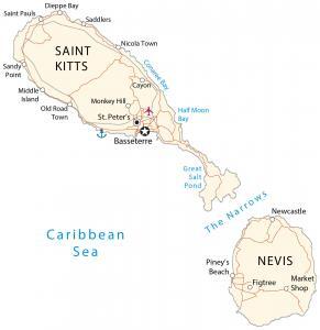
This Saint Kitts and Nevis map contains cities, roads, water, satellite imagery, and elevation – two separate islands in the Caribbean Sea.
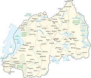
This Rwanda map shows cities, roads, water, imagery, and elevation. Rwanda is a country located in central Africa in the Great Rift Valley.
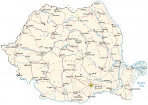
A map of Romania is known for its forested Transylvania region, Carpathian Mountains, and its medieval towns and castles like Bran Castle.
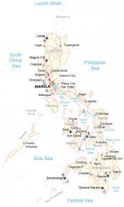
This map of the Philippines displays cities, roads, islands, imagery, and elevation – it consists of about 7,640 islands in the Pacific Ocean
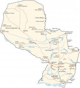
This map of Paraguay shows cities, roads, islands, satellite imagery, and elevation. Paraguay is a landlocked country in South America.
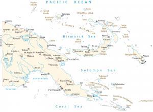
This map of Papua New Guinea shows cities, roads, islands, satellite imagery, and elevation – a country in Oceania along the Pacific Ocean.
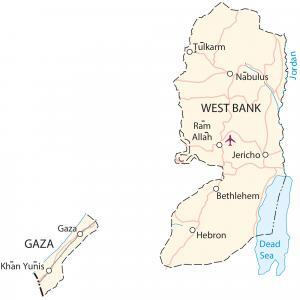
A State of Palestine map showing populated places, roads, satellite imagery, and elevation – including the Gaza Strip and West Bank.