Oman Map – Cities and Roads
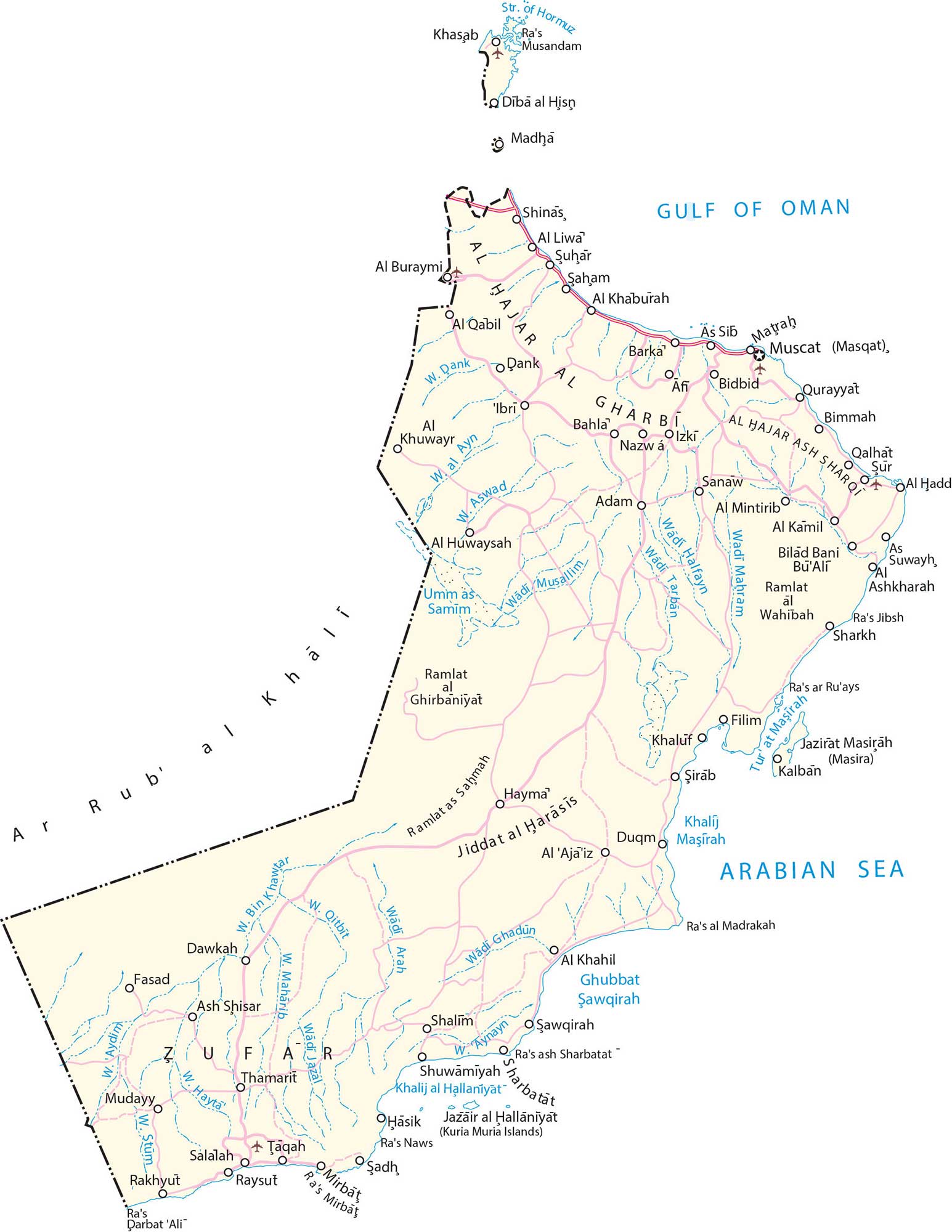
This map of Oman contains cities, towns, populated places, highways, and wadis. Satellite imagery and an elevation map display its vast deserts and mountain ranges.
Oman map collection

You are free to use our map of Oman for educational and commercial uses. Attribution is required. How to attribute?
About the map
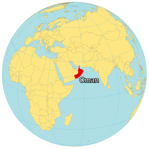
Oman is a country in the Arabian Peninsula and is the oldest independent state in the Arab world. It borders 3 other countries including the United Arab Emirates to the northwest, Saudi Arabia to the west, and Yemen to the southwest. Also, it shares a coastline with both the Gulf of Oman and the Arabian Sea of 3,165 kilometers (1,967 mi).
Its geographic position in the Persian Gulf makes Oman a hub for both trading and commerce. It’s also known for its oil reserves, meteorites, mosques, wadis, and long-serving rulers. Muscat is the capital and largest city. Other major cities are Seeb, Salalah, and Bawshar.
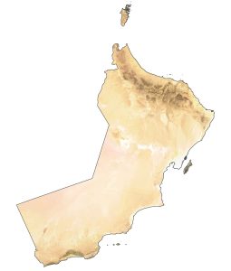
SATELLITE IMAGERY
Oman Satellite Map
Oman occupies an area of 309,500 square kilometers (119,500 sq mi), which is similar in size to Italy or Poland. This includes Oman’s largest island, Masirah Island, off the east coast of the mainland.

The country is mostly desert such as the sandy Rub’Al Khali Desert which covers most of the southern third of the Arabian Peninsula. Whereas the central region consists of a gravel desert plain and most of the country. Oman lies above the equator between 16°N and 28° N latitudes. Although most of the interior has a hot and dry climate, the coastal regions are mostly humid.
PHYSICAL MAP
Oman Elevation Map
While deserts account for more than 80% of Oman, mountains occupy about 15% of its area. For example, the Dhofar Mountains span the southern region of Oman next to its border with Yemen.
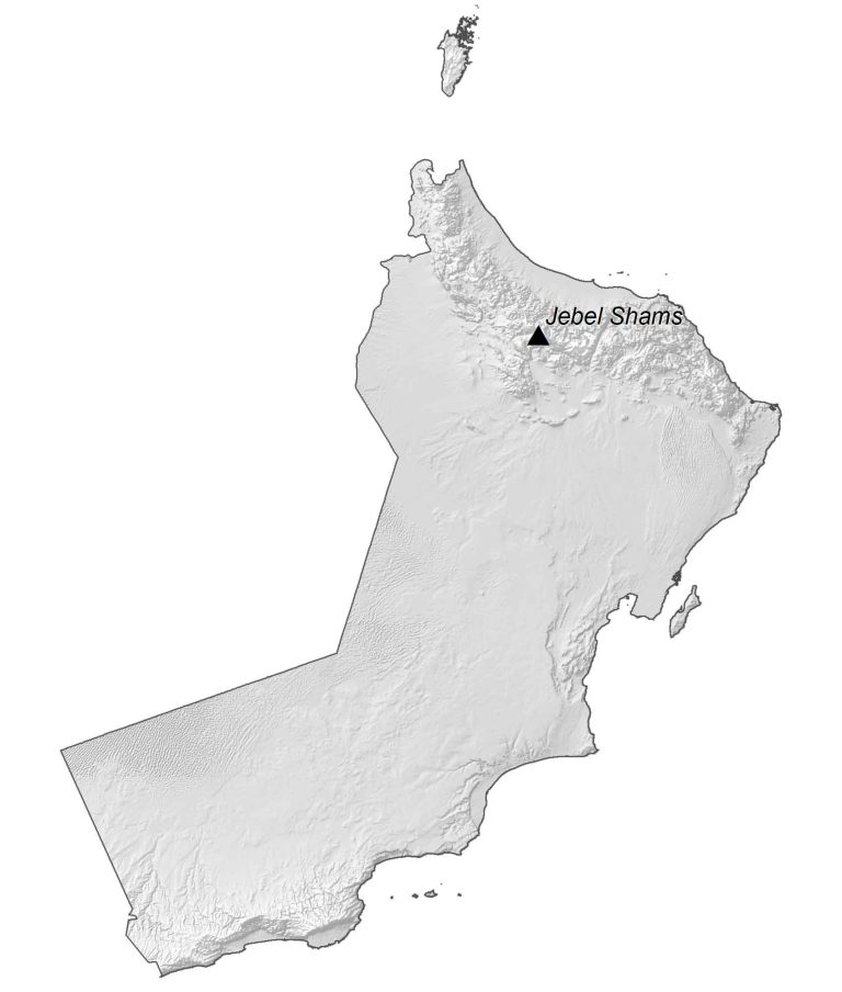
Whereas the Al-Hajar Mountains (Oman Mountains) are situated in the northeast, which also contain Jebel Shams. Although its elevation is contested to be between 2,997 to 3,009 m (9,833 to 9,872 ft), it is Oman’s highest peak. Whereas its lowest point is the Arabian Sea at sea level.
Capital City
Muscat (Masqat)
Major cities
Al Buraymi
As Suwayh
Barka
Ibri
Nizwa
Saham
Salalah
Suhar
Cities, towns and villages
Adam
Al Aja’iz
Al Hadd
Al Huwaysah
Al Khaburah
Al Kamil
Al Liwa
Al Mintirib
Al Qabil
As Sib
Bahla
Bidbid
Bimmah
Dawkah
Dībā al Hisņ
Duqm
Fasad
Filim
Hasik
Hayma
Khasab
Madha
Matraḥ
Mirbat
Mudayy
Qurayyat
Raysut
Rakhyut
Sadh
Sanaw
Shalim
Shinas
Shuwamiyah
Taqah
Thamarit
Lakes, rivers and water features
Arabian Sea
Gulf of Oman
Strait of Hormuz
Wadi Arah
Wadi Aswad
Wadi Aydim
Wadi Bin Khawtar
Wadi Dank
Wadi Ghadun
Wadi Halfayn
Wadi Hayta
Wadi Jazal
Wadi Maharib
Wadi Mahram
Wadi Musallim
Wadi Qitbit
Wadi Stum
Wadi Tarban
Islands
Jazair al Hallaniyat (Kuria Muria Islands)
Jazirat Masirah (Masira)
Landforms
Rub’ al Khali Desert