Saint Kitts and Nevis Map
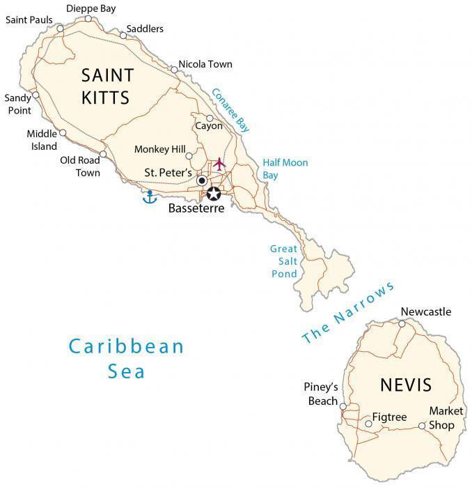
This Saint Kitts and Nevis map contains populated places, roads, and bays. It includes satellite imagery that displays both islands of Saint Kitts in the north and Nevis to the south.
Saint Kitts and Nevis map collection


You are free to use our Saint Kitts and Nevis map for educational and commercial uses. Attribution is required. How to attribute?
About the map
Saint Kitts and Nevis consist of two separate islands in the Caribbean Sea. Altogether, they occupy an area of 261 square kilometers (101 sq mi). This is the smallest island nation in the Caribbean, smaller than Grenada, Barbados, as well as St. Vincent and the Grenadines.
At 168 square kilometers (65 sq mi), Saint Kitts is larger in area than both islands. Whereas the island of Nevis is just 93 square kilometers (36 sq mi) and is located to the south. The country is situated at the northern end of the Lesser Antilles archipelago.
It’s 70 kilometers (44 mi) away from Antigua and Barbuda to the east and about 50 kilometers (31 mi) away from Montserrat to the southwest. Whereas the Dutch island of Oranjestad is just 13 kilometers (8 m) away to the north. Basseterre is the capital and most populous city on the island of Saint Kitts.
SATELLITE IMAGERY
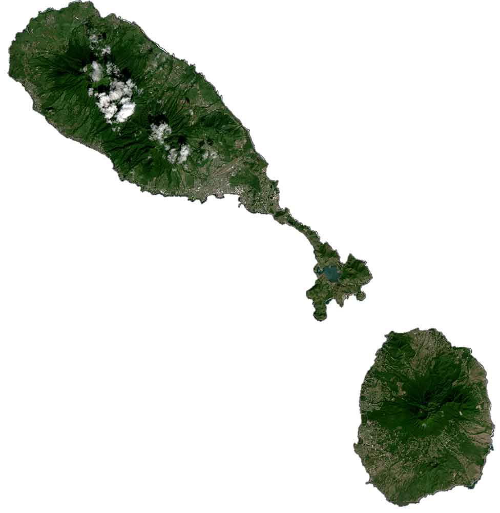
Saint Kitts and Nevis Satellite Map
Both the islands of Saint Kitts and Nevis are recognized for their mountain peaks and rings of beaches surrounding their coastlines. Although the islands are small in area, they both have a single dominant mountain.
For the island of Saint Kitts, the dormant volcano, Mount Liamuiga, towers over the island in the central-north region. But for the island of Nevis, it’s Nevis Peak that lies near the center of the island and gives it a cone-shaped topography. The Narrows is a water passage that splits the islands apart. Its major water features are Conaree Bay, Great Salt Pond, and Half Moon Bay.
Capital City
Basseterre
Major islands
Saint Kitts
Nevis
Towns and villages
Cayon
Figtree
Market Shop
Middle Island
Monkey Hill
Newcastle
Nicola Town
Old Road Town
Piney’s Beach
Saddlers
Saint Pauls
Sandy Point
St. Peter’s
Seas, bays and ponds
Caribbean Sea
Conaree Bay
Dieppe Bay
Great Salt Pond
Half Moon Bay
The Narrows
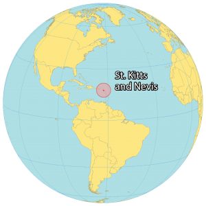
Caribbean


Wow