Map of Romania – Cities and Roads
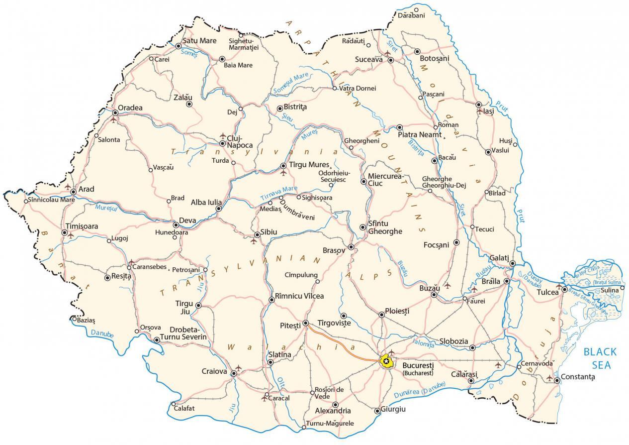
This map of Romania displays cities, roads, water, satellite imagery, and elevation. It contains features like the Transylvania Region, the Carpathian Mountains, and the Wallachian Plain.
Romania map collection

You are free to use our Romania map for educational and commercial uses. Attribution is required. How to attribute?
About the map
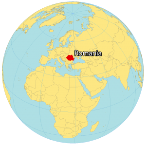
Romania is a country located in southeastern Europe next to the Black Sea. It borders Moldova to the east, Ukraine to the north, Hungary to the northwest, Serbia to the southwest, and Bulgaria to the southeast. Romania is known for its forested Transylvania region and the Carpathian Mountains.
It’s recognized for its medieval towns and castles like the clifftop Bran Castle and the legend of Dracula. Bucharest is the capital and largest city of Romania. Other major cities are Cluj-Napoca, Timișoara, and Constanta.
SATELLITE IMAGERY
Romania Satellite Map
Altogether, Romania occupies an area of 238,397 square kilometers (92,046 sq mi). In comparison, it is smaller than the United Kingdom but larger than Belarus. Romania is not completely landlocked because it shares a coastline of 245 km (152 mi) with the Black Sea to the southeast. At 615 kilometers (382 mi), the Olt River is its longest river.
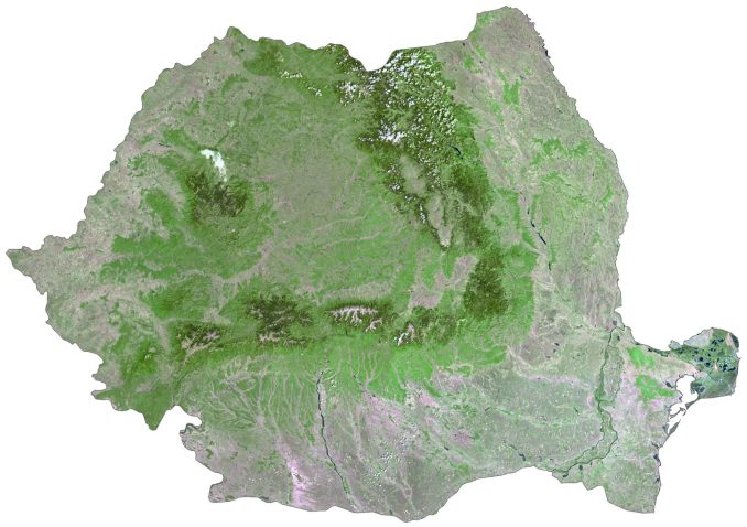
Whereas its largest lake is Lake Razelm at 511 square kilometers (197 sq mi). The country lies between 44°N and 48°N latitude so its climate is mostly temperate continental and wet. According to the FAO, forests cover 28.6% of Romania. Its major historical regions are Oltenia to the southwest and Moldavia to the northeast.
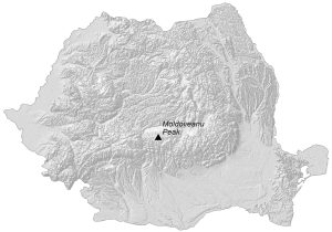
PHYSICAL MAP
Romania Elevation Map
The terrain of Romania is a relatively evenly distributed mix of plains, uplands, hills, and mountains. Its major mountain chain is the Carpathian Mountains, which circle the Transylvania Plateau. Within this mountain range, it contains Moldoveanu Peak. At 2,544 meters (8,346 ft), this is the highest peak in Romania.
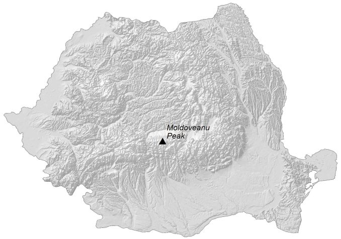
Whereas its lowest point is the Black Sea at 0 meters (0 ft) sea level. The Wallachian Plain is a vast historical region in the south and is bound by the Danube River to the east. Whereas the Dobrogea region is located to the east of the Danube River to the southeast divided between Bulgaria and Romania.
Capital City
Bucharest
Major cities and towns
Alba Iulia
Alexandria
Arad
Baia Mare
Bacau
Botoşani
Braila
Brasov
Călăraşi
Cluj-Napoca
Constanţa
Craiova
Deva
Drobeta-Turnu Severin
Focşani
Galaţi
Hunedoara
Oradea
Piatra Neamţ
Piteşti
Ploieşti
Râmnicu Vâlcea
Reşiţa
Satu Mare
Sibiu
Suceava
Timişoara
Tirgu Jiu
Tîrgu Mureş
Cities, towns and villages
Bârlad
Baziaş
Bistriţa
Brad
Brătu Chilja
Calafat
Carei
Caracal
Caransebeş
Cernavodă
Cîmpulung
Ciuc
Darabani
Dumbrăveni
Făurei
Gheorgheni
Gheorghiu-Dej
Giurgiu
Huşi
Lugoj
Medias
Miercurea-Ciuc
Odorheiul Secuiesc
Orşova
Paşcani
Petroşani
Rădăuţi
Roman
Roşiorii de Vede
Salonta
Sânnicolau Mare
Sfîntu Gheorghe
Sighetu Marmaţiei
Sighişoara
Slatina
Slobozia
Tecuci
Tîrgovişte
Turda
Turnu Măgurele
Văscău
Vaslui
Vatra Dornei
Zalău
Lakes, rivers and water features
Bistriţa River
Black Sea
Brătul Chilia
Brătul Sulina
Brătu Sfîntu Gheorghe
Buzau River
Danube River
Jiu River
Mureş River
Mureşul River
Olt River
Prut River
Sieu River
Siret River
Someş River
Someşul Mare River
Tîrnava Mare River
Landforms and geographic regions
Bamat
Dobruja
Moldovia
Carpathian Mountains
Transylvania
Walachia


Arpathian Mountains are wrong !
Carpathian Mountains are correct name, but the mountains are divided in:
Eastern Carpathians (where it is wrong written / misspelled: Arpathian Mountains)
Southern Carpathians (where it is wrong written / misspelled: Transylvanian Alps)
Western Carpathians (that do not appear in Transylvania / Ardeal): Apuseni Mountains
Also, it is wrong written “Dobruja” in the East of România (on the Balck Sea coast) – correct: Dobrogea.
Râmnicu Vâlcea, România