Philippines Map
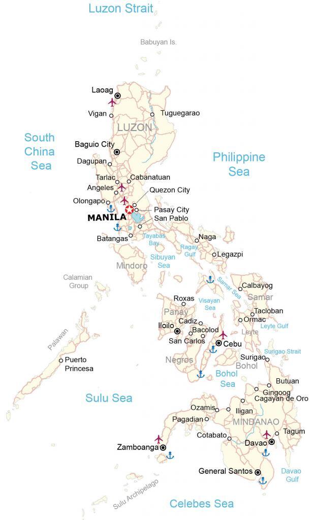
This map of the Philippines contains cities, towns, roads, gulfs, seas, and islands. Satellite imagery and an elevation map show the rugged terrain and topography of the Philippines.
Philippines map collection

You are free to use our Philippines map for educational and commercial uses. Attribution is required. How to attribute?
About the map
The Philippines consists of about 7,640 islands in the Pacific Ocean, which makes it 8th on the list of countries with the most islands. But its three main geographic regions are Luzon, Visayas, and Mindanao.
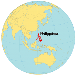
The Philippines is located near Malaysia to the southwest, Vietnam to the west, Hong Kong to the northwest, Taiwan to the north, and Indonesia to the south.
It’s situated between the South China Sea to the west, the Philippines Sea to the east, and the Celebes Sea to the south. Manila is the capital city of the Philippines but its largest city is Quezon City.
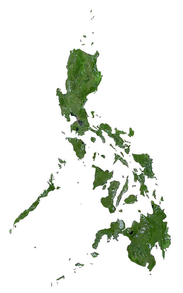
SATELLITE IMAGERY
Philippines Satellite Map
Altogether, the Philippines occupies an area of 300,000 square kilometers (120,000 sq mi). In comparison, this is close to the size of Italy or Ecuador. Some of the common landscapes in the Philippines are its mangroves, large coastal lowland areas, beaches, mountains, north-flowing rivers, and lakes. The Philippines is subject to constant earthquakes and seismic activity.
But it also lies within the “Typhoon Belt” region with an average of 20 typhoons every year. Luzon, Visayas, and Mindanao are the three main regions. Luzon is in the north. Not only is it the largest island, but it’s the most populous. The Visayas Islands contain several hundreds of islands. But its seven main islands are Bohol, Cebu, Leyte, Masbate, Negros, Panay, and Samar. Finally, Mindanao contains the second-largest island.
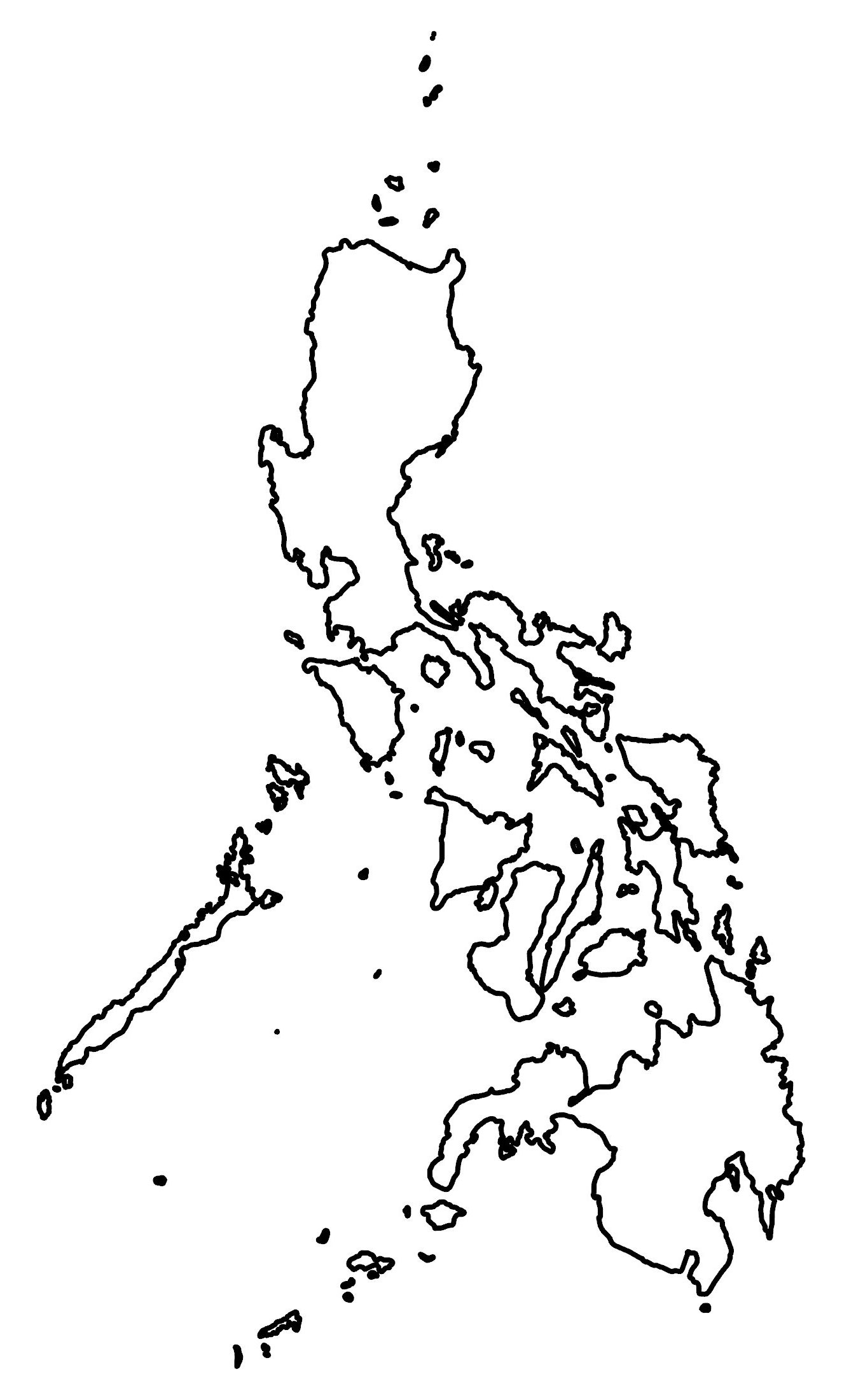
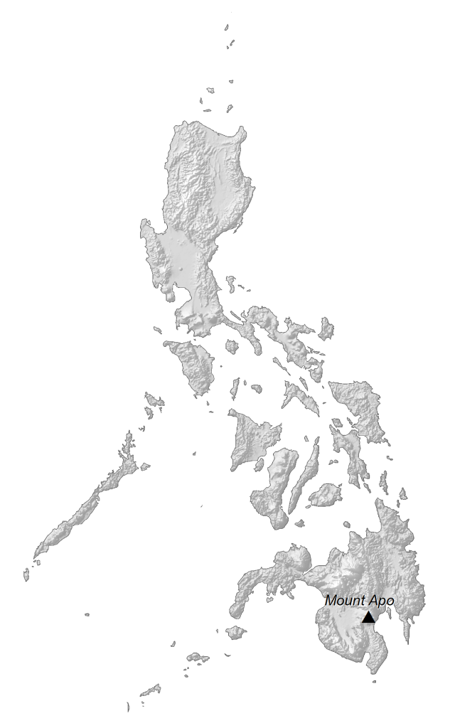
PHYSICAL MAP
Philippines Elevation Map
The country of the Philippines is situated within the Pacific “Ring of Fire” so they are covered with north-south mountain ranges and active volcanoes. For example, the three main mountain chains of Luzon are the Sierra Madre, Cordillera Central, and the Zambales Mountains. Whereas the main mountain ranges on Mindanao are Apo–Talomo and Pantaron Mountain Ranges.
Other mountain ranges are Kalatungan, Kitanglad, and Central Panay Mountain Range. At 2,954 meters (9,692 ft), Mount Apo in south-central Mindanao is the highest peak in the Philippines. Whereas its lowest point is the Galathea Depth at 10,540 meters deep.
Capital City
Manila
Major cities
Baguio City
Cebu
Davao
General Santos
Laoag
Zamboanga
Islands
Babuyan Island
Bohol Island
Calamian Group
Leyte Island
Luzon Island
Mindanao Island
Mindoro Island
Negros Island
Palawan Island
Panay Island
Samar Island
Sulu Archipelago
Populated places
Angeles
Bacolod
Batangas
Butuan
Cabanatuan
Cadiz
Cagayan de Oro
Calbayog
Cotabato
Dagupano
Gingoog
Iloilo
Legazpi
lligan
Naga
Olongapoo
Ormac
Ozamis
Pagadian
Pasay City
Puerto Princesa
Quezon City
Roxas
San Carlos
San Pablo
Surigao
Tacloban
Tagum
Tarlac
Tuguegarao
Vigan
Gulfs, seas and straits
Bohol Sea
Celebes Sea
Davao Gulf
Leyte Gulf
Luzon Strait
Philippine Sea
Ragay Gulf
Samar Sea
Sibuyan Sea
South China Sea
Sulu Sea
Surigao Strait
Tayabas Bay
Visayan Sea