New Jersey State Map – Places and Landmarks
This New Jersey State Map shows major landmarks in New Jersey. It includes national military bases, wildlife refuges and federal lands in New Jersey.
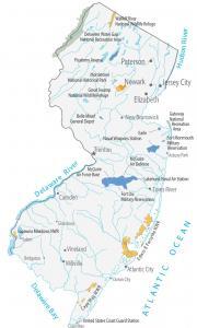
This New Jersey State Map shows major landmarks in New Jersey. It includes national military bases, wildlife refuges and federal lands in New Jersey.
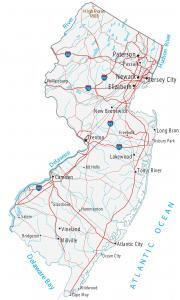
This New Jersey map contains cities, roads, rivers and lakes. Jersey City, Newark and Paterson are major cities shown in this map of New Jersey.
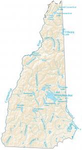
In this map, you will find major rivers, reservoirs and lakes of New Hampshire like Lake Winnipesaukee, Connecticut and Merrimack River.
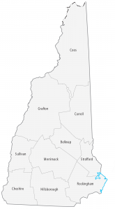
This New Hampshire county map displays its 10 counties. Hillsborough, Rockingham and Merrimack County, are the most populated counties in New Hampshire.
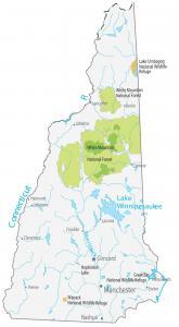
A New Hampshire State Map that displays major landmarks and places. It includes national forests, national wildlife refuges and other federal lands.
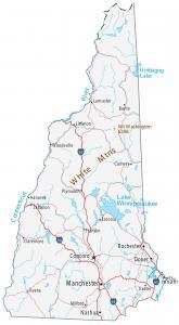
This New Hampshire map contains cities, roads, rivers and lakes. Concord, Manchester and Rochester are major cities shown in this map of New Hampshire.

This map shows major rivers, reservoirs and lakes of Nevada. Rivers in Nevada flow into the Great Basin, Gulf of California and Pacific Ocean.
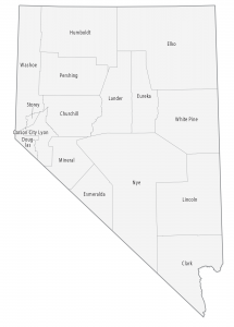
This Nevada county map displays its 16 counties and one independent city (Carson City). Clark, Washoe and Lyon are the most populated counties in Nevada.
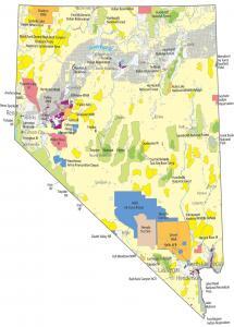
This Nevada State Map shows major landmarks and places in Nevada. It includes national parks, forests, military bases, wildlife areas and federal lands.
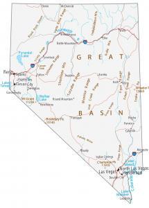
This Nevada map contains cities, roads, rivers and lakes. Las Vegas, Henderson and Reno are major cities displayed in this map of Nevada.