Kentucky Lakes and Rivers Map
This map contains major rivers, reservoirs and lakes of Kentucky like Cave Run and Kentucky Lake. Rivers flow to the Mississippi River.
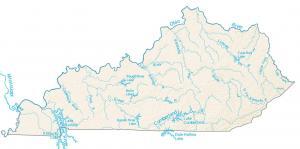
This map contains major rivers, reservoirs and lakes of Kentucky like Cave Run and Kentucky Lake. Rivers flow to the Mississippi River.
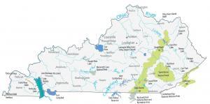
This Kentucky State Map shows major landmarks and places in Kentucky such as national forests, military bases, wildlife refuges and other federal lands.
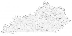
This Kentucky county map displays its 120 counties like Jefferson, Fayette and Kenton county. Each county is labeled with its administration name.
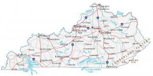
This Kentucky map shows cities, roads, rivers and lakes. Louisville, Lexington and Frankfort are major cities shown in this map of Kentucky.
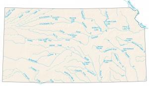
Our map displays major rivers, reservoirs and lakes of Kansas. It includes Milford, Perry, Waconda Lake. etc.
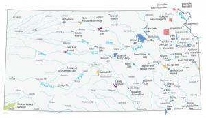
A Kansas State Map that shows major landmarks and places. It includes national wildlife refuges, military bases, Indian reserves and other federal lands in Kansas.
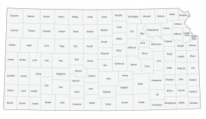
This Kansas county map displays its 105 counties. Johnson, Sedgwick and Shawnee County are the largest counties in Kansas in terms of population.
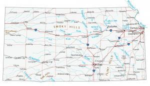
This Kansas map displays cities, roads, rivers and lakes. Kansas City, Wichita and Topeka are some of the major cities shown in this map of Kansas.
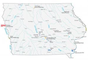
This Iowa State Map shows major landmarks and places in Iowa. It includes national wildlife refuges, military bases and other federal lands in Iowa.
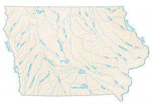
This map contains major rivers, reservoirs and lakes of Iowa. You’ll find Des Moines River, Iowa River, Rathbun Lake and more.